
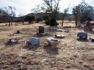
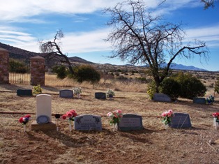
| Memorials | : | 3 |
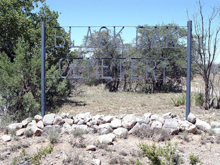
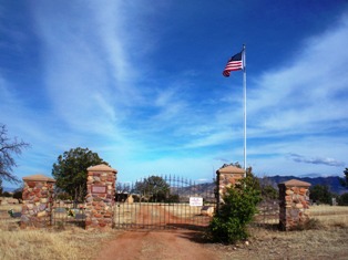
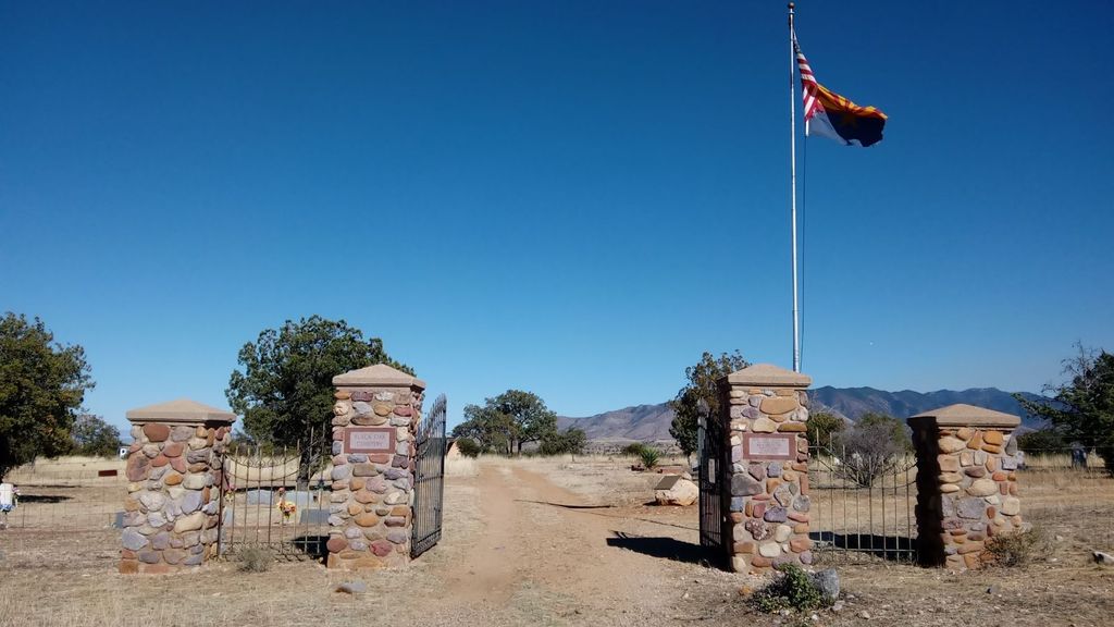
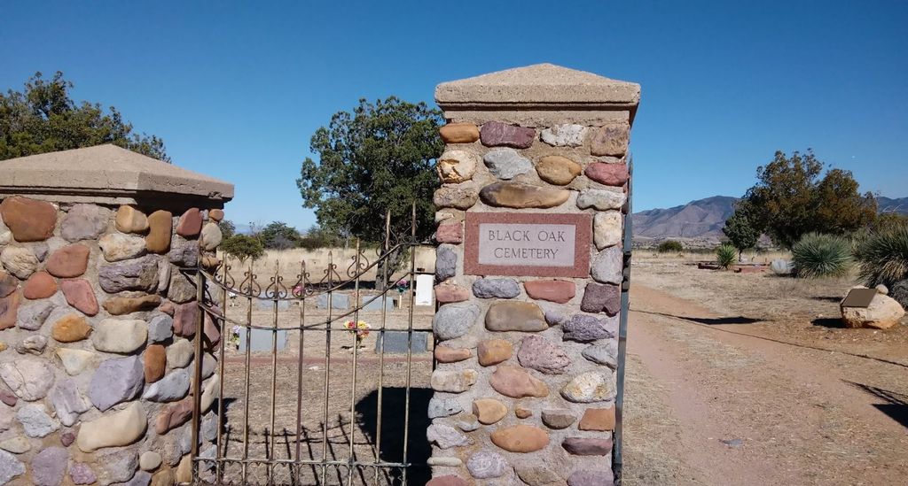
| Location | : | Canelo, Santa Cruz County, USA |
| Coordinate | : | 31.5557995, -110.5457993 |
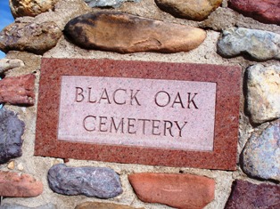
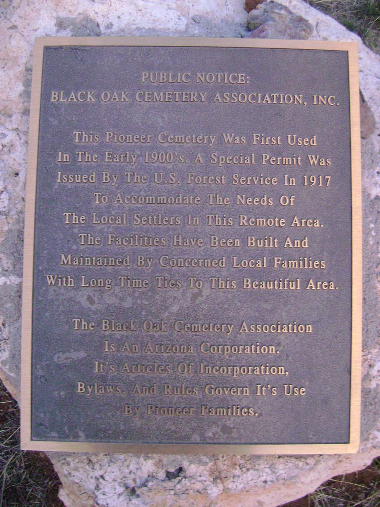
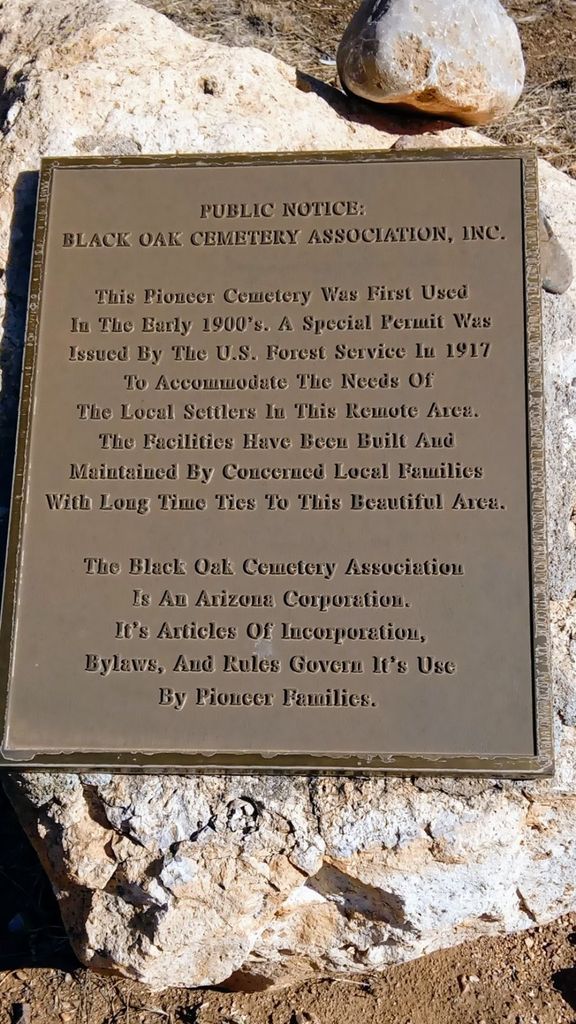
| Description | : | PUBLIC NOTICE: BLACK OAK CEMETERY ASSOCIATION, INC. This Pioneer Cemetery Was First Used In The Burly 1900's. A Special Permit Was Issued By The U.S. Forest Service ln 1917 To Accommodate The Needs Of The Local Settlers In This Remote Ares. The Facilities Have Been Built And Maintained By Concerned Local Families With Long Time Tics To This Beautiful Arca. The Black Oak Cemetery Association Is An Arizont Corporation. It's Articles Of Incorporation, Bylaws, And Rules Govern It's Usc By Pioneer Families. |
frequently asked questions (FAQ):
-
Where is Black Oak Cemetery?
Black Oak Cemetery is located at Canelo, Santa Cruz County ,Arizona ,USA.
-
Black Oak Cemetery cemetery's updated grave count on graveviews.com?
3 memorials
-
Where are the coordinates of the Black Oak Cemetery?
Latitude: 31.5557995
Longitude: -110.5457993
Nearby Cemetories:
1. Babacomari Ranch Cemetery
Huachuca City, Cochise County, USA
Coordinate: 31.6310580, -110.4562600
2. Fruitland Cemetery
Elgin, Santa Cruz County, USA
Coordinate: 31.6698740, -110.5624240
3. Fort Huachuca Cemetery
Sierra Vista, Cochise County, USA
Coordinate: 31.5481200, -110.3759040
4. Hall
Sonoita, Santa Cruz County, USA
Coordinate: 31.6741000, -110.6555760
5. Harshaw Cemetery South
Harshaw, Santa Cruz County, USA
Coordinate: 31.4670380, -110.7081760
6. Harshaw Cemetery
Harshaw, Santa Cruz County, USA
Coordinate: 31.4680000, -110.7089000
7. Gatlin Jones Cemetery
Patagonia, Santa Cruz County, USA
Coordinate: 31.5377998, -110.7493973
8. Sunnyside Cemetery
Cochise County, USA
Coordinate: 31.4256001, -110.4085999
9. Parker Canyon Cemetery
Patagonia, Santa Cruz County, USA
Coordinate: 31.3749610, -110.5258070
10. Mowry Cemetery
Santa Cruz County, USA
Coordinate: 31.4293430, -110.7037050
11. Patagonia Cemetery
Patagonia, Santa Cruz County, USA
Coordinate: 31.5316940, -110.7631890
12. Campstone Cemetery
Huachuca City, Cochise County, USA
Coordinate: 31.6433000, -110.3480000
13. Historic Cemetery of the Southern Arizona Veterans
Sierra Vista, Cochise County, USA
Coordinate: 31.5411000, -110.3050000
14. Saint Andrew the Apostle Memorial Garden
Sierra Vista, Cochise County, USA
Coordinate: 31.5628800, -110.3019300
15. Southern Arizona Veterans Memorial Cemetery
Sierra Vista, Cochise County, USA
Coordinate: 31.5399380, -110.3007278
16. Duquesne Cemetery
Duquesne, Santa Cruz County, USA
Coordinate: 31.3733390, -110.6781290
17. Fry Cemetery
Sierra Vista, Cochise County, USA
Coordinate: 31.5560800, -110.2918700
18. Washington Camp Cemetery
Santa Cruz County, USA
Coordinate: 31.3656110, -110.6690560
19. Brown Canyon Cemetery
Sierra Vista, Cochise County, USA
Coordinate: 31.4638020, -110.3101380
20. Frierson Gravesite
Sierra Vista, Cochise County, USA
Coordinate: 31.4717960, -110.3014180
21. Sierra Evangelical Lutheran Church Columbarium
Sierra Vista, Cochise County, USA
Coordinate: 31.5562140, -110.2816090
22. Enriquito de la Ossa Gravesite
Lochiel, Santa Cruz County, USA
Coordinate: 31.3356500, -110.6255000
23. Lochiel Cemetery
Santa Cruz County, USA
Coordinate: 31.3341000, -110.6250000
24. Mother Teresa Columbarium
Sierra Vista, Cochise County, USA
Coordinate: 31.4821000, -110.2846000