
| Memorials | : | 11 |
| Location | : | Spencer, Medina County, USA |
| Coordinate | : | 41.0857800, -82.0630800 |
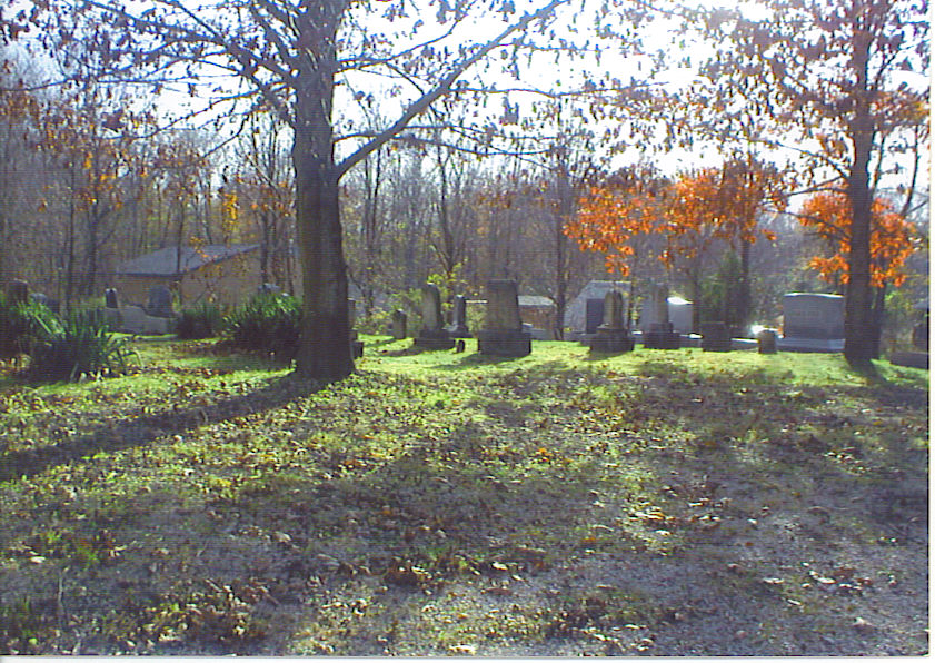
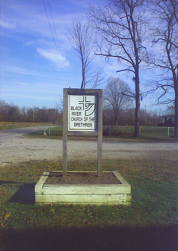
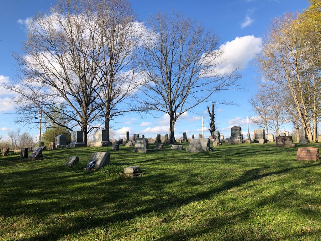
| Description | : | The cemetery is located on the south side of Old Mill Road (Township Road 68) about 800 feet west of its intersection with Rice Road (Township Road 154). The cemetery is 1.83 acres in size and was established in 1834. The cemetery is located in ChathamTownship, Medina County, Ohio, and is # 7457 (Black River Church of Brethren Cemetery / Dunkard Church Cemetery / Rices Dam Cemetery) in “Ohio Cemeteries 1803-2003”, compiled by the Ohio Genealogical Society. The U.S. Geological Survey (USGS) Geographic Names Information System (GNIS) feature ID for the cemetery is 1963480 (Black River Cemetery /... Read More |
frequently asked questions (FAQ):
-
Where is Black River Church Cemetery?
Black River Church Cemetery is located at Old Mill Road (Township Road 68) Spencer, Medina County ,Ohio , 44275USA.
-
Black River Church Cemetery cemetery's updated grave count on graveviews.com?
11 memorials
-
Where are the coordinates of the Black River Church Cemetery?
Latitude: 41.0857800
Longitude: -82.0630800
Nearby Cemetories:
1. Pawnee Cemetery
Spencer, Medina County, USA
Coordinate: 41.0675550, -82.0768160
2. Chatham Township Cemetery
Chatham Township, Medina County, USA
Coordinate: 41.0940400, -82.0243800
3. Jefferies Corners Cemetery
Spencer, Medina County, USA
Coordinate: 41.1104100, -82.0981600
4. Homer Reformed Church Cemetery
Homerville, Medina County, USA
Coordinate: 41.0491400, -82.0771100
5. Spencer Cemetery
Spencer, Medina County, USA
Coordinate: 41.1001500, -82.1203700
6. Zion Lutheran Cemetery
Homerville, Medina County, USA
Coordinate: 41.0432000, -82.0962400
7. Everhard Family Farm Cemetery
Litchfield Township, Medina County, USA
Coordinate: 41.1433550, -82.0446820
8. Vanderhoef Cemetery
Homerville, Medina County, USA
Coordinate: 41.0292320, -82.0907310
9. Woodlawn Cemetery
Lodi, Medina County, USA
Coordinate: 41.0381012, -82.0105972
10. Voorhees Cemetery
Lodi, Medina County, USA
Coordinate: 41.0231018, -82.0777969
11. Amish Cemetery
Homerville, Medina County, USA
Coordinate: 41.0557840, -82.1399390
12. Albert Cemetery
Crawford Corners, Medina County, USA
Coordinate: 41.0189018, -82.0543976
13. Old Lodi Cemetery
Lodi, Medina County, USA
Coordinate: 41.0299988, -82.0058975
14. Wandel Road Cemetery
Homerville, Medina County, USA
Coordinate: 41.0449860, -82.1547150
15. Lafayette Cemetery
Lafayette, Medina County, USA
Coordinate: 41.0699997, -81.9542007
16. Knapp Cemetery (Defunct)
Penfield Township, Lorain County, USA
Coordinate: 41.1652090, -82.0987250
17. N W Homerville Brethren Cemetery
Homer, Medina County, USA
Coordinate: 41.0512500, -82.1649600
18. Waltz Cemetery
Lafayette, Medina County, USA
Coordinate: 41.1214447, -81.9590302
19. Penfield Cemetery
Penfield, Lorain County, USA
Coordinate: 41.1678009, -82.1089020
20. Maple Hill Cemetery
Homerville, Medina County, USA
Coordinate: 41.0057983, -82.1150970
21. Litchfield Burial Park
Litchfield, Medina County, USA
Coordinate: 41.1679500, -82.0172700
22. Friendsville Cemetery
Westfield Center, Medina County, USA
Coordinate: 41.0339012, -81.9644012
23. Shaw Cemetery
Lafayette, Medina County, USA
Coordinate: 41.0710983, -81.9377975
24. Repp Cemetery
Congress, Wayne County, USA
Coordinate: 40.9868011, -82.0534973