
| Memorials | : | 1 |
| Location | : | Washington County, USA |
| Coordinate | : | 41.5521900, -96.1179000 |
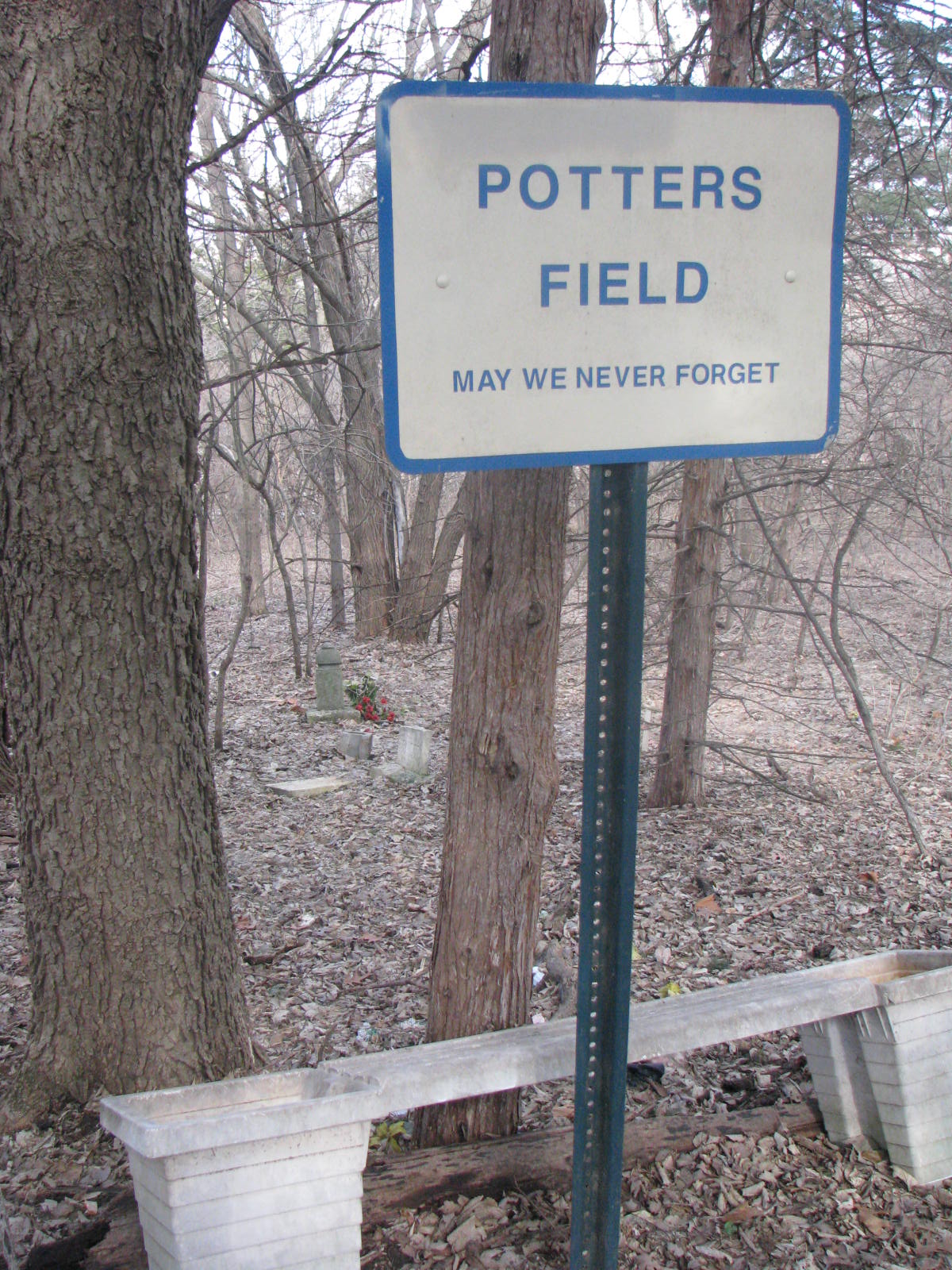
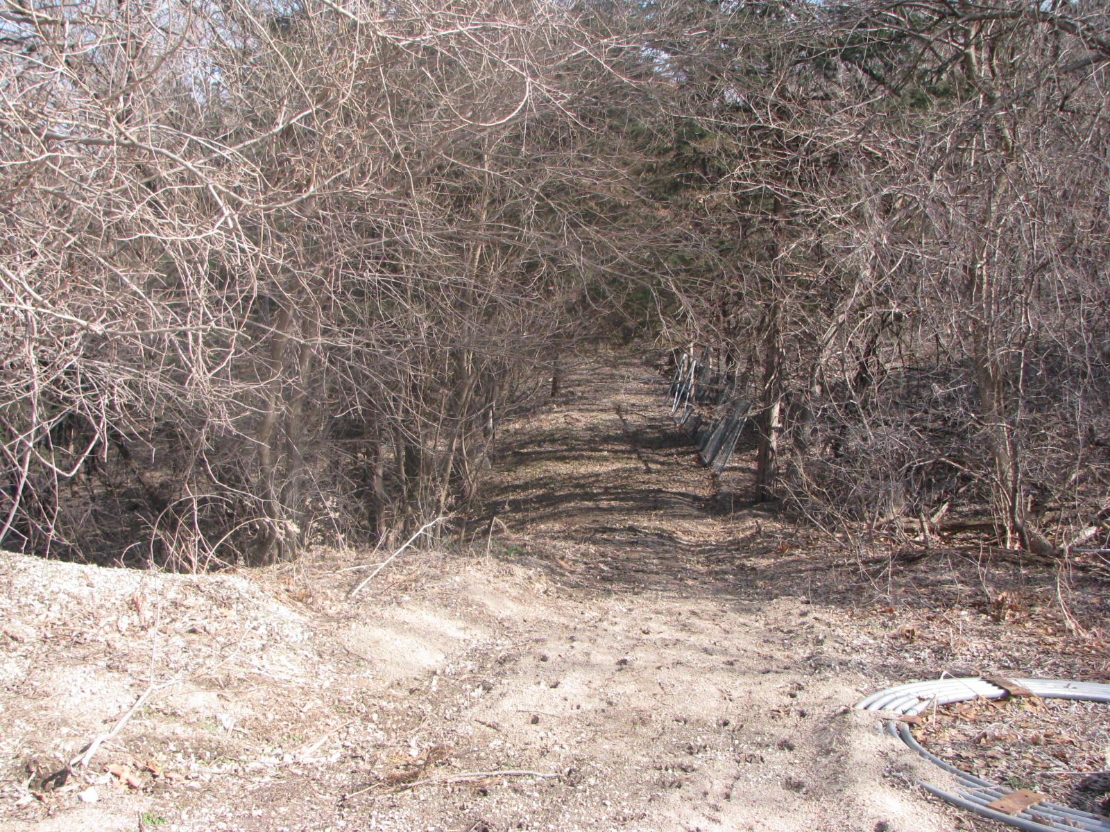
| Description | : | The old Potter's Field is located on the bluff at extreme north edge of the Blair Cemetery in Blair, Nebraska. The area is not maintained and access is gained by walking down a steep embankment. Few stones are visible. The area is no longer used. The burial list has been compiled from the index of readings done in the 1980's by Chris Vinton of Blair, Nebraska, as an Eagle Scout project, and extractions from local newspaper (The Pilot) accounts made by Ainar Vig, a collection currently housed at the Danish American Archives & Library, in Blair. Note: Additional reading was done in... Read More |
frequently asked questions (FAQ):
-
Where is Blair Potters Field?
Blair Potters Field is located at Washington County ,Nebraska ,USA.
-
Blair Potters Field cemetery's updated grave count on graveviews.com?
1 memorials
-
Where are the coordinates of the Blair Potters Field?
Latitude: 41.5521900
Longitude: -96.1179000
Nearby Cemetories:
1. Blair Cemetery
Blair, Washington County, USA
Coordinate: 41.5508003, -96.1185989
2. Holy Cross Cemetery
Blair, Washington County, USA
Coordinate: 41.5493600, -96.1187700
3. Saint Marys Episcopal Church Columbarium
Blair, Washington County, USA
Coordinate: 41.5419239, -96.1379580
4. Prayer Garden at First Lutheran Church
Blair, Washington County, USA
Coordinate: 41.5504880, -96.1452950
5. Cuming City Cemetery
Blair, Washington County, USA
Coordinate: 41.5867004, -96.1727982
6. Brewster Cemetery
Kennard, Washington County, USA
Coordinate: 41.5088250, -96.2042950
7. Hauger-Rumbaugh Cemetery
Modale, Harrison County, USA
Coordinate: 41.6388797, -96.0502906
8. Wilcox Cemetery
Fort Calhoun, Washington County, USA
Coordinate: 41.4509380, -96.1098340
9. Pioneer Memorial Cemetery
Fort Calhoun, Washington County, USA
Coordinate: 41.4472008, -96.0971985
10. Kennard Cemetery
Kennard, Washington County, USA
Coordinate: 41.4738998, -96.2138977
11. Fort Calhoun Cemetery
Fort Calhoun, Washington County, USA
Coordinate: 41.4581375, -96.0352020
12. Rose Hill Cemetery
Orum, Washington County, USA
Coordinate: 41.5814060, -96.2698940
13. Thone Cemetery
Herman, Washington County, USA
Coordinate: 41.6286011, -96.2466965
14. Herman Cemetery
Herman, Washington County, USA
Coordinate: 41.6575012, -96.2033005
15. Lincoln Lutheran Cemetery
Orum, Washington County, USA
Coordinate: 41.5538390, -96.2889030
16. Yutesler Cemetery
Harrison County, USA
Coordinate: 41.6684000, -96.0373000
17. German Cemetery
Washington County, USA
Coordinate: 41.4150600, -96.1366900
18. Prairie View Cemetery
Washington, Washington County, USA
Coordinate: 41.4225006, -96.2241974
19. Colby-Morley Cemetery
Arlington, Washington County, USA
Coordinate: 41.4664050, -96.3126470
20. Champan Frazier Cemetery
Harrison County, USA
Coordinate: 41.5773500, -95.8933500
21. Rose Hill Memorial Gardens
Missouri Valley, Harrison County, USA
Coordinate: 41.5656000, -95.8897000
22. Mount Carmel Cemetery
Missouri Valley, Harrison County, USA
Coordinate: 41.5675011, -95.8897018
23. Noyes Cemetery
Mondamin, Harrison County, USA
Coordinate: 41.7188988, -96.0325012
24. Vacoma Cemetery
Washington County, USA
Coordinate: 41.6130981, -96.3478012