
| Memorials | : | 0 |
| Location | : | Shenandoah, Richland County, USA |
| Coordinate | : | 40.9733009, -82.4942017 |
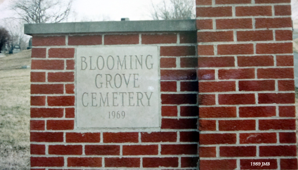
| Description | : | The cemetery is located on the west side of Ohio State Route 13 about 0.2 miles south of its intersection with Noble Road West (County Road 81). The cemetery is located in Butler Township, Richland County, Ohio, and is # 10177 (Bethel Cemetery / Blooming Grove Cemetery / Church of God Cemetery / Mitchell Cemetery / Winebrenner Cemetery) in “Ohio Cemeteries 1803-2003”, compiled by the Ohio Genealogical Society. The cemetery is registered with the Ohio Division of Real Estate and Professional Licensing (ODRE) as Bethel Cemetery with registration license number CRC.0000982780. The U.S. Geological Survey (USGS) Geographic Names Information... Read More |
frequently asked questions (FAQ):
-
Where is Blooming Grove Cemetery?
Blooming Grove Cemetery is located at Ohio State Route 13 Shenandoah, Richland County ,Ohio , 44878USA.
-
Blooming Grove Cemetery cemetery's updated grave count on graveviews.com?
0 memorials
-
Where are the coordinates of the Blooming Grove Cemetery?
Latitude: 40.9733009
Longitude: -82.4942017
Nearby Cemetories:
1. Woodlawn Mennonite Cemetery
Shenandoah, Richland County, USA
Coordinate: 40.9459030, -82.4930510
2. Bloomingrove Mennonite Church Cemetery
Planktown, Richland County, USA
Coordinate: 40.9611760, -82.5289620
3. Country View Mennonite Cemetery
Shiloh, Richland County, USA
Coordinate: 40.9535200, -82.4578600
4. Ninevah Cemetery
Greenwich, Huron County, USA
Coordinate: 41.0085300, -82.4572000
5. Hochstetler Cemetery
Adario, Richland County, USA
Coordinate: 40.9318220, -82.4706590
6. Rome Presbyterian Church Revolutionary War Cemeter
Rome, Richland County, USA
Coordinate: 40.9318581, -82.5366058
7. Rome Presbyterian Church Civil War Cemetery
Shiloh, Richland County, USA
Coordinate: 40.9313730, -82.5383100
8. Adario Cemetery
Adario, Richland County, USA
Coordinate: 40.9312325, -82.4474106
9. Rome East Cemetery
Rome, Richland County, USA
Coordinate: 40.9238091, -82.5310745
10. East Cemetery
Greenwich, Huron County, USA
Coordinate: 41.0292740, -82.4779760
11. Kniffin Cemetery
Greenwich, Huron County, USA
Coordinate: 41.0303001, -82.4858017
12. Jenney Farm Cemetery
Greenwich Township, Huron County, USA
Coordinate: 41.0256271, -82.4571991
13. Eller Cemetery
Adario, Richland County, USA
Coordinate: 40.9169530, -82.4552990
14. Shenandoah Church Cemetery
Shenandoah, Richland County, USA
Coordinate: 40.9095573, -82.4995117
15. Old Salem Cemetery
Shiloh, Richland County, USA
Coordinate: 40.9752998, -82.5832977
16. Greenwich Greenlawn Cemetery
Greenwich, Huron County, USA
Coordinate: 41.0397769, -82.5163400
17. Castle Hill Cemetery
Ashland County, USA
Coordinate: 41.0290000, -82.4346000
18. Edwards Grove Cemetery
Greenwich, Huron County, USA
Coordinate: 41.0275002, -82.5582962
19. Rusco Cemetery
Greenwich, Huron County, USA
Coordinate: 41.0476490, -82.5027138
20. Barre Farm Cemetery
Greenwich, Huron County, USA
Coordinate: 41.0356330, -82.5604490
21. Pleasant Dale Mennonite Church Cemetery
Greenwich, Huron County, USA
Coordinate: 41.0180990, -82.5855300
22. Bly Farm Cemetery
Mansfield, Richland County, USA
Coordinate: 40.8976560, -82.5383750
23. Amish Cemetery
Bailey Lakes, Ashland County, USA
Coordinate: 40.9311200, -82.3975590
24. Ganges Cemetery
Ganges, Richland County, USA
Coordinate: 40.9049034, -82.5616302