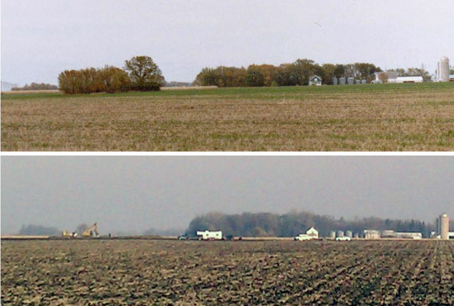
| Memorials | : | 0 |
| Location | : | Herman, Grant County, USA |
| Coordinate | : | 45.8249702, -96.0043716 |
| Description | : | Boerner Cemetery Macsville Township Street Address Township-Range T127N - R43W Section 12 NESW Latitude 454920N Longitude 0960105W USGS 7.5 map Established 1872 Notes Julius Boerner set this plot on his land aside for a private burial place but never took out a deed or exempted it. Twelve burials, last one in 1892. Two bodies were moved to Lakeside Cemetery. This is a very early cemetery in that area and would be considered a "pioneer" cemetery. It needs LOTS of TLC to be restored. Frederick & Christine Boerner are buried there, along with a number of Boerner children, one of them being Laura, a daughter of... Read More |
frequently asked questions (FAQ):
-
Where is Boerner Cemetery?
Boerner Cemetery is located at Herman, Grant County ,Minnesota ,USA.
-
Boerner Cemetery cemetery's updated grave count on graveviews.com?
0 memorials
-
Where are the coordinates of the Boerner Cemetery?
Latitude: 45.8249702
Longitude: -96.0043716
Nearby Cemetories:
1. Roseville Cemetery
Grant County, USA
Coordinate: 45.8027992, -95.9432983
2. Brennin Cemetery
Barrett, Grant County, USA
Coordinate: 45.8018940, -95.9436890
3. Fridhem Cemetery
Grant County, USA
Coordinate: 45.8755989, -95.9456024
4. Lakeside Cemetery
Herman, Grant County, USA
Coordinate: 45.7985992, -96.1110992
5. Bethania Cemetery
Barrett, Grant County, USA
Coordinate: 45.9053001, -95.9867020
6. Immanuel Lutheran Cemetery
Barrett, Grant County, USA
Coordinate: 45.8872450, -95.9284110
7. Saint Charles Cemetery
Herman, Grant County, USA
Coordinate: 45.7828320, -96.1151790
8. Kongsvinger Lutheran Church Cemetery
Donnelly, Stevens County, USA
Coordinate: 45.7311980, -96.0035990
9. Fredens Lund Cemetery
Grant County, USA
Coordinate: 45.9272003, -95.9871979
10. Bethesda Cemetery
Barrett, Grant County, USA
Coordinate: 45.9194680, -95.9028230
11. Union Cemetery
Barrett, Grant County, USA
Coordinate: 45.9194080, -95.9015890
12. Peace Lutheran Cemetery
Barrett, Grant County, USA
Coordinate: 45.9199600, -95.9024580
13. Zion Evangelical Lutheran Cemetery
Barrett, Grant County, USA
Coordinate: 45.9198860, -95.9016000
14. Vinger Cemetery
Donnelly, Stevens County, USA
Coordinate: 45.7010994, -96.0053024
15. Barrett Covenant Cemetery
Barrett, Grant County, USA
Coordinate: 45.9094009, -95.8731003
16. Saint Theresia Cemetery
Donnelly, Stevens County, USA
Coordinate: 45.6955986, -96.0046997
17. Lundberg Cemetery
Donnelly, Stevens County, USA
Coordinate: 45.6926950, -96.0264140
18. Lands Cemetery
Hoffman, Grant County, USA
Coordinate: 45.8321991, -95.8106003
19. Zion Lutheran Church Cemetery
Hoffman, Grant County, USA
Coordinate: 45.8330994, -95.8097000
20. Gorton Cemetery
Grant County, USA
Coordinate: 45.9035980, -96.1717410
21. Norcross Lutheran Cemetery
Norcross, Grant County, USA
Coordinate: 45.9044860, -96.1718600
22. Lincoln Lutheran Cemetery
Hoffman, Grant County, USA
Coordinate: 45.8795560, -95.8053620
23. Bethel Cemetery
Hoffman, Grant County, USA
Coordinate: 45.8246994, -95.7794037
24. Elk Lake Cemetery
Grant County, USA
Coordinate: 45.8894820, -95.7988500

