
| Memorials | : | 0 |
| Location | : | Babbie, Covington County, USA |
| Coordinate | : | 31.2915330, -86.3322570 |
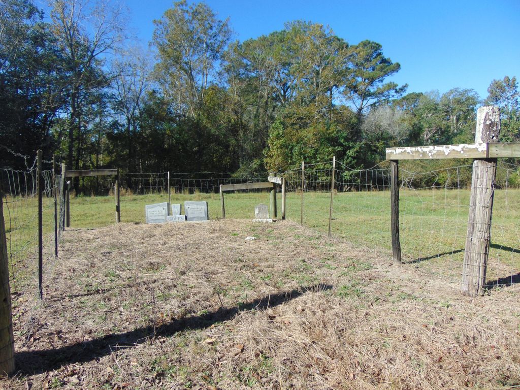
| Description | : | Boles Family Cemetery consists of three graves surrounded by a farm fence on the edge of George Boles Road. The cemetery, at the time, was located on the property of George Washington Boles. The first burial was Martha Boles, the daughter of the same, George and Penelope Boles, in 1881. Later Martha's parents were buried there without stones to mark their graves. In the 1970's, their descendants erected a double stone in remembrance of them. Unfortunately, the stone maker made errors in the dates of the newly erected stone. The dates have been corrected on their Findagrave memorials. History provided... Read More |
frequently asked questions (FAQ):
-
Where is Boles Family Cemetery?
Boles Family Cemetery is located at George Boles Road Babbie, Covington County ,Alabama , 36421USA.
-
Boles Family Cemetery cemetery's updated grave count on graveviews.com?
0 memorials
-
Where are the coordinates of the Boles Family Cemetery?
Latitude: 31.2915330
Longitude: -86.3322570

Nearby Cemetories:
1. Babbie Cemetery
Babbie, Covington County, USA
Coordinate: 31.2765141, -86.3295135
2. Bethel Primitive Baptist Church Cemetery
Babbie, Covington County, USA
Coordinate: 31.2747002, -86.3292007
3. Bethel Congregational Holiness Church Cemetery
Opp, Covington County, USA
Coordinate: 31.2711411, -86.3164902
4. Scripture Truth Baptist Church Cemetery
Andalusia, Covington County, USA
Coordinate: 31.2567005, -86.3453979
5. Hickory Grove Cemetery
Opp, Covington County, USA
Coordinate: 31.2702923, -86.2904510
6. Calvary Holiness Church Cemetery
Covington County, USA
Coordinate: 31.3309950, -86.3133100
7. Gridertown Church of Christ Cemetery
Covington County, USA
Coordinate: 31.2529650, -86.3077890
8. First Baptist Church Cemetery
Sanford, Covington County, USA
Coordinate: 31.2999001, -86.3880005
9. Cedar Grove Baptist Church Cemetery
Babbie, Covington County, USA
Coordinate: 31.3520012, -86.3293076
10. Oakey Ridge Baptist Church Cemetery
Andalusia, Covington County, USA
Coordinate: 31.2488995, -86.3871994
11. Welcome the Way Cemetery
Onycha, Covington County, USA
Coordinate: 31.2343063, -86.2903976
12. Hardin Street Cemetery
Opp, Covington County, USA
Coordinate: 31.2754520, -86.2549820
13. Opp City Cemetery
Opp, Covington County, USA
Coordinate: 31.2880135, -86.2521744
14. Henderson Cemetery
Covington County, USA
Coordinate: 31.3591995, -86.3619003
15. Harmony Baptist Church Cemetery
Harmony, Covington County, USA
Coordinate: 31.3572006, -86.3747025
16. Johns Cemetery
Opp, Covington County, USA
Coordinate: 31.2341232, -86.2721176
17. Cool Springs Primitive Baptist Church Cemetery
Opp, Covington County, USA
Coordinate: 31.2968998, -86.2386017
18. Sweet Home Baptist Church Cemetery
Opp, Covington County, USA
Coordinate: 31.3586006, -86.2752991
19. Blue Springs Church Cemetery
Opp, Covington County, USA
Coordinate: 31.2091999, -86.3133011
20. Stone Lake Gardens Cemetery
Andalusia, Covington County, USA
Coordinate: 31.3190370, -86.4263670
21. Peaceful Acres Memorial Gardens
Opp, Covington County, USA
Coordinate: 31.2635994, -86.2328033
22. Mount Pisgah Church of God Cemetery
Andalusia, Covington County, USA
Coordinate: 31.3488998, -86.4141998
23. Sweetwater Baptist Church Cemetery
Opp, Covington County, USA
Coordinate: 31.3321991, -86.2341995
24. Five Run Cemetery
Libertyville, Covington County, USA
Coordinate: 31.2454700, -86.4300000