
| Memorials | : | 6 |
| Location | : | Hay Springs, Sheridan County, USA |
| Coordinate | : | 42.8062000, -102.6459600 |
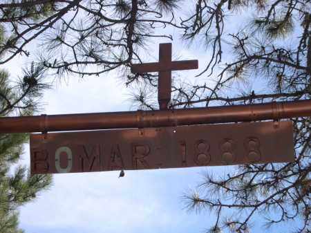
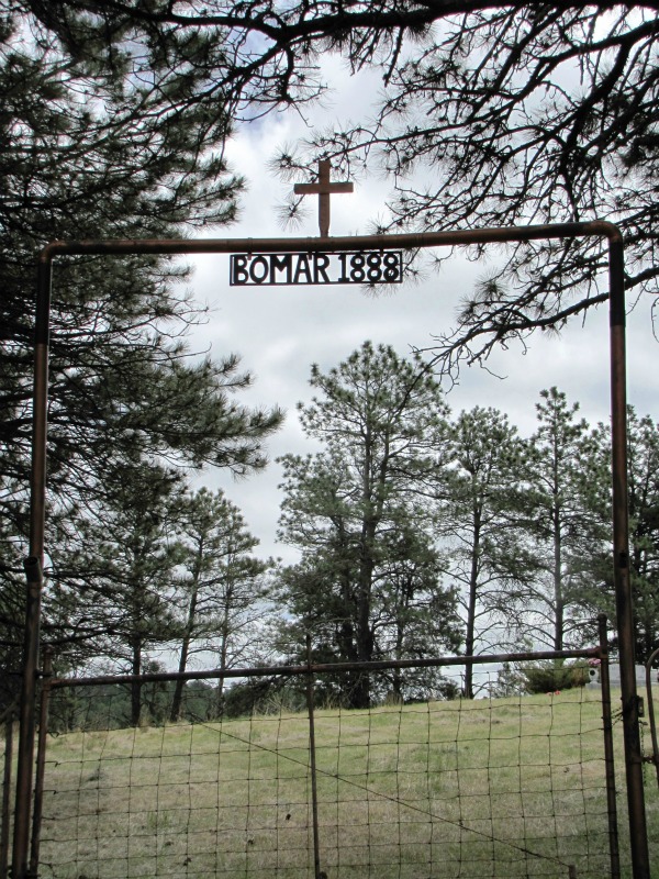
| Description | : | Located about 12 miles northeast of Hay Springs, NE on Section 29 Township 33 Range 45. Some information transcribed from NorthWest Genealogical Society "Wagoneer Journals 1982-1983" by Liz Lee. |
frequently asked questions (FAQ):
-
Where is Bomar Cemetery?
Bomar Cemetery is located at Hay Springs, Sheridan County ,Nebraska ,USA.
-
Bomar Cemetery cemetery's updated grave count on graveviews.com?
6 memorials
-
Where are the coordinates of the Bomar Cemetery?
Latitude: 42.8062000
Longitude: -102.6459600
Nearby Cemetories:
1. Novotny Cemetery
Hay Springs, Sheridan County, USA
Coordinate: 42.7742004, -102.5963974
2. Abold Family Cemetery
Rushville, Sheridan County, USA
Coordinate: 42.8863500, -102.6158000
3. Holly Cemetery
Rushville, Sheridan County, USA
Coordinate: 42.8575120, -102.5370990
4. Beaver Valley Cemetery
Sheridan County, USA
Coordinate: 42.8880997, -102.7517014
5. Highland Cemetery
Hay Springs, Sheridan County, USA
Coordinate: 42.7145500, -102.7727500
6. Antelope Cemetery
Hay Springs, Sheridan County, USA
Coordinate: 42.7144970, -102.7727290
7. St. Mary's Cemetery
Hay Springs, Sheridan County, USA
Coordinate: 42.6721992, -102.7035980
8. Hay Springs Cemetery
Hay Springs, Sheridan County, USA
Coordinate: 42.6702995, -102.7033005
9. Amity Cemetery
Sheridan County, USA
Coordinate: 42.8036003, -102.4389038
10. Preble Cemetery
Sheridan County, USA
Coordinate: 42.6504000, -102.5765000
11. Saint Marys Cemetery
Rushville, Sheridan County, USA
Coordinate: 42.7174988, -102.4436035
12. White Clay Cemetery
Rushville, Sheridan County, USA
Coordinate: 42.9732820, -102.5667230
13. Fair View Cemetery
Rushville, Sheridan County, USA
Coordinate: 42.7155991, -102.4325027
14. Saint Aloysius Cemetery
Sheridan County, USA
Coordinate: 42.9015500, -102.4025500
15. Highland Cemetery
Dawes County, USA
Coordinate: 42.8163986, -102.9302979
16. Holy Cross Cemetery
Pine Ridge, Oglala Lakota County, USA
Coordinate: 43.0194016, -102.5503006
17. Pine Ridge Presbyterian Cemetery
Pine Ridge, Oglala Lakota County, USA
Coordinate: 43.0235200, -102.5506200
18. Antelope Springs Cemetery
Chadron, Dawes County, USA
Coordinate: 42.6185000, -102.8706100
19. Bethel Cemetery
Sheridan County, USA
Coordinate: 42.9011002, -102.3208008
20. Grace Episcopal Cemetery
Chadron, Dawes County, USA
Coordinate: 42.8267000, -102.9996000
21. Calvary Cemetery
Chadron, Dawes County, USA
Coordinate: 42.8224983, -103.0085983
22. Red Cloud Cemetery
Pine Ridge, Oglala Lakota County, USA
Coordinate: 43.0776839, -102.5837514
23. Greenwood Cemetery
Chadron, Dawes County, USA
Coordinate: 42.8272018, -103.0239029
24. Our Lady of Lourdes Catholic Cemetery
Slim Butte, Oglala Lakota County, USA
Coordinate: 43.0619800, -102.8166200