
| Memorials | : | 2 |
| Location | : | Bonnie Claire, Nye County, USA |
| Coordinate | : | 37.2270889, -117.1192169 |
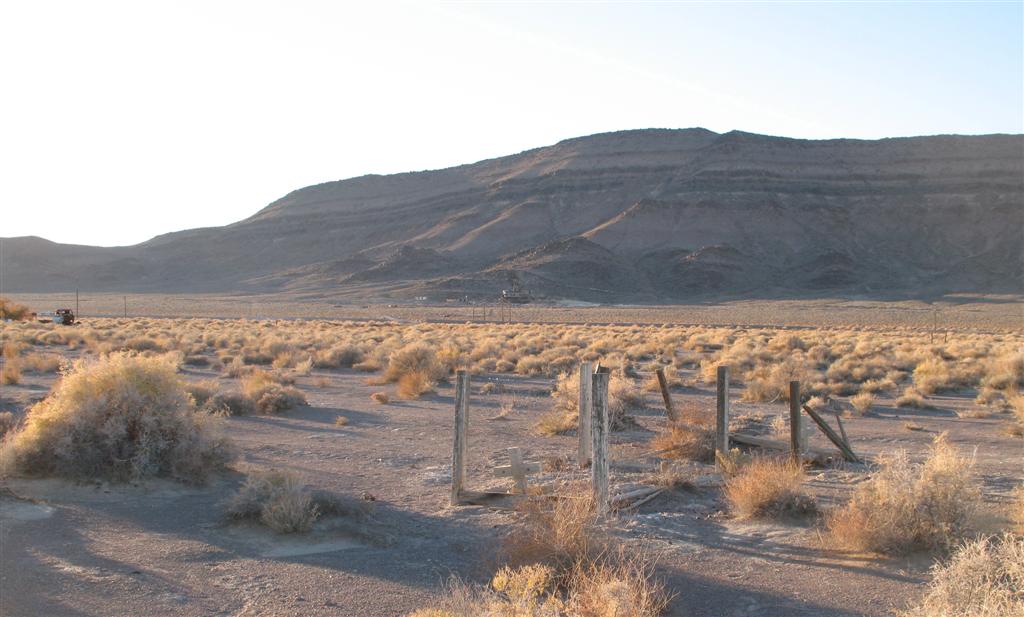
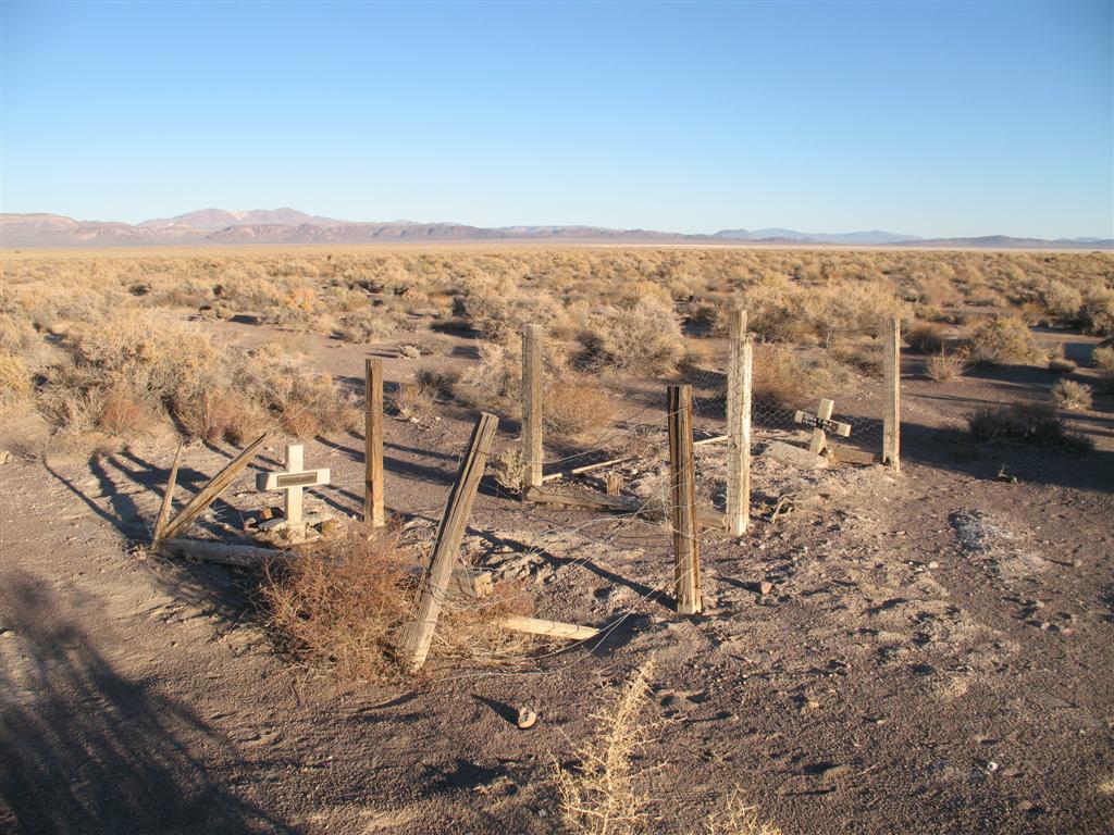
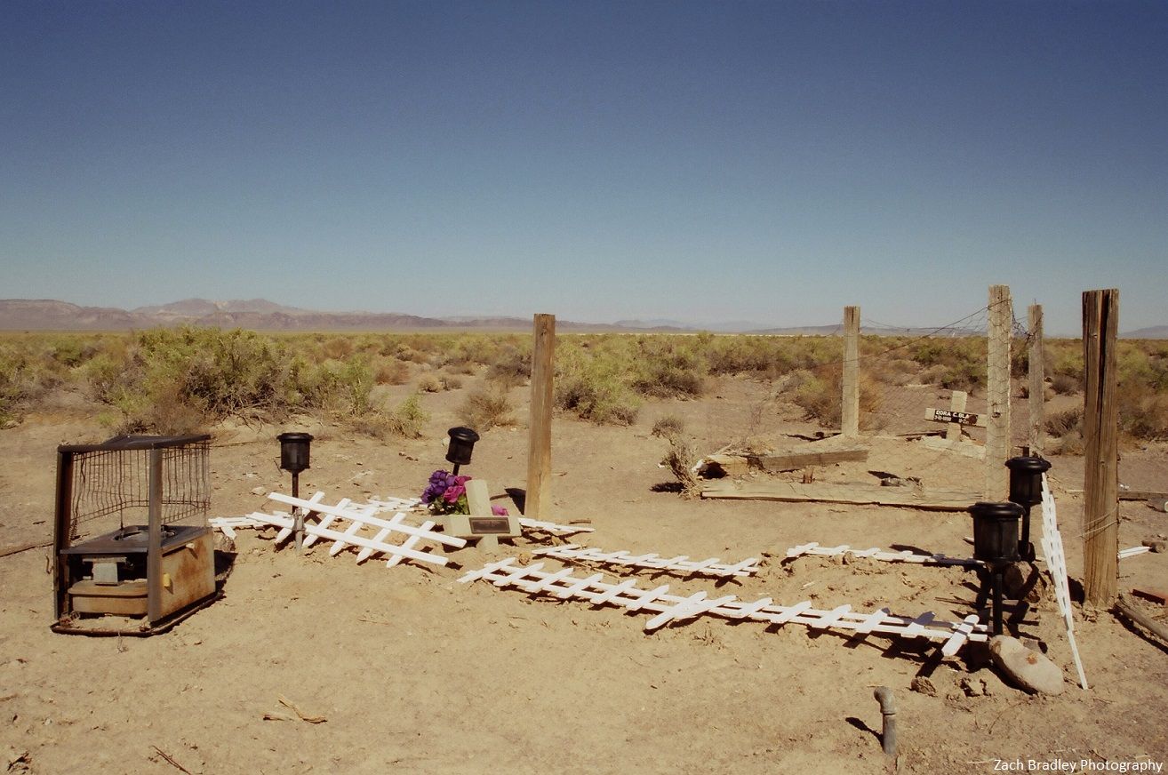
| Description | : | There are two graves east of the town of Bonnie Claire. The town of Bonnie Claire is across the highway from the Bonnie Claire Mill ruins and Lippencott Lead Mine. A stamp mill built in the 1880s led to formation of a camp at Thorp's Wells which is one mile Southeast of Bonnie Claire. The area experienced slow growth over the next 20 years. Another mill was built in 1904. In 1906 the Bullfrog-Goldfield Railroad arrived in Bonnie Claire and it became the main shipping center for the mines of Gold Mountain ten miles to the Northwest. In... Read More |
frequently asked questions (FAQ):
-
Where is Bonnie Claire Burial Ground?
Bonnie Claire Burial Ground is located at Bonnie Claire, Nye County ,Nevada ,USA.
-
Bonnie Claire Burial Ground cemetery's updated grave count on graveviews.com?
2 memorials
-
Where are the coordinates of the Bonnie Claire Burial Ground?
Latitude: 37.2270889
Longitude: -117.1192169
Nearby Cemetories:
1. Scottys Castle Gravesite
Beatty Junction, Inyo County, USA
Coordinate: 37.0336700, -117.3424800
2. Springdale Cemetery
Springdale, Nye County, USA
Coordinate: 37.1218600, -116.8073600
3. Tule Canyon Burial Site
Lida, Esmeralda County, USA
Coordinate: 37.2794400, -117.5213900
4. Lida Cemetery
Lida, Esmeralda County, USA
Coordinate: 37.4597282, -117.4986801
5. Lida Upper Cemetery
Lida, Esmeralda County, USA
Coordinate: 37.4619598, -117.4999313
6. Haskins Gravesite
Rhyolite, Nye County, USA
Coordinate: 36.8996720, -116.8257670
7. Bullfrog-Rhyolite Cemetery
Rhyolite, Nye County, USA
Coordinate: 36.8820000, -116.8292999
8. Desert Hill Cemetery
Beatty, Nye County, USA
Coordinate: 36.9000015, -116.7602997
9. Pigeon Springs Cemetery
Esmeralda County, USA
Coordinate: 37.4239588, -117.6632951
10. Goldfield Pioneer Cemetery
Goldfield, Esmeralda County, USA
Coordinate: 37.7162018, -117.2519989
11. Goldfield Cemetery
Goldfield, Esmeralda County, USA
Coordinate: 37.7173996, -117.2492981
12. Hart Gravesite
Palmetto, Esmeralda County, USA
Coordinate: 37.4557304, -117.7134399
13. Cactus Springs Cemetery
Nye County, USA
Coordinate: 37.7213000, -116.8162280
14. Jean Lemoigne Gravesite
Inyo County, USA
Coordinate: 36.5891991, -116.9689026
15. Silver Peak Cemetery
Silver Peak, Esmeralda County, USA
Coordinate: 37.7565002, -117.6380005
16. Death Valley National Park
Inyo County, USA
Coordinate: 36.4694000, -116.8667000
17. Schwab Cemetery
Inyo County, USA
Coordinate: 36.5055570, -116.7236080
18. Skidoo Cemetery
Skidoo, Inyo County, USA
Coordinate: 36.4364586, -117.1473465
19. Silverbow Cemetery
Silverbow, Nye County, USA
Coordinate: 37.8875999, -116.4872131
20. Amargosa Desert Memorial Cemetery
Amargosa Valley, Nye County, USA
Coordinate: 36.5692787, -116.4563599
21. Old Tonopah Cemetery
Tonopah, Nye County, USA
Coordinate: 38.0719800, -117.2385600
22. New Tonopah Cemetery
Tonopah, Nye County, USA
Coordinate: 38.0764008, -117.2494965
23. Kirchen Gravesite
Tonopah, Nye County, USA
Coordinate: 38.0776700, -117.2505500
24. Fish Lake Valley Cemetery
Dyer, Esmeralda County, USA
Coordinate: 37.7490005, -118.0404968