| Memorials | : | 0 |
| Location | : | Bornerbroek, Almelo Municipality, Netherlands |
| Coordinate | : | 52.3087800, 6.6557500 |
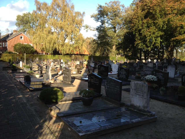
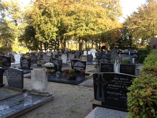
| Description | : | Borne is a village and commune 6 kilometres north-west of Hengelo, in the province of Overijssel. Bornerbroek is a village in the commune, 7 kilometres west of Borne village and 5 kilometres south of the town of Almelo, on the Almelo-Ambt-Delden road. The Roman Catholic churchyard is in the centre of the village. |
frequently asked questions (FAQ):
-
Where is Bornerbroek Roman Catholic Churchyard?
Bornerbroek Roman Catholic Churchyard is located at Bornerbroek, Almelo Municipality ,Overijssel ,Netherlands.
-
Bornerbroek Roman Catholic Churchyard cemetery's updated grave count on graveviews.com?
0 memorials
-
Where are the coordinates of the Bornerbroek Roman Catholic Churchyard?
Latitude: 52.3087800
Longitude: 6.6557500
Nearby Cemetories:
1. Almelo General Cemetery 't Groenedael
Almelo, Almelo Municipality, Netherlands
Coordinate: 52.3531889, 6.6446597
2. Roman Catholic cemetery
Zenderen, Borne Municipality, Netherlands
Coordinate: 52.3237300, 6.7251900
3. Joodse Begraafplaats
Almelo, Almelo Municipality, Netherlands
Coordinate: 52.3591670, 6.6615790
4. Ambt-Delden General Cemetery
Delden, Hof van Twente Municipality, Netherlands
Coordinate: 52.2610900, 6.6903800
5. Delden Roman Catholic Cemetery
Delden, Hof van Twente Municipality, Netherlands
Coordinate: 52.2624600, 6.7059700
6. Joodse Begraafplaats
Borne, Borne Municipality, Netherlands
Coordinate: 52.2992800, 6.7461900
7. Borne General cemetery
Borne, Borne Municipality, Netherlands
Coordinate: 52.3037400, 6.7525900
8. Wierden Appelhofwarstraat Cemetery
Wierden, Wierden Municipality, Netherlands
Coordinate: 52.3591800, 6.5941400
9. Israelitisch Kerkhof
Delden, Hof van Twente Municipality, Netherlands
Coordinate: 52.2615064, 6.7270171
10. Oude Joodse begraafplaats
Almelo Municipality, Netherlands
Coordinate: 52.3736100, 6.6240090
11. Joodse Begraafplaats
Deldeneresch, Hof van Twente Municipality, Netherlands
Coordinate: 52.2487790, 6.7197650
12. Joodse begraafplaats
Goor, Hof van Twente Municipality, Netherlands
Coordinate: 52.2365100, 6.5889600
13. Goor Roman Catholic Cemetery
Goor, Hof van Twente Municipality, Netherlands
Coordinate: 52.2335800, 6.5932700
14. Joodse Begraafplaats
Rijssen-Holten Municipality, Netherlands
Coordinate: 52.2927500, 6.5190000
15. Albergen Roman Catholic Cemetery
Albergen, Tubbergen Municipality, Netherlands
Coordinate: 52.3727900, 6.7640500
16. Joodse begraafplaats
Hengelo, Hengelo Municipality, Netherlands
Coordinate: 52.2695700, 6.7939800
17. Goor New General Cemetery
Goor, Hof van Twente Municipality, Netherlands
Coordinate: 52.2353900, 6.5581200
18. Saasveld Roman Catholic Cemetery
Saasveld, Dinkelland Municipality, Netherlands
Coordinate: 52.3302400, 6.8095800
19. Hengelo Roman Catholic Cemetery
Hengelo, Hengelo Municipality, Netherlands
Coordinate: 52.2797300, 6.8103900
20. Hengelo Overijssel General Cemetery
Hengelo, Hengelo Municipality, Netherlands
Coordinate: 52.2719200, 6.8099900
21. Vriezenveen General Cemetery
Vriezenveen, Twenterand Municipality, Netherlands
Coordinate: 52.4137100, 6.6248400
22. Deurningen Roman Catholic Cemetery
Deurningen, Dinkelland Municipality, Netherlands
Coordinate: 52.3009700, 6.8383400
23. Joodse Begraafplaats
Diepenheim, Hof van Twente Municipality, Netherlands
Coordinate: 52.2102900, 6.5517900
24. Markelo General Cemetery
Markelo, Hof van Twente Municipality, Netherlands
Coordinate: 52.2344500, 6.5029900


