
| Memorials | : | 1 |
| Location | : | Freetown, Bristol County, USA |
| Coordinate | : | 41.7353600, -70.9646500 |
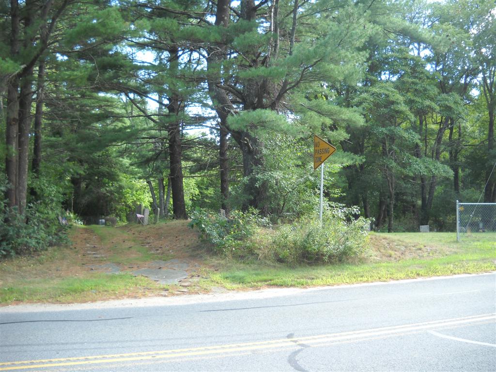
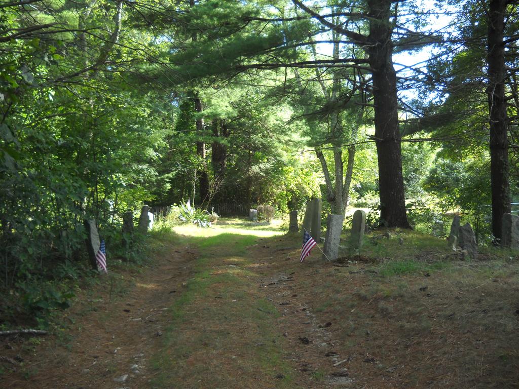
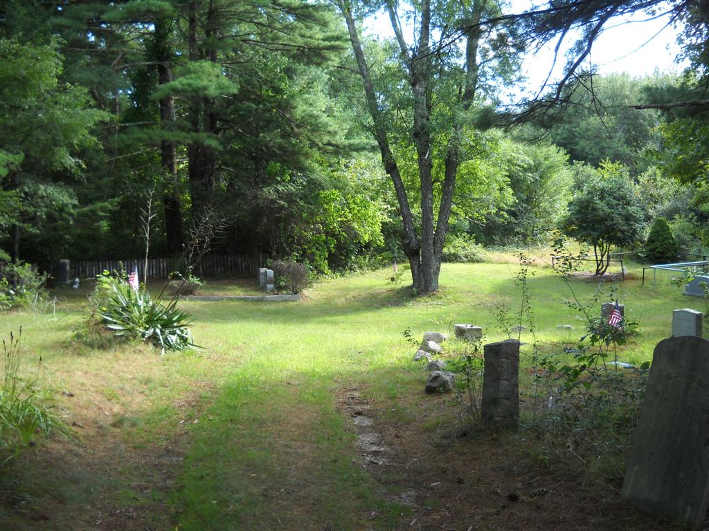
| Description | : | This cemetery is owned by the Town of Freetown. The entrance is to the left of the chainlink fence that identifies the Reynolds Cemetery. Across the railroad tracks is the Braley West Cemetery. This cemetery contains fieldstones, meaning that the establishment date is unknowable. The cemetery is listed on Map 253 Lot 29.01 of the Freetown Assessors Property Maps. The Massachusetts Historical Commission refers to this cemetery in MACRIS as FRE823, however this record lists the three cemeteries as one. This cemetery is referred to in the Bristol County Massachusetts Cemeteries Database as FR006, however this record lists the three cemeteries as one.... Read More |
frequently asked questions (FAQ):
-
Where is Braley East Cemetery?
Braley East Cemetery is located at East Chipaway Road Freetown, Bristol County ,Massachusetts ,USA.
-
Braley East Cemetery cemetery's updated grave count on graveviews.com?
1 memorials
-
Where are the coordinates of the Braley East Cemetery?
Latitude: 41.7353600
Longitude: -70.9646500
Nearby Cemetories:
1. Reynolds Cemetery
Freetown, Bristol County, USA
Coordinate: 41.7357340, -70.9650710
2. Braley West Cemetery
Freetown, Bristol County, USA
Coordinate: 41.7352200, -70.9656930
3. Demoranville Cemetery
Freetown, Bristol County, USA
Coordinate: 41.7322970, -70.9708740
4. Demoranville Family Cemetery
Dartmouth, Bristol County, USA
Coordinate: 41.7267600, -70.9727800
5. Tobey Family Cemetery
New Bedford, Bristol County, USA
Coordinate: 41.7347100, -70.9471300
6. Reynolds Cemetery
New Bedford, Bristol County, USA
Coordinate: 41.7278800, -70.9457800
7. Ashley Family Cemetery
Dartmouth, Bristol County, USA
Coordinate: 41.7200200, -70.9913300
8. Crapo Cemetery
Freetown, Bristol County, USA
Coordinate: 41.7257996, -70.9961014
9. Josiah DeMoranville Family Cemetery
Freetown, Bristol County, USA
Coordinate: 41.7588920, -70.9797050
10. Peckham Cemetery
Acushnet, Bristol County, USA
Coordinate: 41.7349460, -70.9243390
11. Bisbee-Sherman Cemetery
Acushnet, Bristol County, USA
Coordinate: 41.7351620, -70.9228850
12. Polish National Catholic Cemetery
New Bedford, Bristol County, USA
Coordinate: 41.7067680, -70.9458694
13. East Freetown Cemetery
Freetown, Bristol County, USA
Coordinate: 41.7639620, -70.9880140
14. Nathan Spooner Family Cemetery
Freetown, Bristol County, USA
Coordinate: 41.7689000, -70.9682400
15. White Cemetery
Freetown, Bristol County, USA
Coordinate: 41.7546997, -70.9272003
16. Paul M. Burns Family Cemetery
Freetown, Bristol County, USA
Coordinate: 41.7605300, -70.9969100
17. Chace Cemetery
Freetown, Bristol County, USA
Coordinate: 41.7656400, -70.9878700
18. James Emerson Ashley Family Cemetery
Freetown, Bristol County, USA
Coordinate: 41.7703600, -70.9687300
19. Hammond Family Cemetery
New Bedford, Bristol County, USA
Coordinate: 41.7073800, -70.9340800
20. Pine Island Cemetery
Dartmouth, Bristol County, USA
Coordinate: 41.7108600, -71.0018300
21. Indian Burial Site #2
Freetown, Bristol County, USA
Coordinate: 41.7675400, -70.9902100
22. Ashley Family Cemetery
Dartmouth, Bristol County, USA
Coordinate: 41.7016500, -70.9864500
23. Caswell Cemetery
Freetown, Bristol County, USA
Coordinate: 41.7160460, -71.0078570
24. Rounsevell Cemetery
Freetown, Bristol County, USA
Coordinate: 41.7727000, -70.9567000