
| Memorials | : | 0 |
| Location | : | Randolph County, USA |
| Coordinate | : | 35.9062540, -79.7822510 |
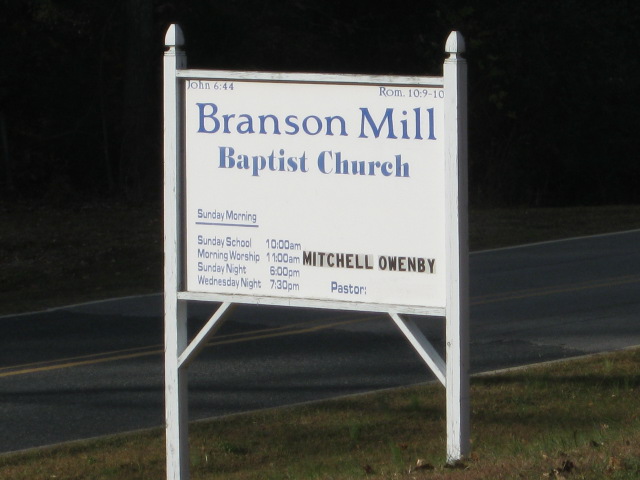
| Description | : | 1362 Branson Mill Road Pleasant Garden, NC 27313 This church was originally known as Mt. Zion Methodist Church. It has also had the name of Welcome Baptist Church. Today it is known as Branson Mill Baptist Church. The cemetery is located in two sections. Section one, on the East side of Branson Mill Road and section two is on the West side. |
frequently asked questions (FAQ):
-
Where is Branson Mill Baptist Church Cemetery?
Branson Mill Baptist Church Cemetery is located at 1362Branson Mill Road Randolph County ,North Carolina , 27313USA.
-
Branson Mill Baptist Church Cemetery cemetery's updated grave count on graveviews.com?
0 memorials
-
Where are the coordinates of the Branson Mill Baptist Church Cemetery?
Latitude: 35.9062540
Longitude: -79.7822510

Nearby Cemetories:
1. Centre Friends Meeting Cemetery
Greensboro, Guilford County, USA
Coordinate: 35.9212000, -79.8014000
2. Level Cross United Methodist Church Cemetery
Randleman, Randolph County, USA
Coordinate: 35.8871100, -79.8066620
3. Level Cross Baptist Church Cemetery
Randleman, Randolph County, USA
Coordinate: 35.8879530, -79.8081950
4. Faith Chapel Cemetery
Pleasant Garden, Guilford County, USA
Coordinate: 35.9433980, -79.7726420
5. Saint Peter United Methodist Church Cemetery
Randleman Township, Randolph County, USA
Coordinate: 35.8601570, -79.7956300
6. Saint Peters UMC Cemetery
Randleman, Randolph County, USA
Coordinate: 35.8601310, -79.7956760
7. Providence Cemetery
Randolph County, USA
Coordinate: 35.8737030, -79.7382820
8. Bethlehem United Methodist Church Cemetery
Climax, Guilford County, USA
Coordinate: 35.9155600, -79.7219500
9. Burnetts Chapel United Methodist Church Cemetery
Greensboro, Guilford County, USA
Coordinate: 35.9454800, -79.8276920
10. Pleasant Garden United Methodist Church Cemetery
Pleasant Garden, Guilford County, USA
Coordinate: 35.9604360, -79.7619630
11. Saint John Baptist Church Cemetery
Climax, Guilford County, USA
Coordinate: 35.9154560, -79.7094780
12. New Salem United Methodist Church Cemetery
Randleman, Randolph County, USA
Coordinate: 35.8406311, -79.7853233
13. Bethel United Methodist Church Cemetery
Randolph County, USA
Coordinate: 35.8779190, -79.7051540
14. Galilee United Church of God Cemetery
Randleman, Randolph County, USA
Coordinate: 35.8887990, -79.8648480
15. Community Baptist Church Cemetery
Greensboro, Guilford County, USA
Coordinate: 35.9548060, -79.8481770
16. Cedar Square Friends Meeting Cemetery
Randolph County, USA
Coordinate: 35.8872860, -79.8696320
17. Red Cross Baptist Church Cemetery
Redcross, Randolph County, USA
Coordinate: 35.8715591, -79.6995850
18. Ebenezer United Methodist Church Cemetery
Archdale, Randolph County, USA
Coordinate: 35.9018700, -79.8760100
19. Mount Lebanon United Methodist Church Cemetery
Randleman, Randolph County, USA
Coordinate: 35.8267230, -79.8039770
20. Islamic Center of High Point Muslim Cemetery
Greensboro, Guilford County, USA
Coordinate: 35.9656310, -79.8526110
21. Concord Friends Meeting Cemetery
Greensboro, Guilford County, USA
Coordinate: 35.9828720, -79.8320007
22. Bell Welborn Cemetery
Randolph County, USA
Coordinate: 35.8400950, -79.8515080
23. Saint Paul Methodist Episcopal South Cemetery
Randleman, Randolph County, USA
Coordinate: 35.8222200, -79.8090410
24. Ferree's Chapel Cemetery
Randleman, Randolph County, USA
Coordinate: 35.8189700, -79.8108000