
| Memorials | : | 0 |
| Location | : | Bridal Veil, Multnomah County, USA |
| Coordinate | : | 45.5619011, -122.1703033 |
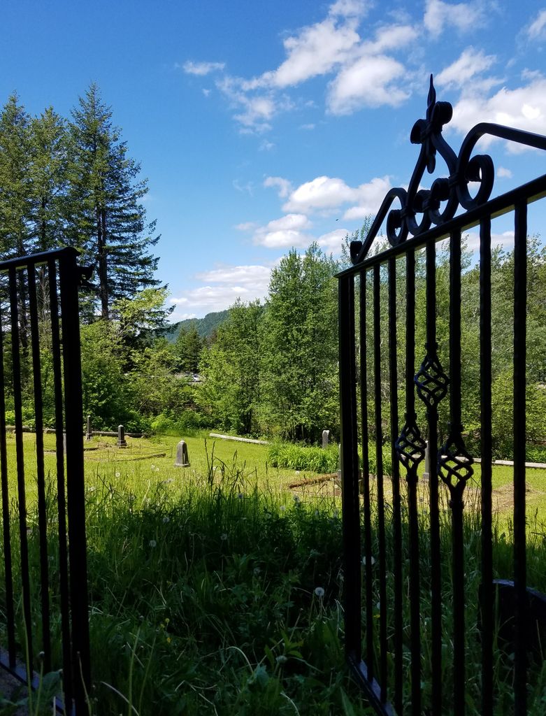
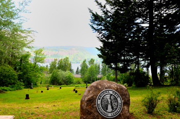
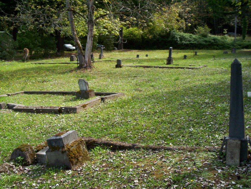
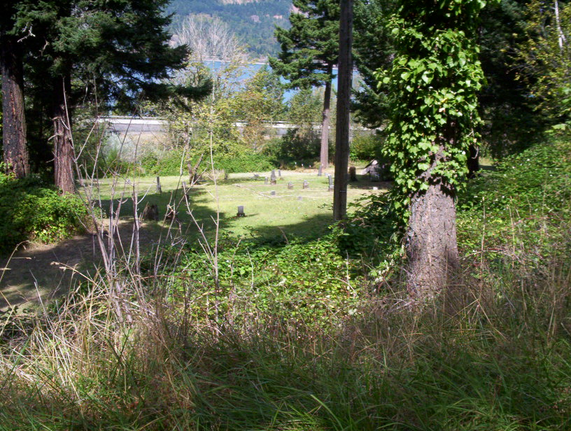
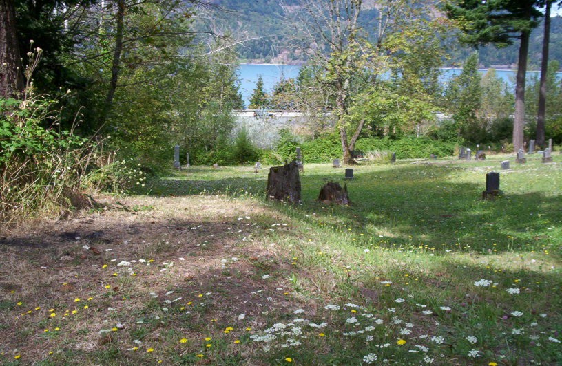
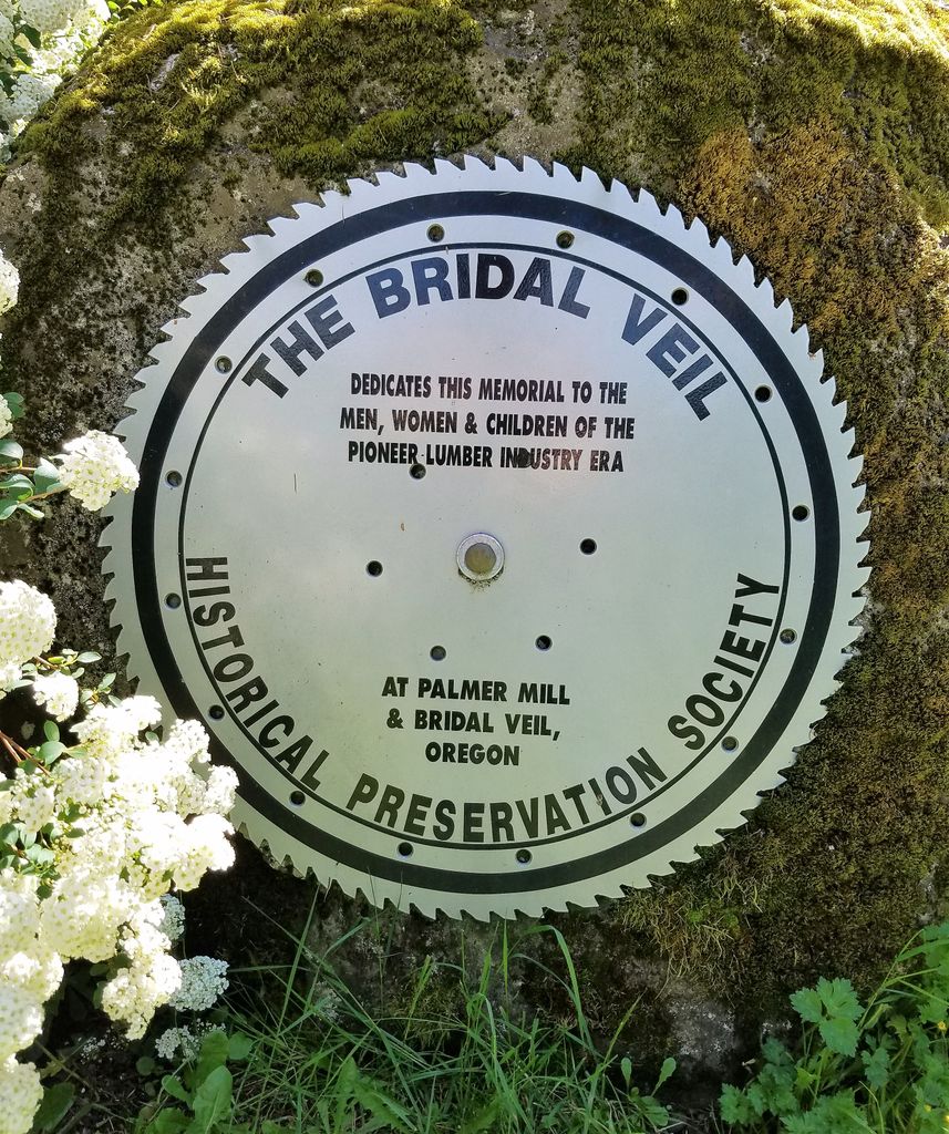
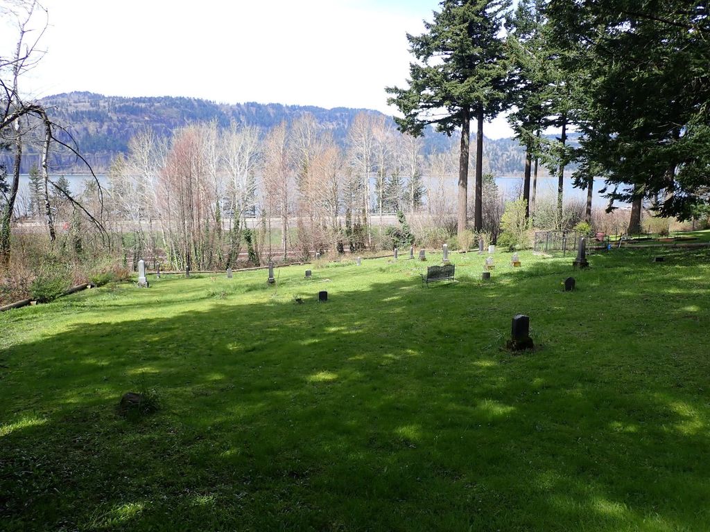
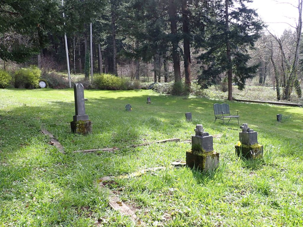
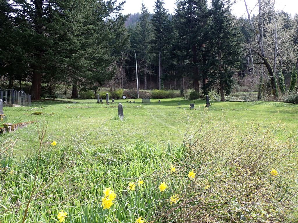
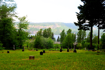
| Description | : | Located on the Columbia River bluff near the former townsite of Bridal Veil, Multnomah County, Oregon, this cemetery has been neglected at times throughout the past hundred years. The first known burial in the cemetery occurred in 1888, and the last in 1934. In 1958 the cemetery was described as being in "total neglect", with only four observable headstones. In 1964 the blackberries were beaten back and the first field survey was conducted. At that time, thirty-one stones were discovered, and additional unmarked graves were documented from town records and obituaries. A recent field survey (May 2000) by the Genealogical... Read More |
frequently asked questions (FAQ):
-
Where is Bridal Veil Cemetery?
Bridal Veil Cemetery is located at Bridal Veil Outlet at Old Scenic Columbia Highway Bridal Veil, Multnomah County ,Oregon ,USA.
-
Bridal Veil Cemetery cemetery's updated grave count on graveviews.com?
0 memorials
-
Where are the coordinates of the Bridal Veil Cemetery?
Latitude: 45.5619011
Longitude: -122.1703033


Nearby Cemetories:
1. Franciscan Sisters of the Eucharist Cemetery
Bridal Veil, Multnomah County, USA
Coordinate: 45.5632000, -122.1667000
2. Mount Pleasant Cemetery
Skamania County, USA
Coordinate: 45.5636930, -122.2295770
3. Belle Center Cemetery
Skamania County, USA
Coordinate: 45.5923000, -122.2213000
4. Pounder Cemetery
Multnomah County, USA
Coordinate: 45.5259980, -122.2781970
5. Mountain View Corbett Cemetery
Corbett, Multnomah County, USA
Coordinate: 45.5188720, -122.2973690
6. Holy Cross Cemetery
Washougal, Clark County, USA
Coordinate: 45.5754013, -122.3158035
7. Washougal Memorial Cemetery
Washougal, Clark County, USA
Coordinate: 45.5882988, -122.3313980
8. Sunnyside Cemetery
Washougal, Clark County, USA
Coordinate: 45.6150017, -122.3475037
9. Pleasant Home Cemetery
Gresham, Multnomah County, USA
Coordinate: 45.4632910, -122.3372480
10. Douglass Pioneer Cemetery
Troutdale, Multnomah County, USA
Coordinate: 45.5316050, -122.3889990
11. Cliffside Cemetery
Sandy, Clackamas County, USA
Coordinate: 45.4098880, -122.2320740
12. Camas Cemetery
Camas, Clark County, USA
Coordinate: 45.5934982, -122.3955994
13. Mountain View Stark Pioneer Cemetery
Troutdale, Multnomah County, USA
Coordinate: 45.5193160, -122.3940360
14. Revenue Cemetery
Sandy, Clackamas County, USA
Coordinate: 45.4072160, -122.2415180
15. McNatt Grave Site
North Bonneville, Skamania County, USA
Coordinate: 45.6430540, -121.9597490
16. Fern Prairie Cemetery
Camas, Clark County, USA
Coordinate: 45.6236000, -122.3964005
17. Cascade Cemetery
North Bonneville, Skamania County, USA
Coordinate: 45.6465800, -121.9588600
18. Fir Hill Cemetery
Sandy, Clackamas County, USA
Coordinate: 45.4006380, -122.2750000
19. Scandinavia Cemetery
Sandy, Clackamas County, USA
Coordinate: 45.3996590, -122.2755040
20. Moore Family Cemetery
Marmot, Clackamas County, USA
Coordinate: 45.3857667, -122.0980555
21. Cherryville Cemetery
Sandy, Clackamas County, USA
Coordinate: 45.3740140, -122.1240450
22. Gresham Pioneer Cemetery
Gresham, Multnomah County, USA
Coordinate: 45.4964660, -122.4339800
23. Forest Lawn Cemetery
Gresham, Multnomah County, USA
Coordinate: 45.4949070, -122.4343760
24. White Birch Cemetery
Gresham, Multnomah County, USA
Coordinate: 45.4959100, -122.4350100