| Memorials | : | 1 |
| Location | : | Broadmarsh, Southern Midlands Council, Australia |
| Coordinate | : | -42.6344620, 147.1129760 |
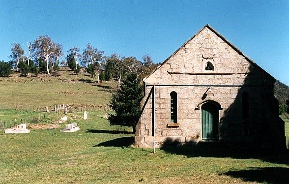
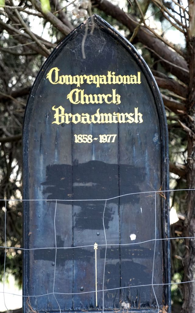
| Description | : | The Broadmarsh Uniting (Congregational) Church was built in 1861 on land owned by William Gunn, at ‘Arndell’. Though it was a Congregational Church, it apparently was predominately used by Presbyterian members before becoming a part of the Uniting Church in 1977. It then became known as the Elderslie Uniting Church, before eventually being sold and converted into a housing structure. Approved access to the cemetery should sought from the property’s current owners. The cemetery is located behind the church, with those buried within mostly being from the rural settlement. Both the church and cemetery can be seen in... Read More |
frequently asked questions (FAQ):
-
Where is Broadmarsh Congregational Cemetery?
Broadmarsh Congregational Cemetery is located at 1497 Elderslie Road Broadmarsh, Southern Midlands Council ,Tasmania , 7030Australia.
-
Broadmarsh Congregational Cemetery cemetery's updated grave count on graveviews.com?
1 memorials
-
Where are the coordinates of the Broadmarsh Congregational Cemetery?
Latitude: -42.6344620
Longitude: 147.1129760
Nearby Cemetories:
1. St. Augustine's Anglican Cemetery
Broadmarsh, Southern Midlands Council, Australia
Coordinate: -42.6380880, 147.1158740
2. St. Michael's Anglican Cemetery
Bagdad, Southern Midlands Council, Australia
Coordinate: -42.6263790, 147.2226500
3. Bagdad Uniting Church Cemetery
Bagdad, Southern Midlands Council, Australia
Coordinate: -42.6084120, 147.2222760
4. St. Anne's Anglican Church Cemetery
Dysart, Southern Midlands Council, Australia
Coordinate: -42.5753650, 147.2165400
5. Kempton Congregational Cemetery
Kempton, Southern Midlands Council, Australia
Coordinate: -42.5361860, 147.2038090
6. St. Peter’s Catholic Church Cemetery
Kempton, Southern Midlands Council, Australia
Coordinate: -42.5299560, 147.1968150
7. St. Mark's Anglican Cemetery
Pontville, Southern Midlands Council, Australia
Coordinate: -42.6807150, 147.2663860
8. Pontville Saint Matthews Roman Catholic Cemetery
Brighton, Brighton Council, Australia
Coordinate: -42.6900390, 147.2629800
9. St Mary’s Anglican Church Cemetery
Kempton, Southern Midlands Council, Australia
Coordinate: -42.5282960, 147.2012760
10. St. Mary's Anglican Cemetery
Bridgewater, Brighton Council, Australia
Coordinate: -42.7374010, 147.2282310
11. St. Mary's Church of England Cemetery
Gretna, Central Highlands Council, Australia
Coordinate: -42.6669200, 146.9333810
12. New Norfolk Old Cemetery
New Norfolk, Derwent Valley Council, Australia
Coordinate: -42.7719330, 147.0579860
13. Lawitta Church Cemetery
Magra, Derwent Valley Council, Australia
Coordinate: -42.7661690, 147.0331060
14. St. Matthew’s Anglican Columbarium Wall
New Norfolk, Derwent Valley Council, Australia
Coordinate: -42.7792220, 147.0673080
15. Saint Matthew's Anglican Cemetery
New Norfolk, Derwent Valley Council, Australia
Coordinate: -42.7806289, 147.0664250
16. Malbina General Cemetery
Malbina, Derwent Valley Council, Australia
Coordinate: -42.7866610, 147.1184830
17. Plenty Anglican Church Cemetery
Plenty, Derwent Valley Council, Australia
Coordinate: -42.7382900, 146.9605860
18. Hestercombe Uniting Church Cemetery
Austins Ferry, Glenorchy City, Australia
Coordinate: -42.7695190, 147.2448030
19. St George's Church of England Cemetery
Gagebrook, Brighton Council, Australia
Coordinate: -42.7499706, 147.2793948
20. Melton Mowbray Church of England
Melton Mowbray, Southern Midlands Council, Australia
Coordinate: -42.4721458, 147.1806319
21. Saint Thomas Anglican Church Cemetery
Tea Tree, Brighton Council, Australia
Coordinate: -42.6915500, 147.3447700
22. Red Hills Cemetery
Bushy Park, Derwent Valley Council, Australia
Coordinate: -42.7091350, 146.8893740
23. St Patrick’s Catholic Church Cemetery
Colebrook, Southern Midlands Council, Australia
Coordinate: -42.5349600, 147.3620500
24. St. James Anglican Cemetery
Colebrook, Southern Midlands Council, Australia
Coordinate: -42.5371373, 147.3641418


