
| Memorials | : | 0 |
| Location | : | East Longmeadow, Hampden County, USA |
| Coordinate | : | 42.0842819, -72.4809036 |
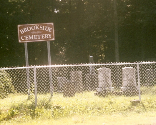
| Description | : | This cemetery is located on Porter Road in East Longmeadow, MA. It is across from the Pine Knoll Executive Golf Course on Porter Rd. There is no parking on the street for this cemetery, so one must park in the Fenway Golf Range Pitch & Putt golf course parking lot located nearby on 112 Allen St. Town Hall keeps no records of interments. Burial records are located at the East Longmeadow Historical Society housed within the E. L. Library. This cemetery has had numerous accidents happen to the fence, as it is very close to the road and at... Read More |
frequently asked questions (FAQ):
-
Where is Brookside Cemetery?
Brookside Cemetery is located at East Longmeadow, Hampden County ,Massachusetts ,USA.
-
Brookside Cemetery cemetery's updated grave count on graveviews.com?
0 memorials
-
Where are the coordinates of the Brookside Cemetery?
Latitude: 42.0842819
Longitude: -72.4809036
Nearby Cemetories:
1. Saint Marks Memorial Garden
East Longmeadow, Hampden County, USA
Coordinate: 42.0725600, -72.5007430
2. Gate of Heaven Cemetery
Springfield, Hampden County, USA
Coordinate: 42.1048370, -72.4778450
3. Wachogue Cemetery
Springfield, Hampden County, USA
Coordinate: 42.0950860, -72.5109030
4. Green Lawn Cemetery
East Longmeadow, Hampden County, USA
Coordinate: 42.0645561, -72.5079727
5. Baptist Village Cemetery
East Longmeadow, Hampden County, USA
Coordinate: 42.0559920, -72.4711310
6. Adams Cemetery
Wilbraham, Hampden County, USA
Coordinate: 42.1082993, -72.4389038
7. Billings Hill Cemetery
East Longmeadow, Hampden County, USA
Coordinate: 42.0433860, -72.5000000
8. Hillcrest Park Cemetery
Springfield, Hampden County, USA
Coordinate: 42.1274986, -72.4933014
9. Kesser Israel Cemetery
Springfield, Hampden County, USA
Coordinate: 42.1145610, -72.5304670
10. Maplewood Cemetery
Springfield, Hampden County, USA
Coordinate: 42.1307983, -72.4957962
11. Sons of Israel Cemetery
Springfield, Hampden County, USA
Coordinate: 42.1143000, -72.5316000
12. City of Homes Cemetery
Springfield, Hampden County, USA
Coordinate: 42.1142980, -72.5316060
13. Woodland Dell Cemetery
Wilbraham, Hampden County, USA
Coordinate: 42.1211014, -72.4263992
14. Old Hampden Cemetery
Hampden, Hampden County, USA
Coordinate: 42.0611000, -72.4111023
15. Saint Michael's Cemetery
Springfield, Hampden County, USA
Coordinate: 42.1240997, -72.5392914
16. Unitarian Universalist Church Memorial Garden
Springfield, Hampden County, USA
Coordinate: 42.0711740, -72.5611830
17. Prospect Hill Cemetery
Hampden, Hampden County, USA
Coordinate: 42.0639000, -72.4028015
18. Deer Creek Harmony Presbyterian Church Cemeter
Havre de Grace, Harford County, USA
Coordinate: 42.0636292, -72.4015503
19. Saint Marys Cemetery
Hampden, Hampden County, USA
Coordinate: 42.0636292, -72.4015503
20. Bay Path Cemetery
Springfield, Hampden County, USA
Coordinate: 42.1231003, -72.5519028
21. Cherry Lane Cemetery
Springfield, Hampden County, USA
Coordinate: 42.0971985, -72.5689011
22. Sinai Memorial Park
Springfield, Hampden County, USA
Coordinate: 42.1427994, -72.5291977
23. Trinity United Methodist Church Memorial Garden
Springfield, Hampden County, USA
Coordinate: 42.0824900, -72.5739240
24. Glendale Cemetery
Wilbraham, Hampden County, USA
Coordinate: 42.1133000, -72.3964000