
| Memorials | : | 0 |
| Location | : | Freestone County, USA |
| Coordinate | : | 31.5942001, -95.9978027 |
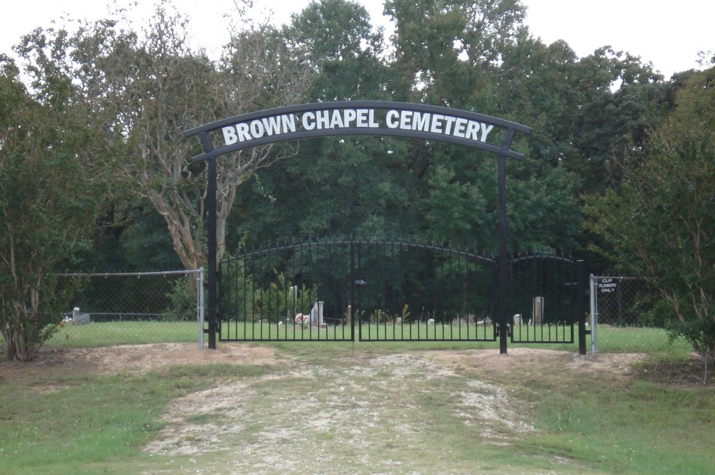
| Description | : | This cemetery is near the Plum Creek community across the road from Brown Chapel A.M.E. Church. Directions: >From Fairfield: Go down Highway 84 to Red Lake. Turn right off Highway 84 at Red Lake going south on Farm-to-Market Road #489 for about 5 miles. >From Lanely Community: Go east on Farm-to-Market Road #489 The cemetery is located where Co. Rd. 371 "T"s into FTM 489. Brown Chapel Church began as a log cabin school/church building on John L. Johnson's land about a mile from the present... Read More |
frequently asked questions (FAQ):
-
Where is Brown Chapel Cemetery?
Brown Chapel Cemetery is located at FM 489 Freestone County ,Texas ,USA.
-
Brown Chapel Cemetery cemetery's updated grave count on graveviews.com?
0 memorials
-
Where are the coordinates of the Brown Chapel Cemetery?
Latitude: 31.5942001
Longitude: -95.9978027
Nearby Cemetories:
1. Brooke Cemetery
Freestone County, USA
Coordinate: 31.6053009, -95.9972000
2. Coston Family Cemetery
Freestone County, USA
Coordinate: 31.6133200, -96.0027500
3. Mount Pleasant Baptist Cemetery
Plum Creek, Freestone County, USA
Coordinate: 31.5647620, -96.0074950
4. Willis Cemetery
Freestone County, USA
Coordinate: 31.6228008, -95.9843979
5. Anderson-Willis Cemetery
Butler, Freestone County, USA
Coordinate: 31.6311980, -95.9939430
6. Shiloh Baptist Church Cemetery
Red Lake, Freestone County, USA
Coordinate: 31.6356850, -95.9660670
7. Gorman Cemetery
Red Lake, Freestone County, USA
Coordinate: 31.6571620, -95.9590320
8. Rocky Mount Cemetery
Freestone County, USA
Coordinate: 31.6101220, -95.8984310
9. Harrison Chapel Cemetery
Dew, Freestone County, USA
Coordinate: 31.5650005, -96.0997009
10. Daniel Memorial Cemetery
Butler, Freestone County, USA
Coordinate: 31.6663860, -95.9314160
11. Pine Top Cemetery
Butler, Freestone County, USA
Coordinate: 31.6769550, -95.9256120
12. Mount Zion Cemetery
Freestone County, USA
Coordinate: 31.6886005, -96.0485992
13. Antioch Cemetery
Fairfield, Freestone County, USA
Coordinate: 31.7076640, -96.0452010
14. Dew Cemetery
Dew, Freestone County, USA
Coordinate: 31.5936960, -96.1410230
15. Compton Cemetery
Freestone County, USA
Coordinate: 31.6039570, -96.1464770
16. Mayes Cemetery
Freestone County, USA
Coordinate: 31.6758000, -95.8833000
17. Lone Star Cemetery
Freestone County, USA
Coordinate: 31.6769880, -95.8830870
18. Varnell Cemetery
Freestone County, USA
Coordinate: 31.5280991, -96.1280975
19. Holly Grove Cemetery
Freestone County, USA
Coordinate: 31.5114002, -96.1157990
20. Post Oak Cemetery
Fairfield, Freestone County, USA
Coordinate: 31.6787760, -96.1349790
21. McDaniel Family Cemetery
Butler, Freestone County, USA
Coordinate: 31.6446870, -95.8336540
22. Sand Hill Cemetery
Freestone County, USA
Coordinate: 31.7378006, -95.9274979
23. Salem Missionary Baptist Church Cemetery
Dew, Freestone County, USA
Coordinate: 31.5758000, -96.1803000
24. Avant Prairie AME Church Cemetery
Teague, Freestone County, USA
Coordinate: 31.6088830, -96.1815780