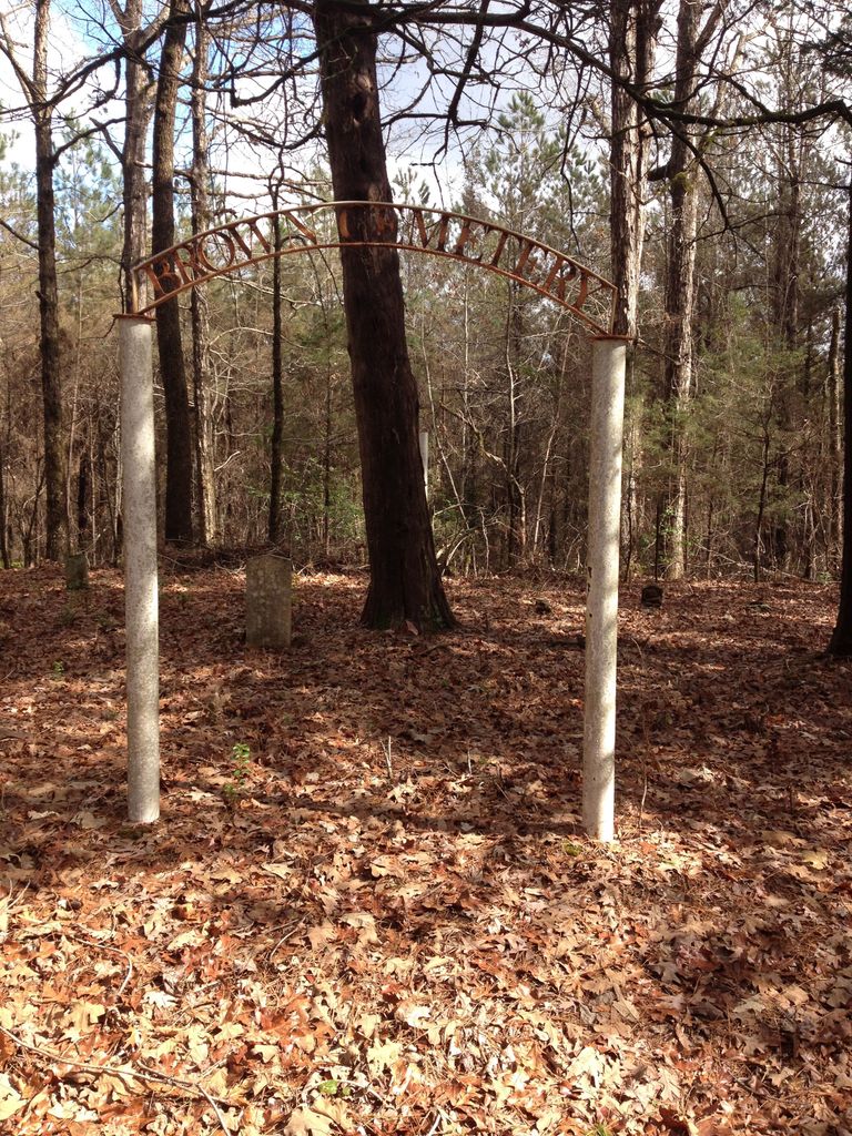
| Memorials | : | 0 |
| Location | : | Kemper County, USA |
| Coordinate | : | 32.6810995, -88.5237538 |
| Description | : | Directions-From the intersection/Junction of US Highway 45 & Mississippi Highway 498 near Porterville, Mississippi, go west on Dekalb-Porterville Road approximately 2 miles to Chapel Hill Church and Chapel Hill Road. Continue west past this intersection for approximately 300 yards. Turn left or south on a logging road and proceed approximately 250-300 yards to a log trail to the right. There is a locked gate. Proceed down this log trail in a westerly direction for approximately 1/8th mile to the cemetery, which is located on timber company property. |
frequently asked questions (FAQ):
-
Where is Brown Family Cemetery?
Brown Family Cemetery is located at Kemper County ,Mississippi ,USA.
-
Brown Family Cemetery cemetery's updated grave count on graveviews.com?
0 memorials
-
Where are the coordinates of the Brown Family Cemetery?
Latitude: 32.6810995
Longitude: -88.5237538
Nearby Cemetories:
1. Chapel Hill Cemetery
Oak Grove, Kemper County, USA
Coordinate: 32.6871986, -88.5186005
2. Saint Luke Church Cemetery
Porterville, Kemper County, USA
Coordinate: 32.6784200, -88.4930800
3. Saint John Cemetery
Oak Grove, Kemper County, USA
Coordinate: 32.6640200, -88.5542100
4. Harvestime Church Cemetery
Porterville, Kemper County, USA
Coordinate: 32.7170780, -88.5425550
5. Robbins Cemetery
Kemper County, USA
Coordinate: 32.6892014, -88.4710999
6. Union United Methodist Church Cemetery
Oak Grove, Kemper County, USA
Coordinate: 32.6791980, -88.5783900
7. Shady Grove Primitive Baptist Church Cemetery
De Kalb, Kemper County, USA
Coordinate: 32.6504100, -88.5686500
8. Bay Springs Baptist Church Cemetery
Porterville, Kemper County, USA
Coordinate: 32.7236000, -88.5536000
9. Center Ridge Cemetery
Kemper County, USA
Coordinate: 32.6680984, -88.5883026
10. Mount Zion Baptist Church Cemetery
Porterville, Kemper County, USA
Coordinate: 32.6393000, -88.4775400
11. Pilgrim Rest M B Church Cemetery
Porterville, Kemper County, USA
Coordinate: 32.6220900, -88.5184600
12. Enondale Cemetery
Kemper County, USA
Coordinate: 32.6366997, -88.4717026
13. Pleasant Grove Baptist Cemetery
De Kalb, Kemper County, USA
Coordinate: 32.6504100, -88.6033800
14. Mount Cephus Cemetery
Porterville, Kemper County, USA
Coordinate: 32.6073600, -88.4925400
15. Cherry Cemetery
Kemper County, USA
Coordinate: 32.7578011, -88.5543976
16. Key Cemetery
De Kalb, Kemper County, USA
Coordinate: 32.6908900, -88.6281000
17. Macedonia Cemetery
De Kalb, Kemper County, USA
Coordinate: 32.7430992, -88.5986023
18. Mount Hebron Cemetery
Kemper County, USA
Coordinate: 32.5993996, -88.4681015
19. Rush Cemetery
Kemper County, USA
Coordinate: 32.6893997, -88.6408005
20. Union Kemper Springs Baptist Church Cemetery
Kemper Springs, Kemper County, USA
Coordinate: 32.5926400, -88.5803200
21. Mosby Kemper Cemetery
De Kalb, Kemper County, USA
Coordinate: 32.5905920, -88.5760400
22. Conner Cemetery
De Kalb, Kemper County, USA
Coordinate: 32.7346320, -88.6485850
23. Briggs Chapel Cemetery
Porterville, Kemper County, USA
Coordinate: 32.6330986, -88.3927994
24. Gordon Cemetery
Lauderdale, Lauderdale County, USA
Coordinate: 32.5485992, -88.5130997

