
| Memorials | : | 0 |
| Location | : | Brunssum, Brunssum Municipality, Netherlands |
| Coordinate | : | 50.9517500, 5.9701700 |
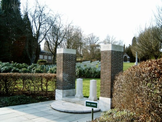
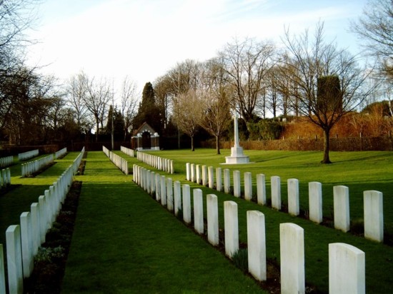
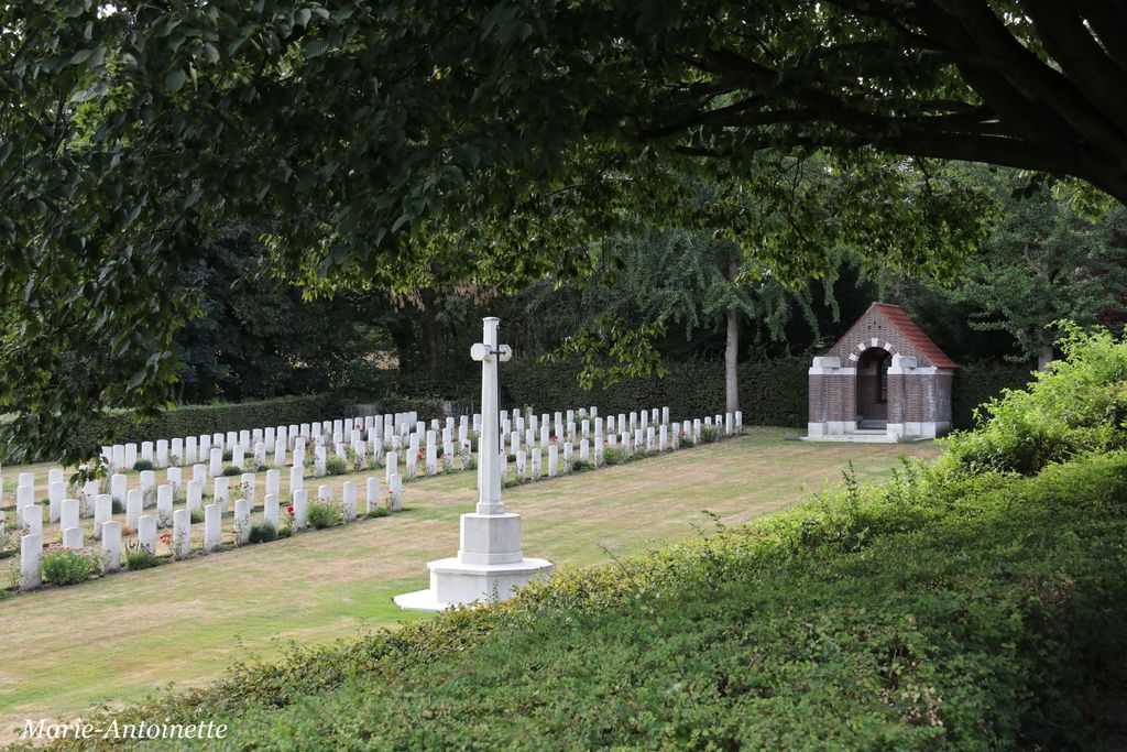
| Description | : | The town of Brunssum is in the south east corner of the Netherlands close to the German border, approx 30kms north east of Maastricht. Brunssum was liberated in September 1944 by U.S. forces; they were shortly afterwards followed by the British 43rd (Wessex) Division, who made their headquarters in the town, and in turn were succeeded by the 52nd (Lowland) Division. The first burials in the cemetery were made by an Advanced Dressing Station and a Casualty Clearing Station which were situated at Merkelbeek in November 1944 when the 43rd Division were engaged in clearing a triangle between... Read More |
frequently asked questions (FAQ):
-
Where is Brunssum War Cemetery?
Brunssum War Cemetery is located at Heufstraat Brunssum, Brunssum Municipality ,Limburg , 6441 TXNetherlands.
-
Brunssum War Cemetery cemetery's updated grave count on graveviews.com?
0 memorials
-
Where are the coordinates of the Brunssum War Cemetery?
Latitude: 50.9517500
Longitude: 5.9701700
Nearby Cemetories:
1. Rumpen Sint-Vincentius Cemetery
Rumpen, Brunssum Municipality, Netherlands
Coordinate: 50.9407100, 5.9760900
2. Treebeek Sint-Barbara Churchyard
Treebeek, Brunssum Municipality, Netherlands
Coordinate: 50.9369100, 5.9512100
3. Hoensbroek Centrale Begraafplaats
Hoensbroek, Heerlen Municipality, Netherlands
Coordinate: 50.9277600, 5.9155300
4. Heerlen General Cemetery
Heerlen, Heerlen Municipality, Netherlands
Coordinate: 50.8849800, 5.9816400
5. Joodse Begraafplaats
Heerlen Municipality, Netherlands
Coordinate: 50.8849460, 5.9817340
6. Begraaf en gedenkpark Broeksittard
Sittard, Sittard-Geleen Municipality, Netherlands
Coordinate: 51.0018175, 5.8908590
7. Sittard General Cemetery
Sittard, Sittard-Geleen Municipality, Netherlands
Coordinate: 50.9953300, 5.8787400
8. Voerendaal Algemeen Begraafplaats
Voerendaal, Voerendaal Municipality, Netherlands
Coordinate: 50.8838100, 5.9271200
9. RK Begraafplaats Kunrade
Kunrade, Voerendaal Municipality, Netherlands
Coordinate: 50.8768009, 5.9344092
10. Kriegsgräberstätte
Saeffelen, Landkreis Heinsberg, Germany
Coordinate: 51.0326056, 5.9589650
11. Sittard War Cemetery
Sittard, Sittard-Geleen Municipality, Netherlands
Coordinate: 50.9891100, 5.8539700
12. R.K. Begraafplaats Petrus en Marcellinus
Geleen, Sittard-Geleen Municipality, Netherlands
Coordinate: 50.9666672, 5.8333335
13. Friedhof Hofstadt in Herzogenrath-Merkstein
Herzogenrath, Stadtkreis Aachen, Germany
Coordinate: 50.9013790, 6.0889200
14. Begraaf en gedenkpark Geleen - Zuid
Geleen, Sittard-Geleen Municipality, Netherlands
Coordinate: 50.9556178, 5.8248520
15. Begraafplaats R.K. Parochie H Remigius
Klimmen, Voerendaal Municipality, Netherlands
Coordinate: 50.8764108, 5.8855418
16. Rooms-Katholieke Begraafplaats Lutterade
Lutterade, Sittard-Geleen Municipality, Netherlands
Coordinate: 50.9703260, 5.8192550
17. Begraaf en gedenkpark Lindenheuvel-Geleen
Sittard-Geleen Municipality, Netherlands
Coordinate: 50.9858162, 5.8200877
18. Begraaf en gedenkpark Lindenheuvel-Geleen
Geleen, Sittard-Geleen Municipality, Netherlands
Coordinate: 50.9858916, 5.8198888
19. Begraaf en gedenkpark Vouersveld
Geleen, Sittard-Geleen Municipality, Netherlands
Coordinate: 50.9639179, 5.8106254
20. Beek De Nieuwe Hof Begraafplaats
Beek, Beek Municipality, Netherlands
Coordinate: 50.9394500, 5.8086500
21. Schifferheide Begraafplaats and Crematorium
Kerkrade, Kerkrade Municipality, Netherlands
Coordinate: 50.8590500, 6.0411700
22. Limbricht Cemetery
Limbricht, Sittard-Geleen Municipality, Netherlands
Coordinate: 51.0156959, 5.8383580
23. Joodse Begraafplaats
Beek, Beek Municipality, Netherlands
Coordinate: 50.9344700, 5.8058880
24. Friedhof Lange Hecke in Herzogenrath-Merkstein
Herzogenrath, Stadtkreis Aachen, Germany
Coordinate: 50.8798130, 6.0945480