| Memorials | : | 2 |
| Location | : | Independence, Buchanan County, USA |
| Coordinate | : | 42.4871560, -91.8647280 |
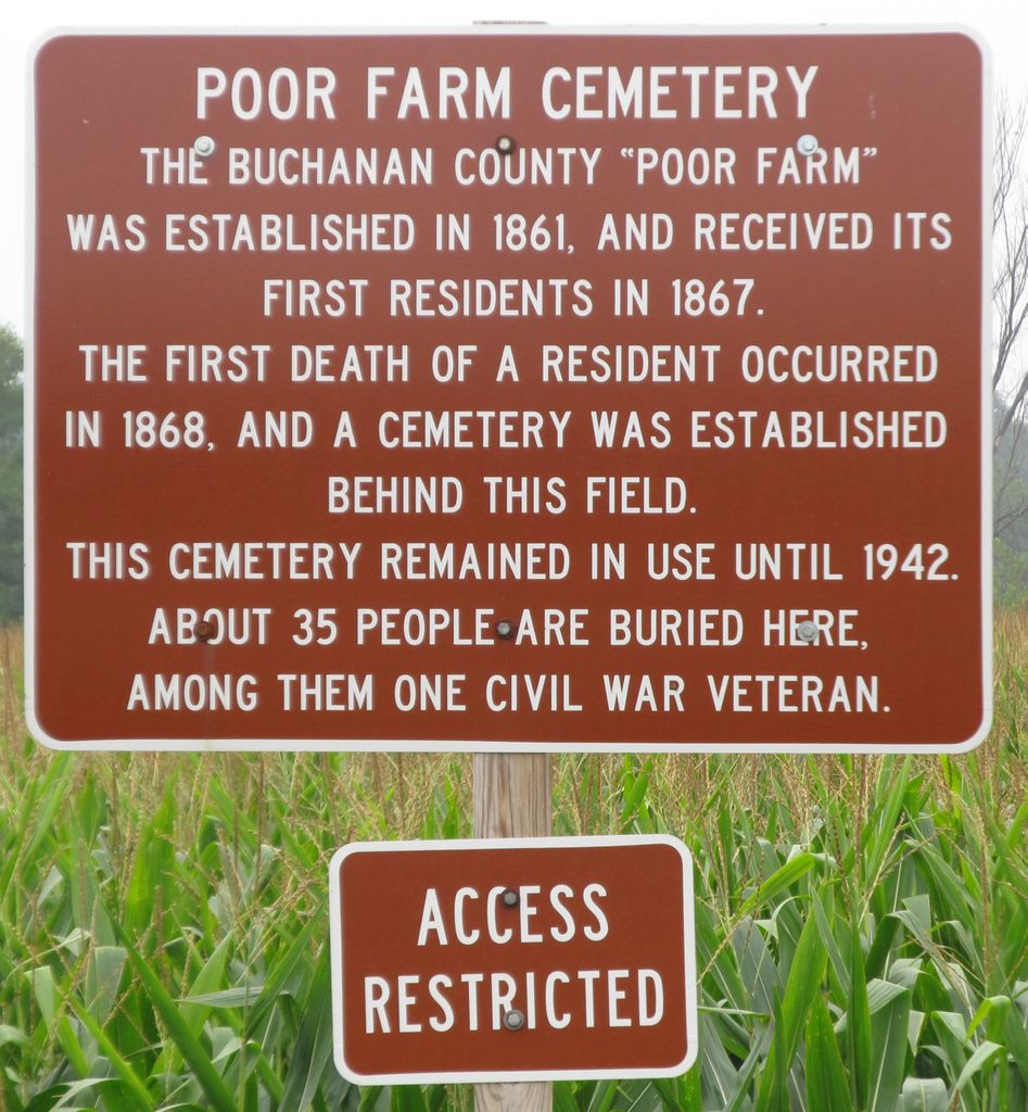
| Description | : | Located Northeast of Independence in Washington Township north of the Illinois Central Railroad Tracks with Byron Township bordering to East. In 1980, The Buchanan County Historical Society directed by Ellen FOLAND wrote(Researched by Lin CAFFERTY): "The County Home was purchased in 1861 and consisted of 194 acres ... In 1881, it was known as the 'Poor Farm' (AKA:Alms House in 1910). In 1914, it consisted of 220 acres with an average of 16 people living there although they had a capacity of 20 people. They took in old people with no families to care for them, people that... Read More |
frequently asked questions (FAQ):
-
Where is Buchanan County Poor Farm Cemetery?
Buchanan County Poor Farm Cemetery is located at Independence, Buchanan County ,Iowa ,USA.
-
Buchanan County Poor Farm Cemetery cemetery's updated grave count on graveviews.com?
2 memorials
-
Where are the coordinates of the Buchanan County Poor Farm Cemetery?
Latitude: 42.4871560
Longitude: -91.8647280
Nearby Cemetories:
1. Buchanan County Home Cemetery
Independence, Buchanan County, USA
Coordinate: 42.4903050, -91.8596350
2. Wilson Cemetery
Independence, Buchanan County, USA
Coordinate: 42.4658012, -91.8516998
3. Saint Johns Catholic Cemetery
Independence, Buchanan County, USA
Coordinate: 42.4822006, -91.8957977
4. Oakwood Cemetery
Independence, Buchanan County, USA
Coordinate: 42.4627991, -91.8927994
5. Mount Hope Cemetery
Independence, Buchanan County, USA
Coordinate: 42.4571991, -91.8914032
6. West Haven Cemetery
Independence, Buchanan County, USA
Coordinate: 42.4588678, -91.8986696
7. State Hospital Cemetery
Independence, Buchanan County, USA
Coordinate: 42.4455986, -91.9253006
8. Otterville Cemetery
Buchanan County, USA
Coordinate: 42.5158005, -91.9392014
9. Pine Creek Cemetery
Quasqueton, Buchanan County, USA
Coordinate: 42.4172400, -91.7867200
10. Fairview Cemetery
Winthrop, Buchanan County, USA
Coordinate: 42.4692001, -91.7407990
11. Payne Cemetery
Winthrop, Buchanan County, USA
Coordinate: 42.5203018, -91.7453003
12. Saint Patricks Cemetery
Winthrop, Buchanan County, USA
Coordinate: 42.4653015, -91.7328033
13. Fremont Township Cemetery
Winthrop, Buchanan County, USA
Coordinate: 42.5046997, -91.7264023
14. Hickory Grove Cemetery
Quasqueton, Buchanan County, USA
Coordinate: 42.4207598, -91.7534684
15. Byron Township Cemetery
Buchanan County, USA
Coordinate: 42.5271988, -91.7275009
16. Rowley Cemetery
Rowley, Buchanan County, USA
Coordinate: 42.3716621, -91.8530655
17. Quasqueton Cemetery
Quasqueton, Buchanan County, USA
Coordinate: 42.3994370, -91.7621231
18. Spangler Cemetery
Aurora, Buchanan County, USA
Coordinate: 42.5811900, -91.7620000
19. Fontana Cemetery
Hazleton, Buchanan County, USA
Coordinate: 42.6046982, -91.9052963
20. Littleton Cemetery
Littleton, Buchanan County, USA
Coordinate: 42.5338593, -92.0179520
21. Cedar Crest Cemetery
Jesup, Buchanan County, USA
Coordinate: 42.4782982, -92.0406036
22. Saint Athanasius Cemetery
Jesup, Buchanan County, USA
Coordinate: 42.4761009, -92.0421982
23. Saint Marys Cemetery
Hazleton, Buchanan County, USA
Coordinate: 42.6164017, -91.8983002
24. Amish Cemetery
Buchanan County, USA
Coordinate: 42.5689011, -92.0224991

