
| Memorials | : | 0 |
| Location | : | Coshocton County, USA |
| Coordinate | : | 40.3953800, -81.8049400 |
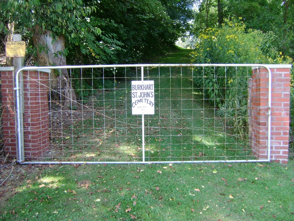
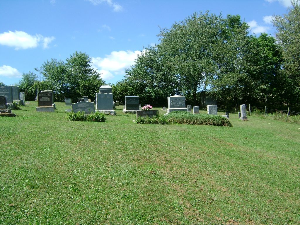
| Description | : | The Burkhardt Cemetery is located partially in Mill Creek Township and partially in Crawford Township. It is located on State Route 643 between County Road 190 and Township Road 224. There are two brick pillars at the entrance with a gate at the road. The cemetery is in excellent condition. |
frequently asked questions (FAQ):
-
Where is Burkhardt Cemetery?
Burkhardt Cemetery is located at Coshocton County ,Ohio ,USA.
-
Burkhardt Cemetery cemetery's updated grave count on graveviews.com?
0 memorials
-
Where are the coordinates of the Burkhardt Cemetery?
Latitude: 40.3953800
Longitude: -81.8049400

Nearby Cemetories:
1. Knob Cemetery
Keene, Coshocton County, USA
Coordinate: 40.3863983, -81.8358002
2. Amity Cemetery
Keene, Coshocton County, USA
Coordinate: 40.3568993, -81.8167038
3. Crossroads Church Cemetery
Chili, Coshocton County, USA
Coordinate: 40.3806220, -81.7517540
4. Chili Methodist Cemetery
Chili, Coshocton County, USA
Coordinate: 40.3718250, -81.7551670
5. Mount Zion Lutheran Church Cemetery
Chili, Coshocton County, USA
Coordinate: 40.3792266, -81.7495691
6. White Eyes Cemetery
Chili, Coshocton County, USA
Coordinate: 40.3499985, -81.7960968
7. Barkman Cemetery
New Bedford, Coshocton County, USA
Coordinate: 40.4409110, -81.7830150
8. Caton Cemetery
Coshocton County, USA
Coordinate: 40.3532982, -81.7600021
9. Shepler Chapel Cemetery
Coshocton County, USA
Coordinate: 40.4288000, -81.8623000
10. Halifax United Brethren Cemetery
Coshocton, Coshocton County, USA
Coordinate: 40.4081150, -81.7342910
11. Yoder Cemetery
Coshocton County, USA
Coordinate: 40.4380470, -81.7569310
12. Zion United Church of Christ Cemetery
New Bedford, Coshocton County, USA
Coordinate: 40.4462100, -81.7709000
13. New Bedford Lutheran Cemetery
New Bedford, Coshocton County, USA
Coordinate: 40.4457800, -81.7661000
14. Halifax Cemetery
Coshocton, Coshocton County, USA
Coordinate: 40.4087030, -81.7294830
15. Noah Miller Farm Cemetery
Farmerstown, Holmes County, USA
Coordinate: 40.4523220, -81.7731300
16. Kimball Cemetery
Fresno, Coshocton County, USA
Coordinate: 40.3541985, -81.7442017
17. Keene Old Presbyterian Church Cemetery
Coshocton County, USA
Coordinate: 40.3480700, -81.8707900
18. Keene Methodist Cemetery
Keene, Coshocton County, USA
Coordinate: 40.3431800, -81.8662500
19. Roman J Miller Farm Cemetery
Becks Mills, Holmes County, USA
Coordinate: 40.4649270, -81.8185090
20. Oakhill Cemetery
Becks Mills, Holmes County, USA
Coordinate: 40.4609985, -81.8430023
21. David Barkman Farm Cemetery
Becks Mills, Holmes County, USA
Coordinate: 40.4684240, -81.7997840
22. Coshocton County Memory Gardens
Coshocton, Coshocton County, USA
Coordinate: 40.3234825, -81.8310089
23. Noah J Raber Farm Cemetery
Becks Mills, Holmes County, USA
Coordinate: 40.4625120, -81.8480780
24. Hill Cemetery
Coshocton County, USA
Coordinate: 40.3208008, -81.7878036