
| Memorials | : | 16 |
| Location | : | Scotland, Van Buren County, USA |
| Coordinate | : | 35.5468864, -92.5545502 |
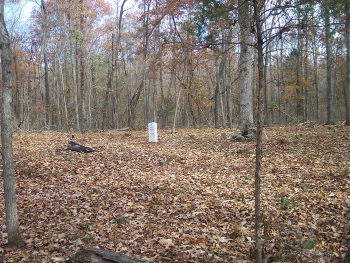
| Description | : | Butter Creek Cemetery is on Private Property and was established in the 1800's or before. Early Land Records indicate Elisha Williams owned the property. You may find that in some early family histories the name Williams Cemetery. The site contains some 70 plus graves marked with fieldstones. This was the burial site of the Walnut Grove Community before the end of the Civil War. Contact the Van Buren County (AR) Historical Society for additional Information about the cemeteries. E-mail: [email protected] Phone: 501-745-4066 |
frequently asked questions (FAQ):
-
Where is Butter Creek Cemetery?
Butter Creek Cemetery is located at Scotland, Van Buren County ,Arkansas ,USA.
-
Butter Creek Cemetery cemetery's updated grave count on graveviews.com?
16 memorials
-
Where are the coordinates of the Butter Creek Cemetery?
Latitude: 35.5468864
Longitude: -92.5545502
Nearby Cemetories:
1. Walnut Grove Cemetery
Van Buren County, USA
Coordinate: 35.5633000, -92.5576000
2. Foster Cemetery
Scotland, Van Buren County, USA
Coordinate: 35.5341988, -92.5924988
3. Brickey Cemetery
Van Buren County, USA
Coordinate: 35.5747986, -92.5273972
4. Culpepper Cemetery
Culpepper, Van Buren County, USA
Coordinate: 35.5167618, -92.5180435
5. Crowell Cemetery
Crabtree, Van Buren County, USA
Coordinate: 35.5889015, -92.5768967
6. Bradley Cemetery
Clinton, Van Buren County, USA
Coordinate: 35.5760994, -92.5049973
7. Gardner Cemetery
Van Buren County, USA
Coordinate: 35.5689011, -92.6144028
8. Pleasant Grove Cemetery
Scotland, Van Buren County, USA
Coordinate: 35.5004000, -92.6103000
9. Evans Cemetery
Van Buren County, USA
Coordinate: 35.6119003, -92.5136032
10. Crabtree Cemetery
Clinton, Van Buren County, USA
Coordinate: 35.6311989, -92.5810776
11. Clinton Cemetery
Clinton, Van Buren County, USA
Coordinate: 35.5945015, -92.4596024
12. Low Gap Cemetery
Van Buren County, USA
Coordinate: 35.5952988, -92.6489029
13. Hunter Hill Cemetery
Clinton, Van Buren County, USA
Coordinate: 35.5526000, -92.4404000
14. Huie Cemetery
Clinton, Van Buren County, USA
Coordinate: 35.5528000, -92.4403000
15. Union Hill Cemetery
Formosa, Van Buren County, USA
Coordinate: 35.4561800, -92.5058400
16. Bluffton Cemetery
Van Buren County, USA
Coordinate: 35.6453018, -92.5255966
17. Woolverton Mountain Cemetery
Center Ridge, Conway County, USA
Coordinate: 35.4444008, -92.5563965
18. Johnson Cemetery
Clinton, Van Buren County, USA
Coordinate: 35.5783005, -92.4338989
19. Burke Chasteen Cemetery
Scotland, Van Buren County, USA
Coordinate: 35.5466995, -92.6830978
20. Kirkendoll Cemetery
Van Buren County, USA
Coordinate: 35.6421840, -92.4896870
21. Halbrook Cemetery
Center Ridge, Conway County, USA
Coordinate: 35.4375000, -92.5385971
22. Pee Dee Cemetery
Clinton, Van Buren County, USA
Coordinate: 35.5999985, -92.4199982
23. Hopewell Cemetery
Rabbit Ridge, Van Buren County, USA
Coordinate: 35.4415120, -92.4785330
24. Old Liberty Cemetery
Scotland, Van Buren County, USA
Coordinate: 35.4702988, -92.6755981