
| Memorials | : | 0 |
| Location | : | Hickory Grove, Lawrence County, USA |
| Coordinate | : | 34.3899000, -87.5022000 |
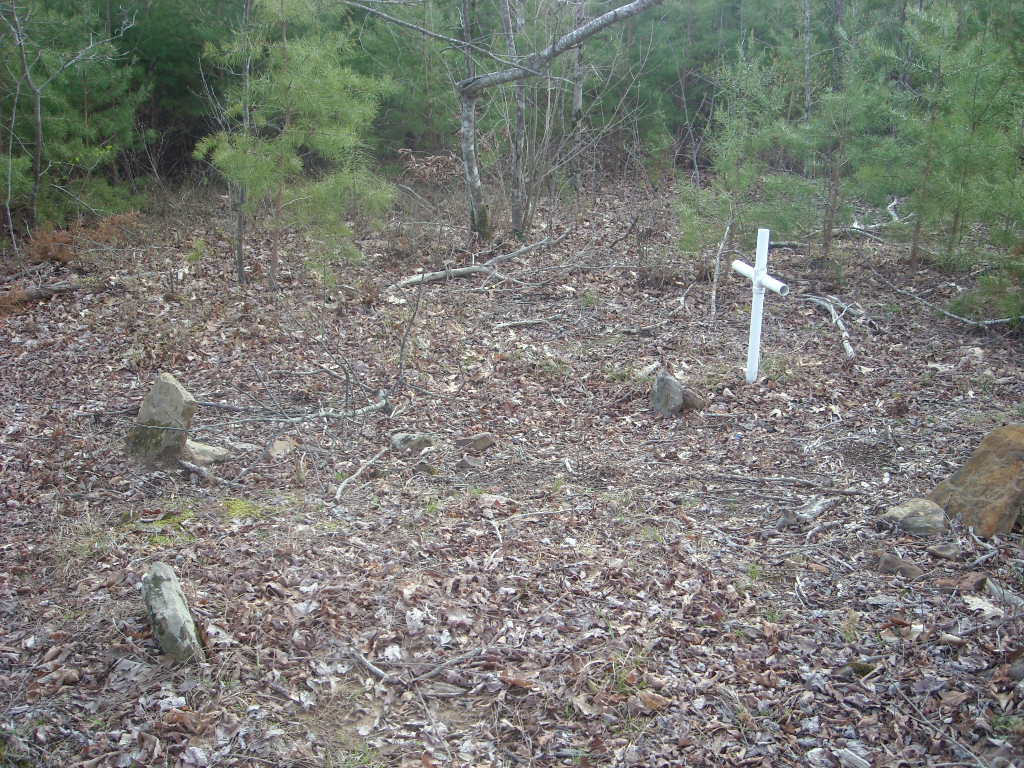
| Description | : | The Byler-Ridge Road Graves are located in the Bankhead National Forest about 70 yards north of the intersection of Byler and Ridge Roads in the NW 1/4 of NE 1/4 Section 5 Township8 Range 9. This cemetery was recorded by Rayford Hyatt. Mr. Hyatt states that there are two unmarked graves here. That they are located in the fork of Byler and Ridge Roads. They are marked with fieldstones without names. Graves appear to have once been covered with stones to keep animals out. Graves may have been dug into at one time. Tradition... Read More |
frequently asked questions (FAQ):
-
Where is Byler-Ridge Road Graves?
Byler-Ridge Road Graves is located at Hickory Grove, Lawrence County ,Alabama ,USA.
-
Byler-Ridge Road Graves cemetery's updated grave count on graveviews.com?
0 memorials
-
Where are the coordinates of the Byler-Ridge Road Graves?
Latitude: 34.3899000
Longitude: -87.5022000
Nearby Cemetories:
1. Beulah Cemetery
Franklin County, USA
Coordinate: 34.4171982, -87.5389023
2. Gum Pond Cemetery
Lawrence County, USA
Coordinate: 34.3760000, -87.4380000
3. Davenport Family Cemetery
Hickory Grove, Lawrence County, USA
Coordinate: 34.3390000, -87.4750000
4. Kimbrough Cemetery
Franklin County, USA
Coordinate: 34.4132996, -87.5697021
5. Oak Grove Cemetery
Phil Campbell, Franklin County, USA
Coordinate: 34.4117012, -87.5792007
6. Duboise Cemetery
Franklin County, USA
Coordinate: 34.3955994, -87.5847015
7. Liberty Chapel FWB Cemetery
Phil Campbell, Franklin County, USA
Coordinate: 34.4011600, -87.5839750
8. East Franklin Cemetery
Franklin County, USA
Coordinate: 34.3996300, -87.5852900
9. New Bethlehem Missionary Baptist Cemetery
Orange, Franklin County, USA
Coordinate: 34.3484590, -87.5790230
10. Denton Hollow Cemetery
Franklin County, USA
Coordinate: 34.4564018, -87.5721970
11. Mountain Home #2 Missionary Baptist Church Cemeter
Phil Campbell, Franklin County, USA
Coordinate: 34.4365950, -87.5960420
12. Johnson Cemetery
Winston County, USA
Coordinate: 34.2991982, -87.4636002
13. Old Town Creek Baptist Church Cemetery
Landersville, Lawrence County, USA
Coordinate: 34.4680000, -87.4330000
14. Macedonia Cemetery
Franklin County, USA
Coordinate: 34.4794006, -87.5472031
15. Blankenship Cemetery
Lawrence County, USA
Coordinate: 34.3850000, -87.3830000
16. Old Town Creek Cemetery
Landersville, Lawrence County, USA
Coordinate: 34.4700000, -87.4320000
17. Maxwell Chapel United Methodist Church Cemetery
Double Springs, Winston County, USA
Coordinate: 34.2927000, -87.5421000
18. Posey Mill Cemetery
Posey Mill, Franklin County, USA
Coordinate: 34.3143997, -87.5880966
19. Martin W. Bowling Gravesite
Concord, Lawrence County, USA
Coordinate: 34.4859000, -87.4542000
20. Town Creek Cemetery #1
Landersville, Lawrence County, USA
Coordinate: 34.4710000, -87.4230000
21. Chilcoat Cemetery
Helicon, Winston County, USA
Coordinate: 34.2893200, -87.5450840
22. Ephesus Baptist Church Cemetery
Winston County, USA
Coordinate: 34.2863800, -87.5477800
23. Landersville Cemetery
Landersville, Lawrence County, USA
Coordinate: 34.4690000, -87.4060000
24. Mount Pleasant Church Cemetery
Franklin County, USA
Coordinate: 34.4810982, -87.5839005