
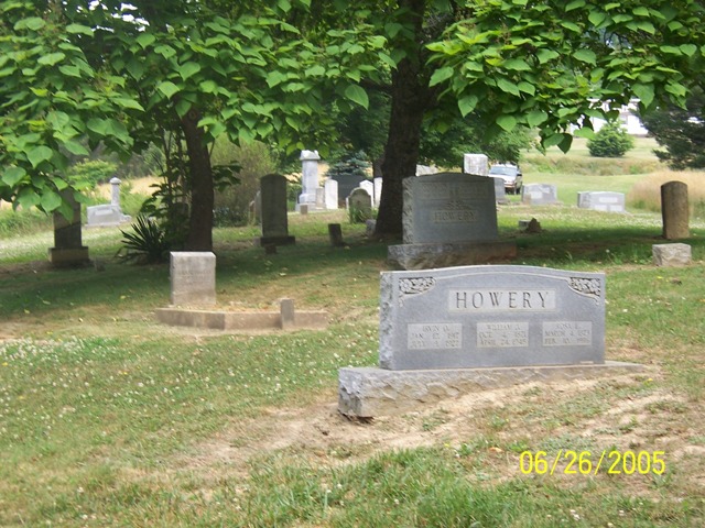
| Memorials | : | 39 |
| Location | : | Floyd, Floyd County, USA |
| Coordinate | : | 36.9857210, -80.3322000 |
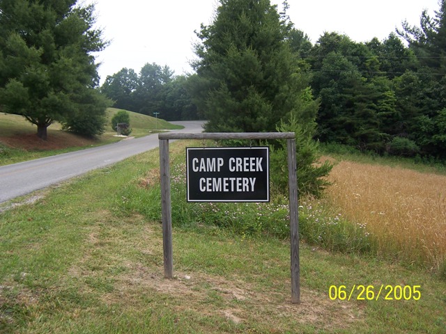
| Description | : | On Route #615 Christiansburg Pike NE, about 6.5 miles northeast of the town of Floyd, Virginia, at Camp Creek. The cemetery is on top of a hill on the east/right side of the road about half a mile after you pass the old Camp Creek church and just north of the Rt. 689 Huckleberry Ridge Rd NE intersection. Cemetery access road in on the east/right side between Hucleberry Ridge Rd NE and Camp Creek Rd NE. |
frequently asked questions (FAQ):
-
Where is Camp Creek Cemetery?
Camp Creek Cemetery is located at Floyd, Floyd County ,Virginia ,USA.
-
Camp Creek Cemetery cemetery's updated grave count on graveviews.com?
39 memorials
-
Where are the coordinates of the Camp Creek Cemetery?
Latitude: 36.9857210
Longitude: -80.3322000
Nearby Cemetories:
1. Sumpter-Duncan Cemetery
Floyd, Floyd County, USA
Coordinate: 36.9866670, -80.3519440
2. Sumner Cemetery
Sowers, Floyd County, USA
Coordinate: 36.9916547, -80.3572657
3. Moore-Pugh Cemetery
Sowers, Floyd County, USA
Coordinate: 36.9784900, -80.3579630
4. Hale Family Cemetery
Floyd, Floyd County, USA
Coordinate: 36.9730100, -80.3076697
5. Hungate Farm Cemetery
Floyd, Floyd County, USA
Coordinate: 36.9628010, -80.3233970
6. Helm Cemetery
Floyd County, USA
Coordinate: 37.0108920, -80.3174900
7. Basham Cemetery
Floyd, Floyd County, USA
Coordinate: 37.0184170, -80.3406090
8. Red Oak Grove Cemetery
Floyd County, USA
Coordinate: 36.9818410, -80.2863910
9. Moses Dickerson, Jr. Cemetery
Floyd County, USA
Coordinate: 36.9482030, -80.3347460
10. Simmons Farm Cemetery
Floyd, Floyd County, USA
Coordinate: 36.9557687, -80.3688661
11. Otey Cemetery
Sowers, Floyd County, USA
Coordinate: 37.0146600, -80.3736100
12. Alexander Davis Cemetery
Basham, Montgomery County, USA
Coordinate: 37.0285780, -80.3491220
13. Saint Matthews Cemetery
Floyd County, USA
Coordinate: 37.0204300, -80.3709800
14. Beaver Creek Cemetery
Floyd, Floyd County, USA
Coordinate: 36.9508050, -80.3743620
15. Spangler Cemetery
Floyd, Floyd County, USA
Coordinate: 36.9489217, -80.2917725
16. Thomas Cemetery
Floyd, Floyd County, USA
Coordinate: 36.9692460, -80.3914720
17. Bower Cemetery
Riner, Montgomery County, USA
Coordinate: 37.0193720, -80.3796220
18. Mannon Cemetery
Floyd County, USA
Coordinate: 36.9704734, -80.3940267
19. Laurel Creek Primitive Baptist Church Cemetery
Simpsons, Floyd County, USA
Coordinate: 37.0246040, -80.2886810
20. Ward Sutphin Cemetery
Pilot, Montgomery County, USA
Coordinate: 37.0362700, -80.3485400
21. Gray Cemetery
Basham, Montgomery County, USA
Coordinate: 37.0378400, -80.3391300
22. Clinger Cemetery
Floyd, Floyd County, USA
Coordinate: 36.9343992, -80.3151036
23. Lampey - Martin - Spangler Cemetery
Floyd County, USA
Coordinate: 37.0134472, -80.2753057
24. Boothe Family Cemetery
Pilot, Montgomery County, USA
Coordinate: 37.0390980, -80.3496930