
| Memorials | : | 0 |
| Location | : | Fairfield, Utah County, USA |
| Phone | : | 801-768-8932 |
| Coordinate | : | 40.2524280, -112.0984160 |
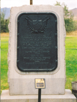
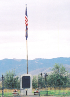
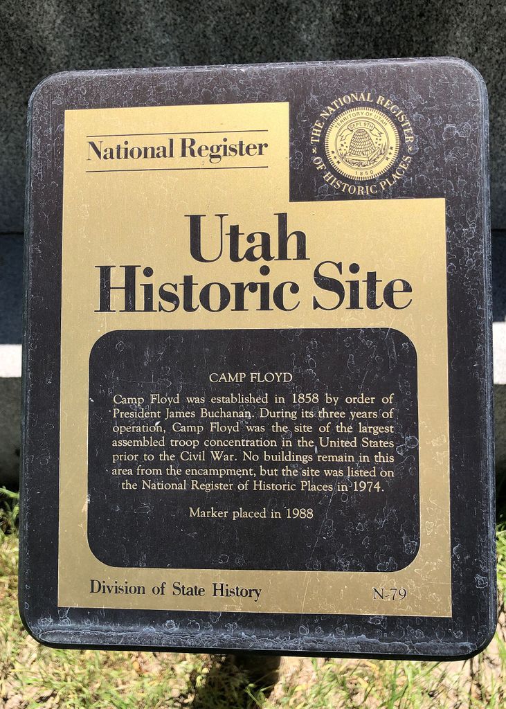
| Description | : | Camp Floyd/Stagecoach Inn State Park is located in Fairfield Utah and this cemetery is part of the park. In 1858 the Cemetery was established but just 3 years later in 1861 the troops stationed at Camp Floyd returned to fight in the Civil War and abandoned the Camp & Stagecoach stop as well as the cemetery. Due to poor record keeping on the Army's part the actual number, location, and identities of soldiers buried in the cemetery is not known with certainty. In 1913 the War Department built and dedicated a monument in the cemetery. In 1960 the local American... Read More |
frequently asked questions (FAQ):
-
Where is Camp Floyd Cemetery?
Camp Floyd Cemetery is located at Fairfield, Utah County ,Utah ,USA.
-
Camp Floyd Cemetery cemetery's updated grave count on graveviews.com?
0 memorials
-
Where are the coordinates of the Camp Floyd Cemetery?
Latitude: 40.2524280
Longitude: -112.0984160


Nearby Cemetories:
1. Fairfield Cemetery
Fairfield, Utah County, USA
Coordinate: 40.2627983, -112.0952988
2. Cedar Fort Cemetery
Cedar Fort, Utah County, USA
Coordinate: 40.3238080, -112.1083660
3. Old Pioneer Cemetery
Cedar Fort, Utah County, USA
Coordinate: 40.3247000, -112.1068000
4. Pony Express Memorial Cemetery
Eagle Mountain, Utah County, USA
Coordinate: 40.3135900, -112.0282900
5. Mercur Cemetery
Tooele County, USA
Coordinate: 40.3051000, -112.2585000
6. Find A Grave Test Cemetery - Eagle Mountain
Eagle Mountain, Utah County, USA
Coordinate: 40.3713503, -111.9817899
7. Ophir Cemetery
Ophir, Tooele County, USA
Coordinate: 40.3574000, -112.2895000
8. Ophir New Cemetery
Ophir, Tooele County, USA
Coordinate: 40.3573000, -112.2906000
9. Johnson Cemetery
Stockton, Tooele County, USA
Coordinate: 40.3218860, -112.3408100
10. Utah State Veterans Memorial Park
Bluffdale, Salt Lake County, USA
Coordinate: 40.4417800, -111.9321600
11. Daughters of the Utah Pioneers Park
Lehi, Utah County, USA
Coordinate: 40.3991510, -111.8505370
12. Lehi City Cemetery
Lehi, Utah County, USA
Coordinate: 40.4021988, -111.8427963
13. Find a Grave Test Cemetery - Lehï
Lehi, Utah County, USA
Coordinate: 40.4353500, -111.8720400
14. Pioneer Memorial Cemetery
American Fork, Utah County, USA
Coordinate: 40.3835983, -111.7953033
15. American Fork Cemetery
American Fork, Utah County, USA
Coordinate: 40.3896713, -111.7968750
16. Bluffdale City Cemetery
Bluffdale, Salt Lake County, USA
Coordinate: 40.4928017, -111.9375000
17. Old Faust Ranch Cemetery
Tooele County, USA
Coordinate: 40.1549500, -112.4346000
18. Slagtown Cemetery
Stockton, Tooele County, USA
Coordinate: 40.4237600, -112.3818200
19. Herriman Cemetery
Herriman, Salt Lake County, USA
Coordinate: 40.5250015, -112.0330963
20. Wasatch Lawn Memorial Park South Valley
Riverton, Salt Lake County, USA
Coordinate: 40.5149002, -111.9769974
21. Highland City Cemetery
Highland, Utah County, USA
Coordinate: 40.4315000, -111.8071000
22. Riverton City Cemetery
Riverton, Salt Lake County, USA
Coordinate: 40.5119019, -111.9338989
23. Stockton Cemetery
Stockton, Tooele County, USA
Coordinate: 40.4589005, -112.3641968
24. Saint John Cemetery
Rush Valley, Tooele County, USA
Coordinate: 40.3616982, -112.4599991