
| Memorials | : | 0 |
| Location | : | Grayling, Crawford County, USA |
| Coordinate | : | 44.6449850, -84.7561680 |
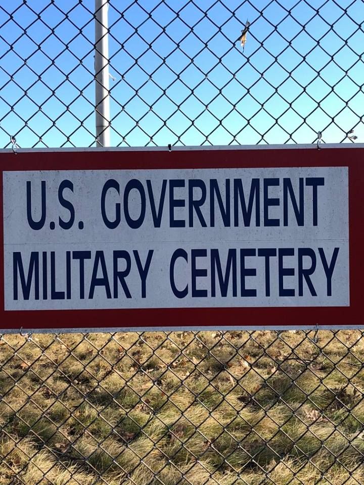
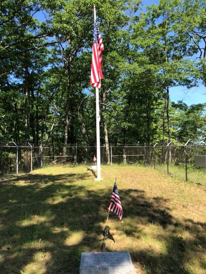
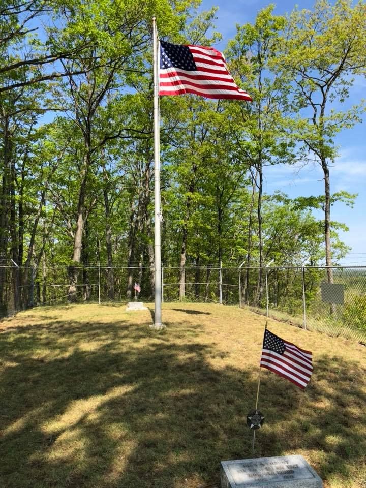
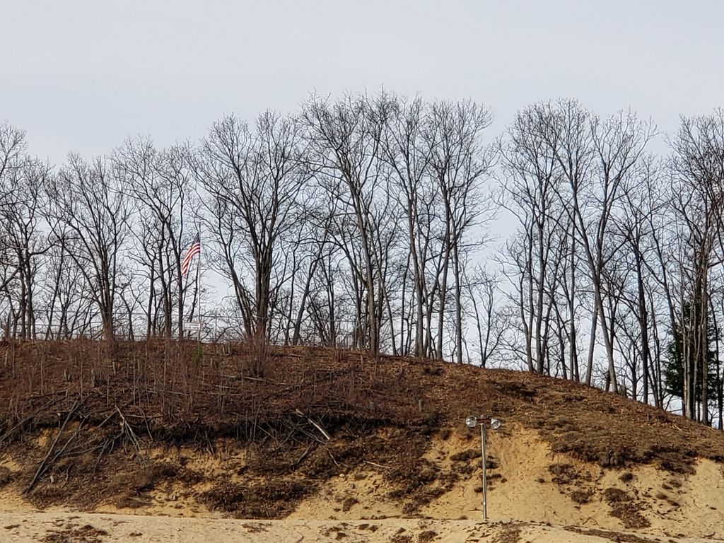
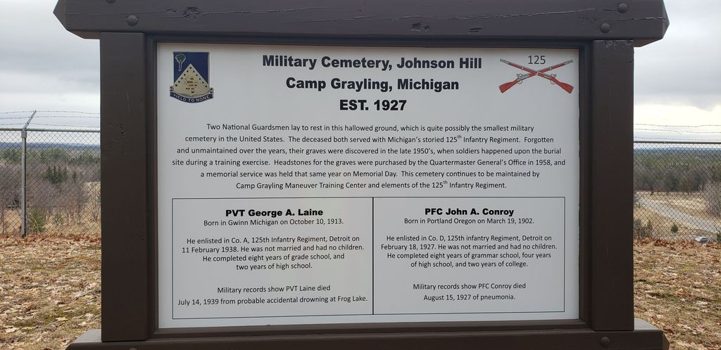
| Description | : | This cemetery is located atop of Hanson Recreational Area on the hill left of the old tobaggan run. Hanson Recreational Area is located on Old Lake Road just west of Grayling and the AuSable River. The cemetery is located at the top of a hill on military land that is adjacent to land currently used by the Grayling Recreational Authority as a ski park. Access to the site is via trail roads or by walking from the ski park parking lot. The cemetery is located in Grayling Township in Hanson Hills Recreational Area. The U.S. Geological Survey (USGS) Geographic Names Information System... Read More |
frequently asked questions (FAQ):
-
Where is Camp Grayling Military Cemetery?
Camp Grayling Military Cemetery is located at Old Lake Road Grayling, Crawford County ,Michigan , 49738USA.
-
Camp Grayling Military Cemetery cemetery's updated grave count on graveviews.com?
0 memorials
-
Where are the coordinates of the Camp Grayling Military Cemetery?
Latitude: 44.6449850
Longitude: -84.7561680
Nearby Cemetories:
1. Elmwood Cemetery
Grayling, Crawford County, USA
Coordinate: 44.6730995, -84.7169037
2. Beaver Creek Cemetery
Beaver Creek Township, Crawford County, USA
Coordinate: 44.5550003, -84.7921982
3. Pere Cheney Cemetery
Pere Cheney, Crawford County, USA
Coordinate: 44.5732880, -84.6363525
4. Oakwood Cemetery
Frederic Township, Crawford County, USA
Coordinate: 44.7716700, -84.7525860
5. Stephan Family Cemetery
Grayling, Crawford County, USA
Coordinate: 44.6742380, -84.5811650
6. Whispering Pines Pet Cemetery
Beaver Creek Township, Crawford County, USA
Coordinate: 44.5184040, -84.7242670
7. Maple Forest Cemetery
Maple Forest Township, Crawford County, USA
Coordinate: 44.7855988, -84.6960983
8. Heidemann Cemetery
Roscommon, Roscommon County, USA
Coordinate: 44.4886026, -84.7986059
9. Shrine Cemetery
Frederic, Crawford County, USA
Coordinate: 44.8055471, -84.7536059
10. Pioneer Cemetery
South Branch Township, Crawford County, USA
Coordinate: 44.5256004, -84.5808029
11. Gerrish Township Cemetery
Roscommon, Roscommon County, USA
Coordinate: 44.4786110, -84.6625000
12. Oakwood Cemetery
Higgins Lake, Roscommon County, USA
Coordinate: 44.4652778, -84.7786110
13. Roscommon Village Cemetery
Roscommon, Roscommon County, USA
Coordinate: 44.4916700, -84.5852780
14. Oliver Township Cemetery
Sigma, Kalkaska County, USA
Coordinate: 44.6563988, -85.0727997
15. Excelsior Township Cemetery
Kalkaska, Kalkaska County, USA
Coordinate: 44.7311110, -85.0530560
16. Crest View Cemetery
Markey Township, Roscommon County, USA
Coordinate: 44.4075020, -84.6803250
17. Lovells Cemetery
Lovells Township, Crawford County, USA
Coordinate: 44.7956009, -84.4805984
18. Moorestown Cemetery
Moorestown, Missaukee County, USA
Coordinate: 44.4578018, -84.9839020
19. Rock Cemetery
Eldorado, Crawford County, USA
Coordinate: 44.5746994, -84.4105988
20. Richardson Cemetery
Saint Helen, Roscommon County, USA
Coordinate: 44.5093994, -84.4483032
21. Ball Cemetery
Grayling, Crawford County, USA
Coordinate: 44.5516710, -84.4128730
22. Cold Springs Township Cemetery
Coldsprings Township, Kalkaska County, USA
Coordinate: 44.8086014, -85.0522003
23. Otsego Lake Township Cemetery
Gaylord, Otsego County, USA
Coordinate: 44.9157982, -84.6857986
24. Lodi Cemetery
Orange Township, Kalkaska County, USA
Coordinate: 44.6371920, -85.1744760