
| Memorials | : | 1 |
| Location | : | Sharp County, USA |
| Coordinate | : | 35.8994710, -91.4120060 |
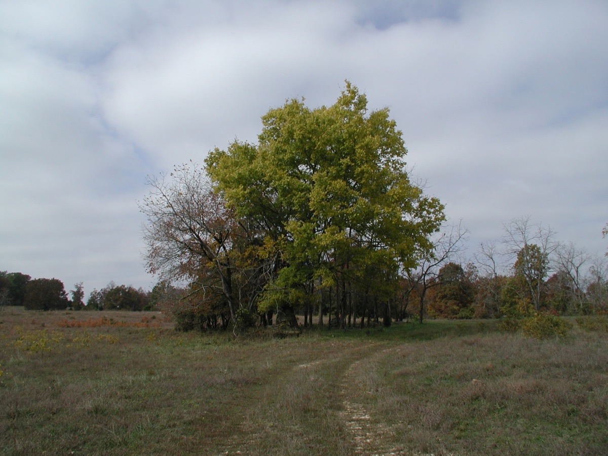
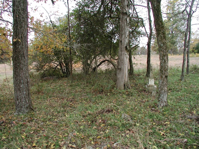
| Description | : | Captain Bill Dawson and at least three of his children are buried alone in a stand of trees near the community of Old Hazel Grove. The cemetery is on the west side of Wild Cat Road, just below the Mahan Cemetery which is perhaps 1/8 mile further west up on the ridge. The cemetery can be reached by driving south from the Cave City/Strawberry blacktop, or by driving north from Hwy 25 on the Charlotte Road, following the eastern leg of Wild Cat. This cemetery is not to be confused with the Dawson Family Cemetery in Aetna, also in Sharp... Read More |
frequently asked questions (FAQ):
-
Where is Captain William Dawson Family Cemetery?
Captain William Dawson Family Cemetery is located at West side of Wild Cat Road, south of the Strawberry/Cave City blacktop.Near Old Hazel Grove Sharp County ,Arkansas ,USA.
-
Captain William Dawson Family Cemetery cemetery's updated grave count on graveviews.com?
1 memorials
-
Where are the coordinates of the Captain William Dawson Family Cemetery?
Latitude: 35.8994710
Longitude: -91.4120060
Nearby Cemetories:
1. Mahan Cemetery
Sharp County, USA
Coordinate: 35.8998450, -91.4139100
2. James Cemetery
Independence County, USA
Coordinate: 35.8899994, -91.4439011
3. Shamrock Cemetery
Charlotte, Independence County, USA
Coordinate: 35.8692700, -91.4284500
4. Cedar Grove Cemetery
Cedar Grove (Charlotte), Independence County, USA
Coordinate: 35.8814011, -91.4514008
5. Rawlings Cemetery
Independence County, USA
Coordinate: 35.9091988, -91.4666977
6. Dawson Cemetery
Sharp County, USA
Coordinate: 35.9324989, -91.4505997
7. Mount View Cemetery
Cave City, Sharp County, USA
Coordinate: 35.9371986, -91.4436035
8. Young Cemetery
Dota, Independence County, USA
Coordinate: 35.8688560, -91.4571450
9. Campbell Cemetery
Lawrence County, USA
Coordinate: 35.9171982, -91.3503036
10. Gardner Cemetery
Sharp County, USA
Coordinate: 35.9508018, -91.3822021
11. Runyan Cemetery
Lawrence County, USA
Coordinate: 35.9110985, -91.3396988
12. Parsley Cemetery
Sharp County, USA
Coordinate: 35.9618988, -91.4143982
13. Convenience Cemetery
Independence County, USA
Coordinate: 35.8647003, -91.4760971
14. Mount Zion Cemetery
Saffell, Lawrence County, USA
Coordinate: 35.9220000, -91.3390000
15. Mount View Cemetery
Saffell, Lawrence County, USA
Coordinate: 35.9220009, -91.3389969
16. Shaver Cemetery
Sharp County, USA
Coordinate: 35.9646988, -91.4013977
17. Shaver Cemetery
Shelbyville, Sharp County, USA
Coordinate: 35.9651990, -91.4016580
18. Wilkerson Cemetery
Sharp County, USA
Coordinate: 35.9658012, -91.4235992
19. John 3:16 Memorial Garden
Charlotte, Independence County, USA
Coordinate: 35.8359630, -91.4503590
20. Willmuth Cemetery
Lawrence County, USA
Coordinate: 35.9197006, -91.3272018
21. Ashby Cemetery
Lawrence County, USA
Coordinate: 35.9021988, -91.3202972
22. Roe Cemetery
Sharp County, USA
Coordinate: 35.9735985, -91.3925018
23. Ball Cemetery
Independence County, USA
Coordinate: 35.9006004, -91.5096970
24. Fairview Cemetery
Cave City, Sharp County, USA
Coordinate: 35.9585600, -91.4805200