
| Memorials | : | 1 |
| Location | : | Maurice, Lawrence County, USA |
| Coordinate | : | 44.4000000, -103.8680500 |
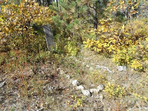
| Description | : | This cemetery is located at the old silver mining town of Carbonate between Central City, Trojan and Maurice. Many of the burials are of children who died in the scarlet fever epidemic of 1888. Carbonate had two booms, one in 1881 and the other in 1886. People dwindled away from the town after that. This cemetery was the only one surveyed by the Works Progress Administration (WPA) in 1941 that was published and given to the State of South Dakota. |
frequently asked questions (FAQ):
-
Where is Carbonate Cemetery?
Carbonate Cemetery is located at Maurice, Lawrence County ,South Dakota ,USA.
-
Carbonate Cemetery cemetery's updated grave count on graveviews.com?
1 memorials
-
Where are the coordinates of the Carbonate Cemetery?
Latitude: 44.4000000
Longitude: -103.8680500


Nearby Cemetories:
1. Preston Ghost Town Cemetery
Preston, Lawrence County, USA
Coordinate: 44.3577500, -103.8871670
2. Terry Cemetery
Terry, Lawrence County, USA
Coordinate: 44.3344290, -103.8165110
3. Rose Hill Cemetery
Spearfish, Lawrence County, USA
Coordinate: 44.4802180, -103.8509270
4. West Lead Cemetery
Lead, Lawrence County, USA
Coordinate: 44.3484001, -103.7779999
5. South Lead Cemetery
Lead, Lawrence County, USA
Coordinate: 44.3478510, -103.7606260
6. Saint Ambrose Cemetery
Deadwood, Lawrence County, USA
Coordinate: 44.3821983, -103.7266998
7. Mount Moriah Cemetery
Deadwood, Lawrence County, USA
Coordinate: 44.3760986, -103.7253036
8. Bear Gulch Cemetery
Lawrence County, USA
Coordinate: 44.3819008, -104.0325012
9. Holy Cross Cemetery
Englewood, Lawrence County, USA
Coordinate: 44.2818985, -103.8047028
10. Mountain Lawn Cemetery
Englewood, Lawrence County, USA
Coordinate: 44.2818985, -103.8047028
11. Oak Ridge Cemetery
Deadwood, Lawrence County, USA
Coordinate: 44.3891983, -103.6766968
12. Anderson Cemetery
Lawrence County, USA
Coordinate: 44.4747009, -103.6896973
13. Carr Cemetery
Hanna, Lawrence County, USA
Coordinate: 44.2411003, -103.8606033
14. Gate of Heaven Cemetery
Saint Onge, Lawrence County, USA
Coordinate: 44.5353000, -103.7237000
15. Galena Cemetery
Galena, Lawrence County, USA
Coordinate: 44.3349220, -103.6438410
16. Whitewood Cemetery
Whitewood, Lawrence County, USA
Coordinate: 44.4617820, -103.6330030
17. Crook City Cemetery
Crook City, Lawrence County, USA
Coordinate: 44.4432100, -103.6241500
18. Dumont Cemetery
Lawrence County, USA
Coordinate: 44.2270000, -103.7860000
19. Little Dane Cemetery
Saint Onge, Lawrence County, USA
Coordinate: 44.5252500, -103.6705540
20. Roubaix Cemetery
Roubaix, Lawrence County, USA
Coordinate: 44.2789380, -103.6656600
21. Beulah Cemetery
Beulah, Crook County, USA
Coordinate: 44.5441550, -104.0754550
22. Pine Slope Cemetery
Belle Fourche, Butte County, USA
Coordinate: 44.6460991, -103.8666992
23. Saint Paul's Catholic Cemetery
Belle Fourche, Butte County, USA
Coordinate: 44.6461000, -103.8667000
24. Mountain Meadow Cemetery
Lawrence County, USA
Coordinate: 44.2038994, -103.6557999