
| Memorials | : | 0 |
| Location | : | Hereford, Cochise County, USA |
| Coordinate | : | 31.4425800, -110.2843900 |
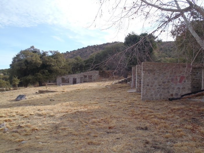
| Description | : | James Carr first arrived in the canyon that now bears his name in 1880, where he operated a lumber mill and built a toll road. In 1883 he filed a claim for 160 acres in the canyon and shortly thereafter in 1884 sold his holdings to Robert Todd. Robert and Elizabeth Todd permanently moved into the canyon in 1887 and made it their home. Robert Todd died at his ranch and was buried there. After his death, the property went to a son and daughter in 1925. They in turn sold the property to John and Ida Healy in June... Read More |
frequently asked questions (FAQ):
-
Where is Carr Homestead Burial?
Carr Homestead Burial is located at Hereford, Cochise County ,Arizona ,USA.
-
Carr Homestead Burial cemetery's updated grave count on graveviews.com?
0 memorials
-
Where are the coordinates of the Carr Homestead Burial?
Latitude: 31.4425800
Longitude: -110.2843900
Nearby Cemetories:
1. Biederman Homestead Burial Site
Cochise County, USA
Coordinate: 31.4387830, -110.2905790
2. Newman Ranch Family Cemetery
Sierra Vista, Cochise County, USA
Coordinate: 31.4695510, -110.2803840
3. Brown Canyon Cemetery
Sierra Vista, Cochise County, USA
Coordinate: 31.4638020, -110.3101380
4. Frierson Gravesite
Sierra Vista, Cochise County, USA
Coordinate: 31.4717960, -110.3014180
5. Mother Teresa Columbarium
Sierra Vista, Cochise County, USA
Coordinate: 31.4821000, -110.2846000
6. Faith Presbyterian Church Memorial Garden
Sierra Vista, Cochise County, USA
Coordinate: 31.4896000, -110.2783000
7. Sierra Vista United Methodist Church Columbarium
Sierra Vista, Cochise County, USA
Coordinate: 31.5104180, -110.2651550
8. Ashworth Gravesite
Sierra Vista, Cochise County, USA
Coordinate: 31.4709140, -110.2074730
9. Southern Arizona Veterans Memorial Cemetery
Sierra Vista, Cochise County, USA
Coordinate: 31.5399380, -110.3007278
10. Saint Stephens Episcopal Church Columbarium
Sierra Vista, Cochise County, USA
Coordinate: 31.5409760, -110.2711270
11. Historic Cemetery of the Southern Arizona Veterans
Sierra Vista, Cochise County, USA
Coordinate: 31.5411000, -110.3050000
12. Sunnyside Cemetery
Cochise County, USA
Coordinate: 31.4256001, -110.4085999
13. Holy Hope Cemetery
Sierra Vista, Cochise County, USA
Coordinate: 31.5297450, -110.2025000
14. Sierra Evangelical Lutheran Church Columbarium
Sierra Vista, Cochise County, USA
Coordinate: 31.5562140, -110.2816090
15. Fry Cemetery
Sierra Vista, Cochise County, USA
Coordinate: 31.5560800, -110.2918700
16. Saint Andrew the Apostle Memorial Garden
Sierra Vista, Cochise County, USA
Coordinate: 31.5628800, -110.3019300
17. Miracle Valley Cemetery
Palominas, Cochise County, USA
Coordinate: 31.3750000, -110.1598000
18. Fort Huachuca Cemetery
Sierra Vista, Cochise County, USA
Coordinate: 31.5481200, -110.3759040
19. Cochise Memory Gardens
Sierra Vista, Cochise County, USA
Coordinate: 31.5698000, -110.2283000
20. Campstone Cemetery
Huachuca City, Cochise County, USA
Coordinate: 31.6433000, -110.3480000
21. Charleston Cemetery
Cochise County, USA
Coordinate: 31.6357260, -110.1775570
22. Parker Canyon Cemetery
Patagonia, Santa Cruz County, USA
Coordinate: 31.3749610, -110.5258070
23. Brunckow's Cabin
Cochise County, USA
Coordinate: 31.6385120, -110.1575450
24. Babacomari Ranch Cemetery
Huachuca City, Cochise County, USA
Coordinate: 31.6310580, -110.4562600