
| Memorials | : | 4 |
| Location | : | Winnett, Petroleum County, USA |
| Coordinate | : | 47.0816394, -108.1663116 |
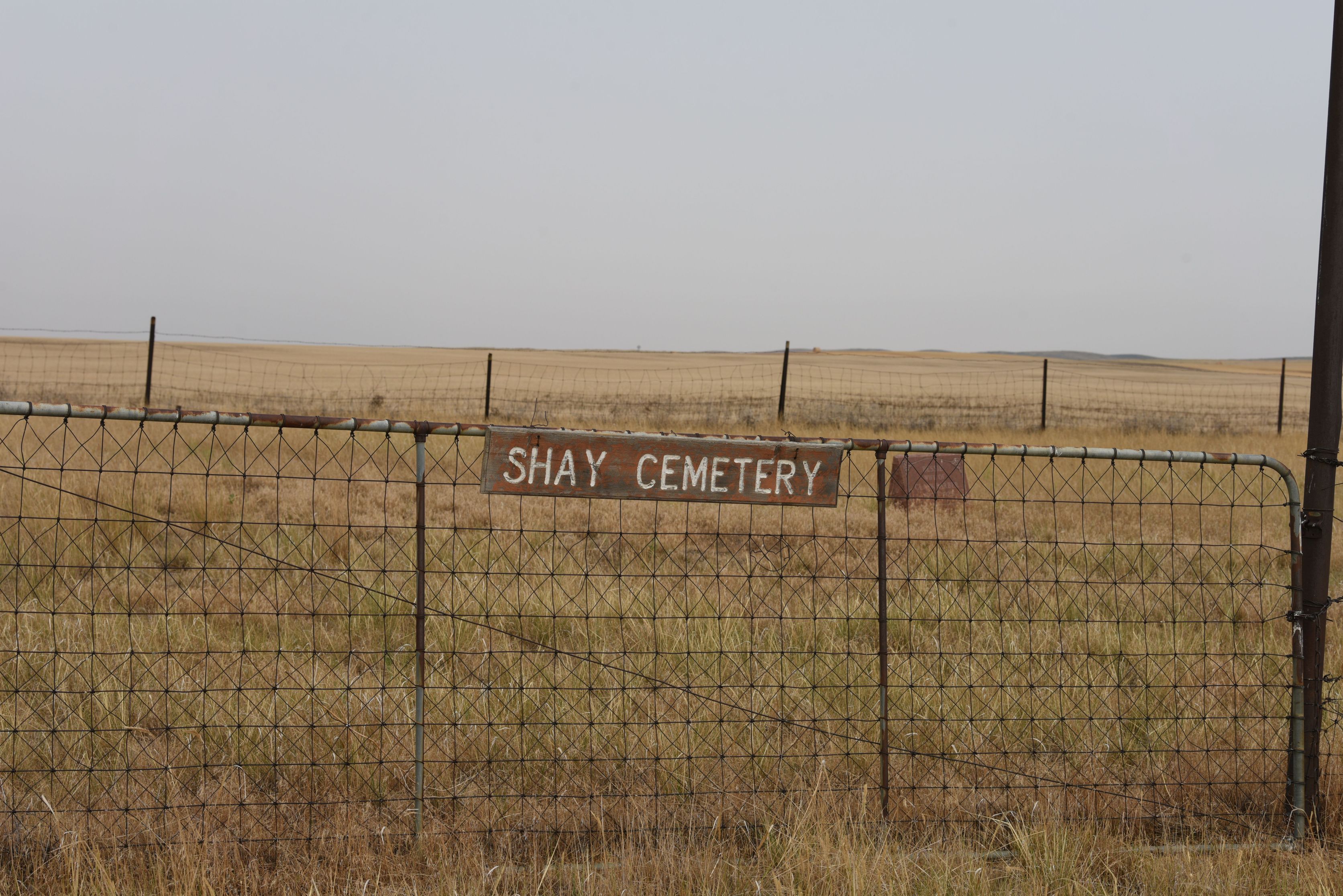
| Description | : | The cemetery is located about 0.2 miles south of Old Cat Creek Road. The U.S. Geological Survey (USGS) Geographic Names Information System (GNIS) feature ID for the cemetery is 1721680 (Cat Creek Cemetery). |
frequently asked questions (FAQ):
-
Where is Cat Creek Cemetery?
Cat Creek Cemetery is located at Old Cat Creek Road Winnett, Petroleum County ,Montana , 59087USA.
-
Cat Creek Cemetery cemetery's updated grave count on graveviews.com?
4 memorials
-
Where are the coordinates of the Cat Creek Cemetery?
Latitude: 47.0816394
Longitude: -108.1663116
Nearby Cemetories:
1. Ashley Cemetery
Winnett, Petroleum County, USA
Coordinate: 47.1666775, -108.2810059
2. Winnett City Cemetery
Petroleum County, USA
Coordinate: 47.0181900, -108.3558400
3. Gilfeather Cemetery
Benzien, Garfield County, USA
Coordinate: 47.2348310, -107.9476920
4. Coon Cemetery
Garfield County, USA
Coordinate: 47.3263790, -107.9323320
5. Flatwillow Cemetery
Flatwillow, Petroleum County, USA
Coordinate: 46.8288640, -108.4004060
6. Wallview Cemetery
Flatwillow, Petroleum County, USA
Coordinate: 46.7644970, -108.4732787
7. Wolf Cemetery
Garfield County, USA
Coordinate: 47.1528015, -107.5924988
8. Flat Willow Hutterite Colony Cemetery
Flatwillow Colony, Musselshell County, USA
Coordinate: 46.7236654, -108.4919070
9. Grass Range Cemetery
Grass Range, Fergus County, USA
Coordinate: 47.0229190, -108.8119200
10. Ford's Creek Colony
Grass Range, Fergus County, USA
Coordinate: 47.1306882, -108.9208610
11. Melstone Cemetery
Melstone, Musselshell County, USA
Coordinate: 46.6068993, -107.8507996
12. Ayers Ranch Colony Cemetery
Ayers Ranch Colony, Fergus County, USA
Coordinate: 47.0508000, -108.9514000
13. Ayers Ranch Hutterite Cemetery
Grass Range, Fergus County, USA
Coordinate: 47.0507550, -108.9514013
14. Musselshell Cemetery
Musselshell County, USA
Coordinate: 46.4989014, -108.0888977
15. Steve Forks Cemetery
Garfield County, USA
Coordinate: 47.2627983, -107.3321991
16. Roy Cemetery
Roy, Fergus County, USA
Coordinate: 47.3404680, -108.9571450
17. Kilby Butte Hutterite Cemetery
Musselshell County, USA
Coordinate: 46.4746694, -108.3626017
18. Sumatra Cemetery
Rosebud County, USA
Coordinate: 46.6136017, -107.5674973
19. Forest Grove Cemetery
Fergus County, USA
Coordinate: 46.9909000, -109.0752000
20. Hearts at Peace Cemetery
Brusett, Garfield County, USA
Coordinate: 47.5441900, -107.5399200
21. Cabin Creek Cemetery
Musselshell County, USA
Coordinate: 46.4794006, -107.8122025
22. Minerva Creek Cemetery
Roundup, Musselshell County, USA
Coordinate: 46.7216370, -108.9834300
23. Roundup Cemetery
Roundup, Musselshell County, USA
Coordinate: 46.4558560, -108.5060570
24. Fort Maginnis Cemetery
Giltedge, Fergus County, USA
Coordinate: 47.1869011, -109.1461029