
| Memorials | : | 0 |
| Location | : | Brussels, Arrondissement Brussel-Hoofdstad, Belgium |
| Coordinate | : | 50.8478880, 4.3590030 |
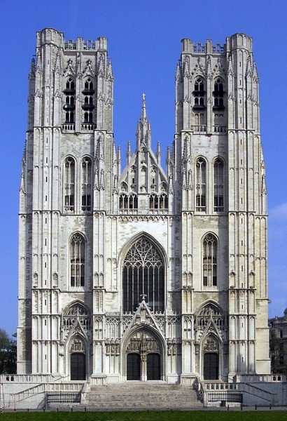
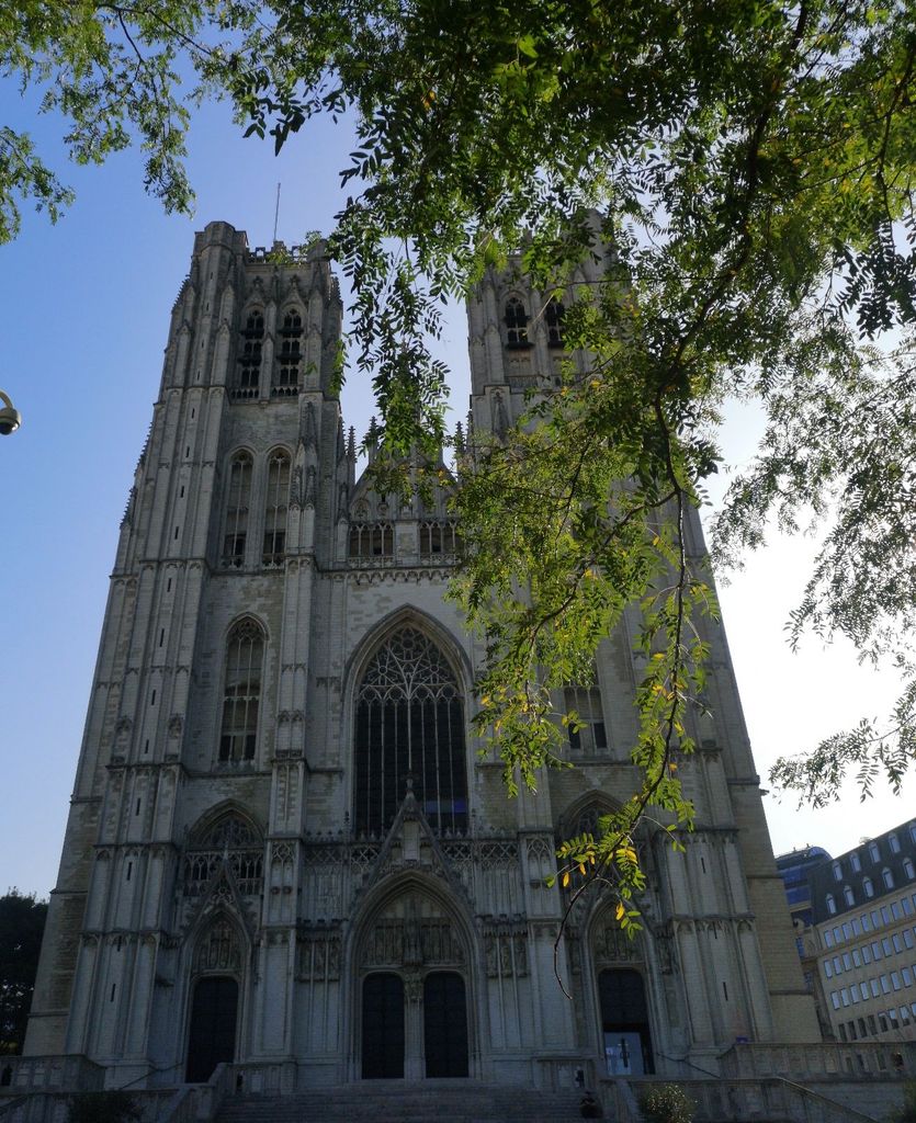
| Description | : | A chapel dedicated to St. Michael was probably built on the Treurenberg hill as early as the 9th century. In the 11th century, it was replaced by a Romanesque church. In 1047, Lambert II, Count of Leuven founded a chapter in this church and organized the transportation of the relics of the martyr St. Gudula, housed before then in Saint Gaugericus Church on Saint-Géry Island. The patron saints of the church, St. Michael and St. Gudula, are also the patron saints of the city of Brussels. In the thirteenth century, Henry I, Duke of Brabant ordered two round... Read More |
frequently asked questions (FAQ):
-
Where is Cathedral of Saint Michael and Saint Gudula?
Cathedral of Saint Michael and Saint Gudula is located at Brussels, Arrondissement Brussel-Hoofdstad ,Brussels-Capital Region ,Belgium.
-
Cathedral of Saint Michael and Saint Gudula cemetery's updated grave count on graveviews.com?
0 memorials
-
Where are the coordinates of the Cathedral of Saint Michael and Saint Gudula?
Latitude: 50.8478880
Longitude: 4.3590030
Nearby Cemetories:
1. Tomb of the Unknown Soldier
Brussels, Arrondissement Brussel-Hoofdstad, Belgium
Coordinate: 50.8500000, 4.3633000
2. Place des Martyrs
Brussels, Arrondissement Brussel-Hoofdstad, Belgium
Coordinate: 50.8517200, 4.3563520
3. Eglise Saint-Nicolas
Brussels, Arrondissement Brussel-Hoofdstad, Belgium
Coordinate: 50.8478500, 4.3514400
4. Notre-Dame du Sablon
Brussels, Arrondissement Brussel-Hoofdstad, Belgium
Coordinate: 50.8405140, 4.3564010
5. Church of Notre Dame de la Chapelle
Brussels, Arrondissement Brussel-Hoofdstad, Belgium
Coordinate: 50.8414860, 4.3509450
6. Ancien cimetière de Schaarbeek
Schaarbeek, Arrondissement Brussel-Hoofdstad, Belgium
Coordinate: 50.8686033, 4.3905789
7. Saint Josse Ten Noode Cemetery
Schaarbeek, Arrondissement Brussel-Hoofdstad, Belgium
Coordinate: 50.8576100, 4.4041900
8. Enclos des Fusilles
Schaarbeek, Arrondissement Brussel-Hoofdstad, Belgium
Coordinate: 50.8525300, 4.4066800
9. Cimetière de Laeken
Laken, Arrondissement Brussel-Hoofdstad, Belgium
Coordinate: 50.8786155, 4.3548143
10. Notre Dame Church
Laken, Arrondissement Brussel-Hoofdstad, Belgium
Coordinate: 50.8790000, 4.3557000
11. Laken Cemetery
Brussels, Arrondissement Brussel-Hoofdstad, Belgium
Coordinate: 50.8797900, 4.3527700
12. Sint-Jans-Molenbeek Communal Cemetery
Molenbeek-Saint-Jean, Arrondissement Brussel-Hoofdstad, Belgium
Coordinate: 50.8608600, 4.3109800
13. Jette Communal Cemetery
Jette, Arrondissement Brussel-Hoofdstad, Belgium
Coordinate: 50.8803500, 4.3338100
14. Ixelles Communal Cemetery
Ixelles, Arrondissement Brussel-Hoofdstad, Belgium
Coordinate: 50.8154100, 4.3929600
15. Ganshoren Old Cemetery
Ganshoren, Arrondissement Brussel-Hoofdstad, Belgium
Coordinate: 50.8730900, 4.3105900
16. Brussels Communal Cemetery
Evere, Arrondissement Brussel-Hoofdstad, Belgium
Coordinate: 50.8643700, 4.4173200
17. Sint-Agatha-Berchem Old Cemetery
Berchem-Sainte-Agathe, Arrondissement Brussel-Hoofdstad, Belgium
Coordinate: 50.8587000, 4.2944200
18. Evere Old Cemetery
Evere, Arrondissement Brussel-Hoofdstad, Belgium
Coordinate: 50.8786900, 4.4067300
19. Evere New Cemetery
Evere, Arrondissement Brussel-Hoofdstad, Belgium
Coordinate: 50.8704351, 4.4194828
20. Koekelberg Dilbeek Cemetery
Dilbeek, Arrondissement Halle-Vilvoorde, Belgium
Coordinate: 50.8562300, 4.2890300
21. Klooster Forest
Forest, Arrondissement Brussel-Hoofdstad, Belgium
Coordinate: 50.8112000, 4.3178200
22. Église Saint-Denis
Forest, Arrondissement Brussel-Hoofdstad, Belgium
Coordinate: 50.8111350, 4.3176810
23. Schaarbeek Cemetery
Evere, Arrondissement Brussel-Hoofdstad, Belgium
Coordinate: 50.8702800, 4.4219100
24. Woluwe-Saint-Lambert Old Cemetery
Woluwe-Saint-Lambert, Arrondissement Brussel-Hoofdstad, Belgium
Coordinate: 50.8427900, 4.4309100