
| Memorials | : | 2 |
| Location | : | Chuckey, Greene County, USA |
| Coordinate | : | 36.1583250, -82.6779360 |
frequently asked questions (FAQ):
-
Where is Cedar Grove United Methodist Church Cemetery?
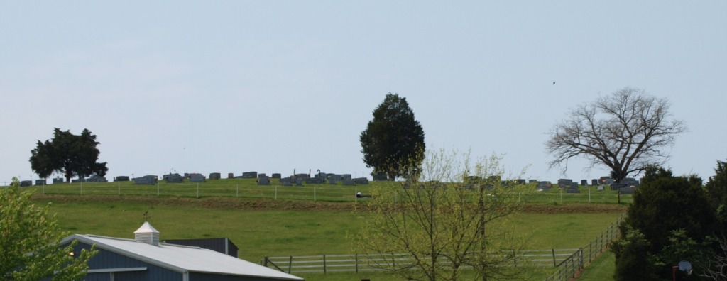
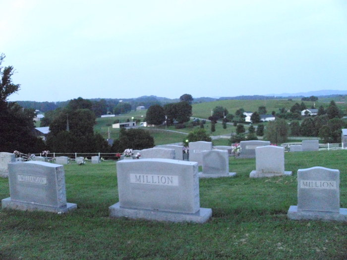
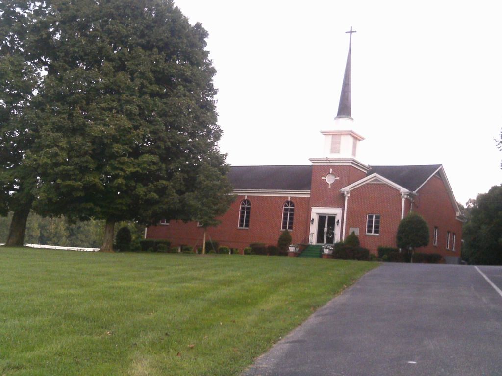
Cedar Grove United Methodist Church Cemetery is located at 5270 Chuckey Pike Chuckey, Greene County ,Tennessee ,USA.
-
Cedar Grove United Methodist Church Cemetery cemetery's updated grave count on graveviews.com?
2 memorials
-
Where are the coordinates of the Cedar Grove United Methodist Church Cemetery?
Latitude: 36.1583250
Longitude: -82.6779360
Nearby Cemetories:
1. Broyles Family Cemetery
Horse Creek, Greene County, USA
Coordinate: 36.1622940, -82.6886170
2. Jason Williamson Family Cemetery
Chuckey, Greene County, USA
Coordinate: 36.1481700, -82.6701530
3. Broyles-Kyker Cemetery
Horse Creek, Greene County, USA
Coordinate: 36.1594680, -82.6630340
4. Thomas Williamson Family Graves
Horse Creek, Greene County, USA
Coordinate: 36.1446290, -82.6793870
5. Greene County Mennonite Church Cemetery
Chuckey, Greene County, USA
Coordinate: 36.1797900, -82.6817660
6. Fox Cemetery
Chuckey, Greene County, USA
Coordinate: 36.1768990, -82.6931000
7. Horse Creek Church of God Cemetery
Horse Creek, Greene County, USA
Coordinate: 36.1605500, -82.7058430
8. Burgner Cemetery
Chuckey, Greene County, USA
Coordinate: 36.1553420, -82.6495880
9. Union Chapel Cemetery
Horse Creek, Greene County, USA
Coordinate: 36.1309870, -82.6780530
10. Adam Painter Cemetery
Horse Creek, Greene County, USA
Coordinate: 36.1395820, -82.6475020
11. Greene Ridge Free Will Baptist Cemetery
Horse Creek, Greene County, USA
Coordinate: 36.1268730, -82.6711870
12. Pleasant Hill Methodist Cemetery
Horse Creek, Greene County, USA
Coordinate: 36.1372000, -82.6482000
13. Ebenezer Methodist Church Cemetery
Chuckey, Greene County, USA
Coordinate: 36.1900900, -82.6933000
14. Hermon United Methodist Church Cemetery
Greene County, USA
Coordinate: 36.1455220, -82.7280540
15. Haire Cemetery
Horse Creek, Greene County, USA
Coordinate: 36.1139710, -82.6532640
16. David Crockett Birthplace State Park
Limestone Springs, Greene County, USA
Coordinate: 36.2069290, -82.6568220
17. Mountain View Cemetery
Greene County, USA
Coordinate: 36.1100006, -82.7005997
18. Graceland Memorial Gardens
Afton, Greene County, USA
Coordinate: 36.1963350, -82.7218150
19. Chuckey Community Cemetery
Chuckey, Greene County, USA
Coordinate: 36.2141500, -82.6861070
20. Stone Dam Methodist Church Cemetery
Chuckey, Greene County, USA
Coordinate: 36.1995860, -82.7279730
21. Glaze Cemetery
Washington County, USA
Coordinate: 36.2056007, -82.6363983
22. Zion Presbyterian Church Cemetery
Greeneville, Greene County, USA
Coordinate: 36.1281100, -82.7421400
23. Greystone Freewill Baptist Church Cemetery
Greystone, Greene County, USA
Coordinate: 36.1021240, -82.7051940
24. Gethsemane Cemetery
Gethsemane, Greene County, USA
Coordinate: 36.1049156, -82.7277832