
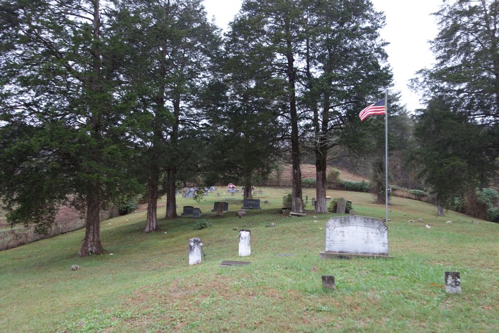
| Memorials | : | 5 |
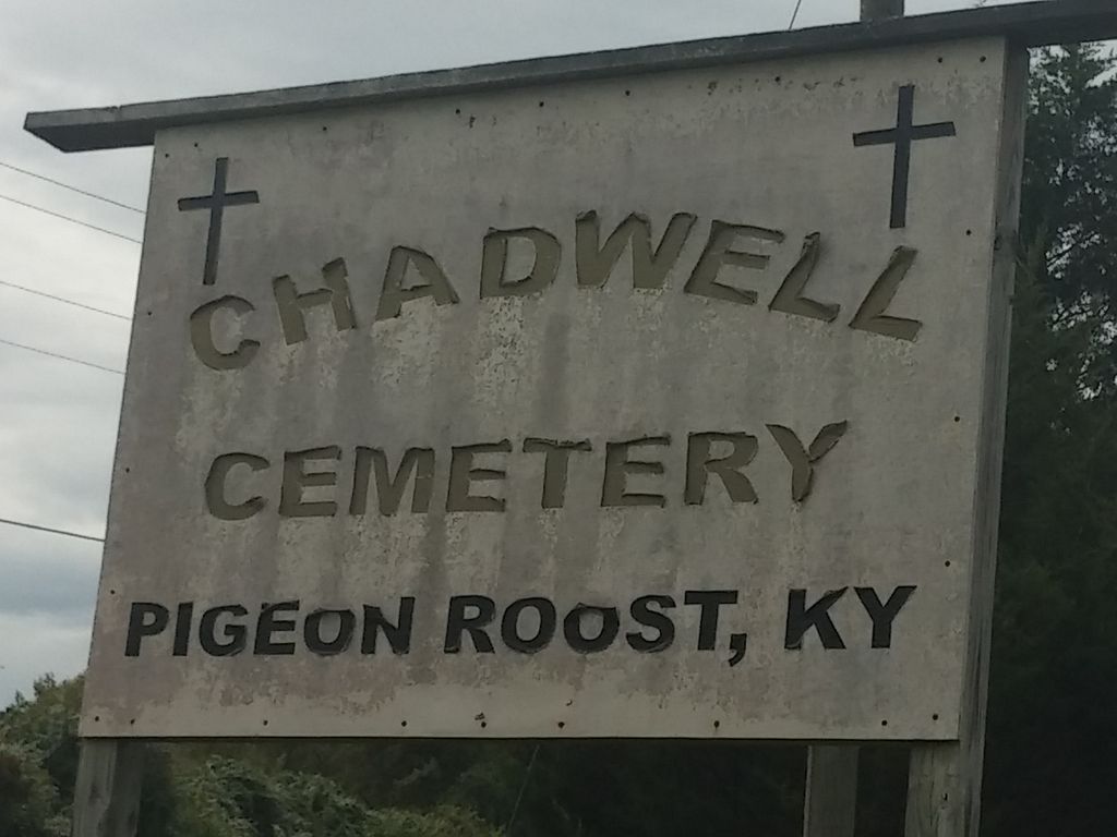
| Location | : | Pigeonroost, Clay County, USA |
| Coordinate | : | 37.0993300, -83.8489400 |
| Description | : | From Manchester, take Hwy 80 west toward London. After you pass Pigeon Roost Rd, the cemetery will be on the right. Turn right onto Firehouse Road to get to the cemetery. This is just before you start up Big Hill. Reynolds Road will be on your left. |
frequently asked questions (FAQ):
-
Where is Chadwell Cemetery?
Chadwell Cemetery is located at Pigeonroost, Clay County ,Kentucky ,USA.
-
Chadwell Cemetery cemetery's updated grave count on graveviews.com?
5 memorials
-
Where are the coordinates of the Chadwell Cemetery?
Latitude: 37.0993300
Longitude: -83.8489400
Nearby Cemetories:
1. Charlie Minton Cemetery
Bush, Laurel County, USA
Coordinate: 37.0897100, -83.8563100
2. Thomas Cemetery
Pigeonroost, Clay County, USA
Coordinate: 37.0935100, -83.8638500
3. Harris Cemetery
Laurel County, USA
Coordinate: 37.0943985, -83.8685989
4. Roots Branch Cemetery
Pigeonroost, Clay County, USA
Coordinate: 37.1034500, -83.8228400
5. York Cemetery
Bush, Laurel County, USA
Coordinate: 37.0807320, -83.8719100
6. Freedom Cemetery
Bush, Laurel County, USA
Coordinate: 37.0896160, -83.8795750
7. Vaughn Cemetery
Cottongim, Clay County, USA
Coordinate: 37.0713180, -83.8492970
8. Roberts Cemetery
Pigeonroost, Clay County, USA
Coordinate: 37.1041200, -83.8130700
9. Dobson Cemetery
Hima, Clay County, USA
Coordinate: 37.1140100, -83.8164600
10. Curry Branch Cemetery
Pigeonroost, Clay County, USA
Coordinate: 37.0971400, -83.8109300
11. Patterson Cemetery
Lake, Laurel County, USA
Coordinate: 37.0784770, -83.8792890
12. Swafford Cemetery
Pigeonroost, Clay County, USA
Coordinate: 37.1108450, -83.8086840
13. Gray Cemetery
Bush, Laurel County, USA
Coordinate: 37.1147200, -83.8882600
14. Jarvis-Goins Cemetery
Hima, Clay County, USA
Coordinate: 37.1129700, -83.8069100
15. Taylor Cemetery
Lake, Laurel County, USA
Coordinate: 37.0871010, -83.8936920
16. Crawford Cemetery
Hooker, Clay County, USA
Coordinate: 37.1385300, -83.8403600
17. Smith Cemetery
Blackwater, Laurel County, USA
Coordinate: 37.0597940, -83.8795010
18. Ephram Branch Cemetery
Hooker, Clay County, USA
Coordinate: 37.1418900, -83.8188200
19. Hurd Cemetery
Sibert, Clay County, USA
Coordinate: 37.1226300, -83.7928900
20. Cottongim Cemetery
Cottongim, Clay County, USA
Coordinate: 37.0637600, -83.8038500
21. Goodman Cemetery
Sibert, Clay County, USA
Coordinate: 37.1300900, -83.7971000
22. Hoskins Cemetery
Bush, Laurel County, USA
Coordinate: 37.0905991, -83.9167023
23. Downey Cemetery
Hima, Clay County, USA
Coordinate: 37.1233700, -83.7836200
24. Birch Cemetery
Hima, Clay County, USA
Coordinate: 37.1151500, -83.7788700