
| Memorials | : | 10 |
| Location | : | Herington, Dickinson County, USA |
| Coordinate | : | 38.7032010, -97.0104170 |
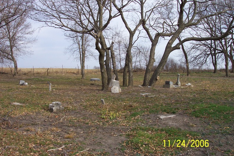
| Description | : | This cemetery is on private land. The cemetery exists on land previously owned by the Ziebell family. Over the years, cattle had entered the cemetery and knocked over several of the stones. In 2006 a few members of the township board got together and built a fence around the cemetery and cleared away brush and trees. In 2007, some family members repaired and re-set several of the broken stones. |
frequently asked questions (FAQ):
-
Where is Chalker Cemetery?
Chalker Cemetery is located at Herington, Dickinson County ,Kansas ,USA.
-
Chalker Cemetery cemetery's updated grave count on graveviews.com?
10 memorials
-
Where are the coordinates of the Chalker Cemetery?
Latitude: 38.7032010
Longitude: -97.0104170
Nearby Cemetories:
1. Saint Johns Lutheran Cemetery
Herington, Dickinson County, USA
Coordinate: 38.6957512, -96.9995117
2. Mollhagen Gravesite
Herington, Dickinson County, USA
Coordinate: 38.6979350, -96.9874040
3. Blanchett Cemetery
Herington, Dickinson County, USA
Coordinate: 38.7000130, -96.9765330
4. Saint Phillips Cemetery
Hope, Dickinson County, USA
Coordinate: 38.6810989, -97.0507965
5. Saint Paul Cemetery
Shady Brook, Dickinson County, USA
Coordinate: 38.7358017, -96.9816971
6. Immanuel Lutheran Cemetery
Shady Brook, Dickinson County, USA
Coordinate: 38.7392890, -96.9842260
7. Fall Cemetery
Herington, Dickinson County, USA
Coordinate: 38.7324440, -96.9642810
8. Hope Cemetery
Hope, Dickinson County, USA
Coordinate: 38.6924057, -97.0706329
9. Sunset Hill Cemetery
Herington, Dickinson County, USA
Coordinate: 38.6777992, -96.9561005
10. Pilgrim Home Cemetery
Hope, Dickinson County, USA
Coordinate: 38.7257996, -97.0852966
11. Wager-Hislop-Cory Family Cemetery
Herington, Dickinson County, USA
Coordinate: 38.6377570, -97.0275380
12. Sohns Graveyard
Herington, Dickinson County, USA
Coordinate: 38.6354780, -97.0191050
13. Biehler Gravesite
Herington, Dickinson County, USA
Coordinate: 38.6311370, -97.0261000
14. Lyons Creek German Baptist Cemetery
Woodbine, Dickinson County, USA
Coordinate: 38.7672680, -96.9645600
15. Langhofer-Riffel Cemetery
Woodbine, Dickinson County, USA
Coordinate: 38.7835530, -96.9874660
16. Saint Johns Catholic Cemetery
Herington, Dickinson County, USA
Coordinate: 38.6390000, -96.9393500
17. Langhofer Cemetery
Woodbine, Dickinson County, USA
Coordinate: 38.7905530, -96.9921110
18. Rosebank Cemetery
Hope, Dickinson County, USA
Coordinate: 38.6242240, -97.0779650
19. Woodbine Cemetery
Woodbine, Dickinson County, USA
Coordinate: 38.7924995, -96.9636002
20. Ashton Cemetery
Hope, Dickinson County, USA
Coordinate: 38.6817017, -97.1314011
21. Saint Pauls Evangelical Lutheran Cemetery
Ramona, Marion County, USA
Coordinate: 38.6086884, -97.0386963
22. Mitchell Valley Cemetery
Morris County, USA
Coordinate: 38.6669006, -96.8936005
23. Riffel Cemetery (Defunct)
Woodbine, Dickinson County, USA
Coordinate: 38.8177986, -97.0342026
24. Lewis Cemetery
Ramona, Marion County, USA
Coordinate: 38.5950012, -97.0671997