
| Memorials | : | 0 |
| Location | : | Chalvington, Wealden District, England |
| Coordinate | : | 50.8636010, 0.1569790 |
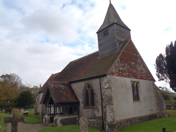
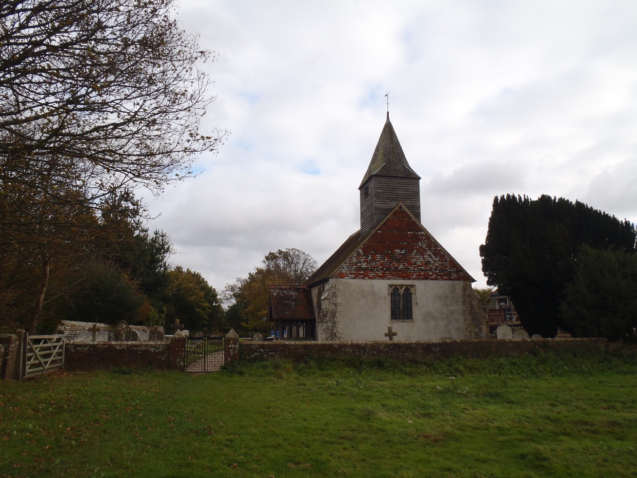
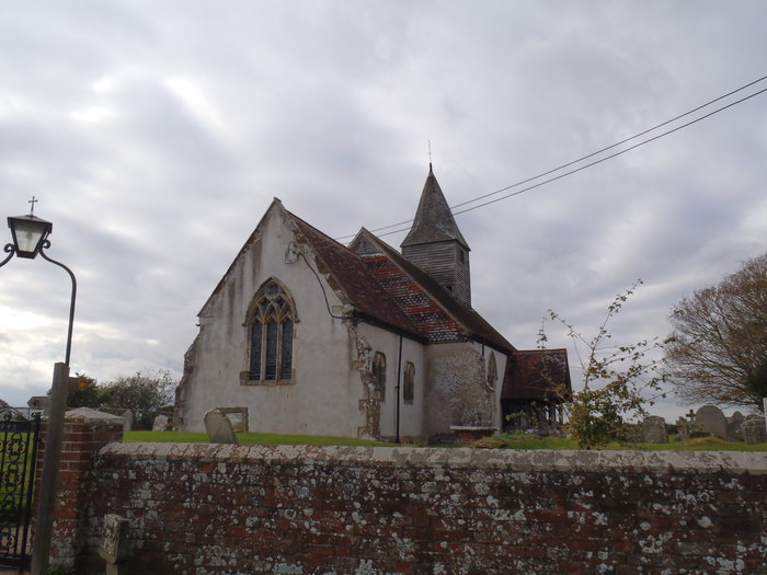
| Description | : | The village of Chalvington once known as Calvintone or Caveltone lies between the A27 Eastbourne to Lewes road and the A22 Hailsham to Uckfield main roads, in a quiet rural backwater. The parish existed in 1086 and is mentioned in the Domesday Book. The church is not mentioned until a tax record from Pope Nicholas IV in 1291. The church is tiny and very unusual being made of flints from the local South Downs, and looks like a miniature of the other churches in the area the church tower is wooden, and leans slightly due to the October hurricane of... Read More |
frequently asked questions (FAQ):
-
Where is Chalvington Churchyard?
Chalvington Churchyard is located at Church Farm Lane Chalvington, Wealden District ,East Sussex , BN27 3TDEngland.
-
Chalvington Churchyard cemetery's updated grave count on graveviews.com?
0 memorials
-
Where are the coordinates of the Chalvington Churchyard?
Latitude: 50.8636010
Longitude: 0.1569790
Nearby Cemetories:
1. St John the Baptist Churchyard
Ripe, Wealden District, England
Coordinate: 50.8684650, 0.1498400
2. Selmeston Churchyard
Selmeston, Wealden District, England
Coordinate: 50.8425010, 0.1430420
3. St Pancras Churchyard
Arlington, Wealden District, England
Coordinate: 50.8461030, 0.1902540
4. Holy Trinity Churchyard
Upper Dicker, Wealden District, England
Coordinate: 50.8669500, 0.2040591
5. Golden Cross Chapel
Golden Cross, Wealden District, England
Coordinate: 50.8912820, 0.1861750
6. All Saints Churchyard
Laughton, Wealden District, England
Coordinate: 50.8931320, 0.1326320
7. Alciston Parish Church
Alciston, Wealden District, England
Coordinate: 50.8299300, 0.1368560
8. St. Michael and All Angels Churchyard
Berwick, Wealden District, England
Coordinate: 50.8239060, 0.1550480
9. Zoar Baptist Chapel
Lower Dicker, Wealden District, England
Coordinate: 50.8788990, 0.2268400
10. St. Peter's Churchyard
West Firle, Lewes District, England
Coordinate: 50.8448639, 0.0884910
11. Chiddingly Parish Churchyard
Chiddingly, Wealden District, England
Coordinate: 50.9056710, 0.1957580
12. St. Mary and St. Peter Churchyard
Wilmington, Wealden District, England
Coordinate: 50.8175070, 0.1906410
13. St. Mary the Virgin Churchyard
Glynde, Lewes District, England
Coordinate: 50.8646000, 0.0683000
14. Alfriston United Reformed Church Cemetery
Alfriston, Wealden District, England
Coordinate: 50.8073380, 0.1571130
15. St. Andrew's Churchyard
Alfriston, Wealden District, England
Coordinate: 50.8065580, 0.1580570
16. Parish Church of the Good Shepherd
Lullington, Wealden District, England
Coordinate: 50.8068880, 0.1676260
17. Hellingly Cemetery
Hellingly, Wealden District, England
Coordinate: 50.8852690, 0.2415280
18. Hailsham Cemetery
Hailsham, Wealden District, England
Coordinate: 50.8537230, 0.2527740
19. East Hoathly Parish Church
East Hoathly, Wealden District, England
Coordinate: 50.9248990, 0.1616530
20. East Hoathly Parish Churchyard
East Hoathly, Wealden District, England
Coordinate: 50.9249039, 0.1615840
21. St. Peter and St. Paul Churchyard
Hellingly, Wealden District, England
Coordinate: 50.8885260, 0.2460540
22. St Peter ad Vincula Churchyard
Folkington, Wealden District, England
Coordinate: 50.8127860, 0.2120120
23. St. Margaret's Churchyard
Ditchling, Lewes District, England
Coordinate: 50.8376010, 0.2513120
24. St Mary Churchyard
Hailsham, Wealden District, England
Coordinate: 50.8630880, 0.2604170