| Memorials | : | 0 |
| Location | : | Champagnole, Departement du Jura, France |
| Coordinate | : | 46.7467200, 5.9115500 |
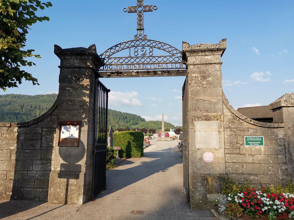
| Description | : | Champagnole is a town in the Department of Jura, 30 kilometres north-east of Lons-le-Saunier on the D471. The Communal Cemetery is located in the north-east of the town near the railway station. The 20 war graves are in 8 separate kerbed plots with chippings and will be found immediately to the left of the cemetery entrance. |
frequently asked questions (FAQ):
-
Where is Champagnole Communal Cemetery?
Champagnole Communal Cemetery is located at Champagnole, Departement du Jura ,Franche-Comté ,France.
-
Champagnole Communal Cemetery cemetery's updated grave count on graveviews.com?
0 memorials
-
Where are the coordinates of the Champagnole Communal Cemetery?
Latitude: 46.7467200
Longitude: 5.9115500
Nearby Cemetories:
1. Supt Churchyard
Supt, Departement du Jura, France
Coordinate: 46.8488200, 5.9588400
2. Censeau Communal Cemetery
Censeau, Departement du Jura, France
Coordinate: 46.8152700, 6.0636100
3. Couvent des Carmélites
Salins-les-Bains, Departement du Jura, France
Coordinate: 46.9289658, 5.8860429
4. Abbaye Saint-Pierre de Baume-les-Messieurs
Baume-les-Messieurs, Departement du Jura, France
Coordinate: 46.7077780, 5.6486110
5. Cimetiere du Publy
Publy, Departement du Jura, France
Coordinate: 46.6320900, 5.6410900
6. Mouchard Communal Cemetery
Mouchard, Departement du Jura, France
Coordinate: 46.9784400, 5.7935600
7. Église des Cordeliers
Lons-le-Saunier, Departement du Jura, France
Coordinate: 46.6753000, 5.5544000
8. Chapelle d'Huin Cemetery
Chapelle-d'Huin, Departement du Doubs, France
Coordinate: 46.9380000, 6.1760000
9. Arc-et-Senans Communal Cemetery
Arc-et-Senans, Departement du Doubs, France
Coordinate: 47.0398800, 5.7889200
10. Cimetière de Vallorbe
Vallorbe, District du Jura-Nord vaudois, Switzerland
Coordinate: 46.7119590, 6.3791670
11. Pontarlier Communal Cemetery
Pontarlier, Departement du Doubs, France
Coordinate: 46.9060200, 6.3573800
12. Abbey of Saint Claude
Saint-Claude, Departement du Jura, France
Coordinate: 46.3861480, 5.8653490
13. Église Notre-Dame de Rahon
Rahon, Departement du Jura, France
Coordinate: 46.9875906, 5.4619957
14. Cimetière Communal d'Ornans
Ornans, Departement du Doubs, France
Coordinate: 47.1024685, 6.1474573
15. Gilly Cemetery
Gilly, District de Nyon, Switzerland
Coordinate: 46.4567466, 6.2975880
16. Temple De Chevilly
Chevilly, District de Morges, Switzerland
Coordinate: 46.6423520, 6.4770260
17. Montcony Churchyard
Montcony, Departement de Saône-et-Loire, France
Coordinate: 46.7001500, 5.2906900
18. Cimetière d’Etoy
Etoy, District de Morges, Switzerland
Coordinate: 46.4875864, 6.4226213
19. Cimetière de Lussery-Villars
Lussery, District du Gros-de-Vaud, Switzerland
Coordinate: 46.6317260, 6.5272370
20. Tavaux
Tavaux, Departement du Jura, France
Coordinate: 47.0351030, 5.4115047
21. Couvent des Cordeliers de Dole
Dole, Departement du Jura, France
Coordinate: 47.0907070, 5.4905120
22. Église de Rochefort-sur-Nenon
Rochefort-sur-Nenon, Departement du Jura, France
Coordinate: 47.1263890, 5.5619440
23. Cimetière de Trépot
Trepot, Departement du Doubs, France
Coordinate: 47.1661000, 6.1445360
24. Notre-Dame de Mont Roland
Dole, Departement du Jura, France
Coordinate: 47.0931000, 5.4906000


