
| Memorials | : | 6 |
| Location | : | Champion Hill, Hinds County, USA |
| Coordinate | : | 32.3209150, -90.5350820 |
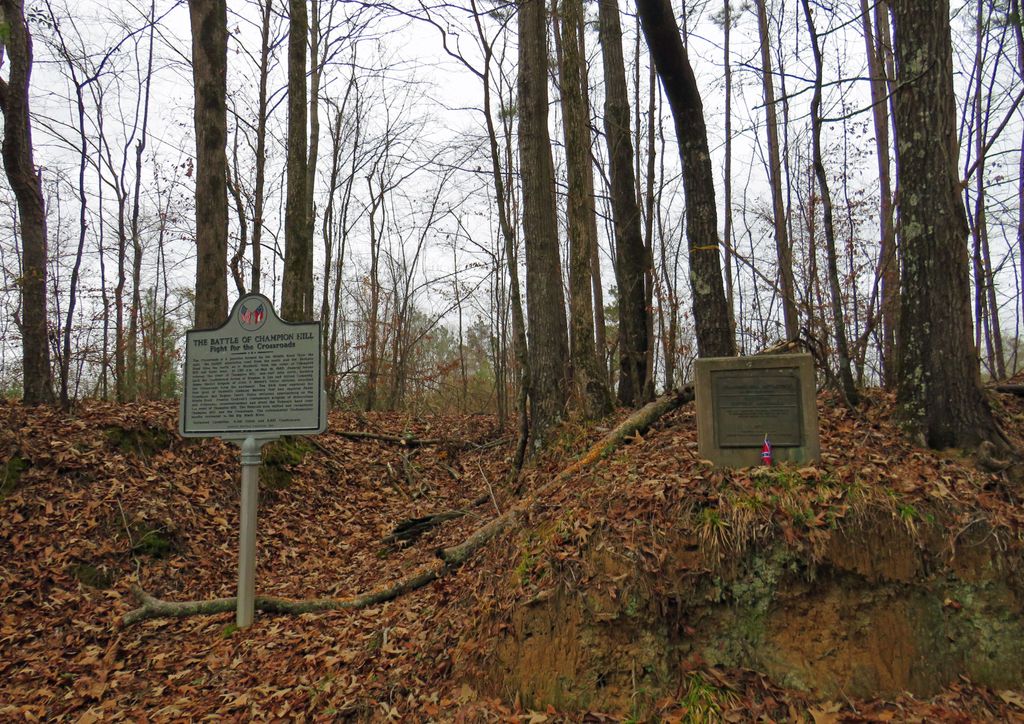
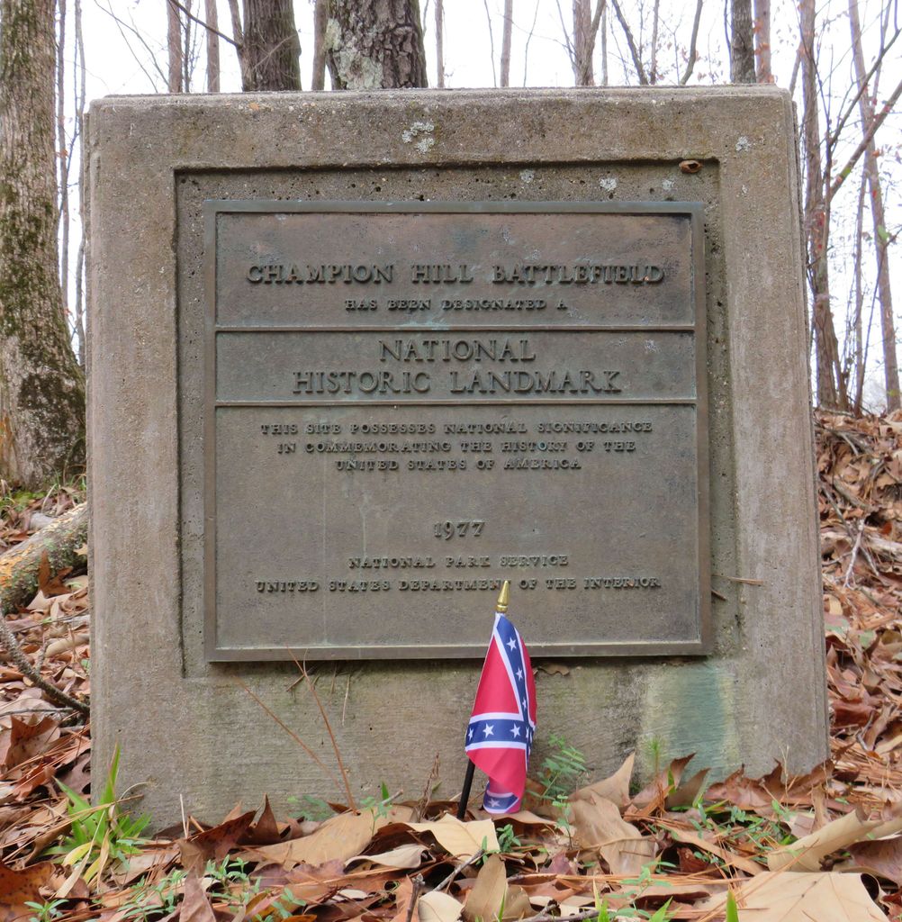
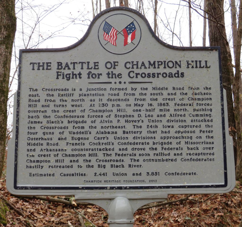
| Description | : | This is the resting place of many Union and Confederate soldiers. Soldiers were buried in mass graves on the property of the Champion family estate. The battle of Champion Hill took place on May 16, 1863. The Hiawatha plantation house was used as a hospital for the wounded. In the battle of Baker's Creek, or Champion Hill, our Confederate dead were buried by the Federals (Grand Army of the Repuplic) in trenches, no separate graves being made. This spot has been so long neglected that there is nothing now discernible by which the burial trenches can be identified. |
frequently asked questions (FAQ):
-
Where is Champion Hill Burial Ground?
Champion Hill Burial Ground is located at Champion Hill, Hinds County ,Mississippi ,USA.
-
Champion Hill Burial Ground cemetery's updated grave count on graveviews.com?
6 memorials
-
Where are the coordinates of the Champion Hill Burial Ground?
Latitude: 32.3209150
Longitude: -90.5350820
Nearby Cemetories:
1. William Lowe Family Cemetery
Hinds County, USA
Coordinate: 32.3005829, -90.5498428
2. Abney Family Cemetery
Champion Hill, Hinds County, USA
Coordinate: 32.3445820, -90.5203060
3. Saint James Cemetery
Edwards, Hinds County, USA
Coordinate: 32.3077778, -90.5716667
4. Gillespie Family Cemetery
Hinds County, USA
Coordinate: 32.2869380, -90.5025760
5. Edwards Cemetery
Edwards, Hinds County, USA
Coordinate: 32.3339005, -90.5856018
6. Ratliff Chapel M.B. Church
Edwards, Hinds County, USA
Coordinate: 32.3638510, -90.5673210
7. New Hope Church Cemetery
Raymond, Hinds County, USA
Coordinate: 32.2854610, -90.4899950
8. Sand Hill Missionary Baptist Church Cemetery
Edwards, Hinds County, USA
Coordinate: 32.3722191, -90.5463867
9. Pleasant Grove Missionary Baptist Church Smith Sta
Edwards, Hinds County, USA
Coordinate: 32.3549100, -90.5879700
10. Galilee Missionary Baptist Church Cemetery
Raymond, Hinds County, USA
Coordinate: 32.2551330, -90.5251880
11. Carnes Cemetery
Morning Star, Hinds County, USA
Coordinate: 32.2669411, -90.5817566
12. Mount Elizabeth Missionary Baptist Church Cemetery
Bolton, Hinds County, USA
Coordinate: 32.3387566, -90.4575958
13. Friendship Cemetery
Edwards, Hinds County, USA
Coordinate: 32.3139000, -90.6156006
14. Bolton Family Cemetery
Bolton, Hinds County, USA
Coordinate: 32.3535461, -90.4634247
15. Asbury United Methodist Cemetery
Hinds County, USA
Coordinate: 32.3471360, -90.4591910
16. Mount Shiloh M.B. Church Cemetery
Edwards, Hinds County, USA
Coordinate: 32.3476786, -90.6108864
17. Zion Chapel Cemetery
Bolton, Hinds County, USA
Coordinate: 32.3708305, -90.4705582
18. Mount Moriah Missionary Baptist Church Cemetery
Edwards, Hinds County, USA
Coordinate: 32.2835197, -90.6165619
19. Cherry Grove Church Cemetery
Morning Star, Hinds County, USA
Coordinate: 32.2427788, -90.5625000
20. Dillon Family Cemetery
Morning Star, Hinds County, USA
Coordinate: 32.2358551, -90.5406876
21. Fairchild Cemetery
Raymond, Hinds County, USA
Coordinate: 32.2562714, -90.4688721
22. Bolton Cemetery
Bolton, Hinds County, USA
Coordinate: 32.3574982, -90.4424973
23. Hinds Independent Methodist Church Cemetery
Oakley, Hinds County, USA
Coordinate: 32.2350197, -90.5175552
24. New Salem Cemetery
Bolton, Hinds County, USA
Coordinate: 32.3602430, -90.4302260