
| Memorials | : | 0 |
| Location | : | Woodville Hills, Monroe County, USA |
| Coordinate | : | 39.0864670, -86.3746330 |
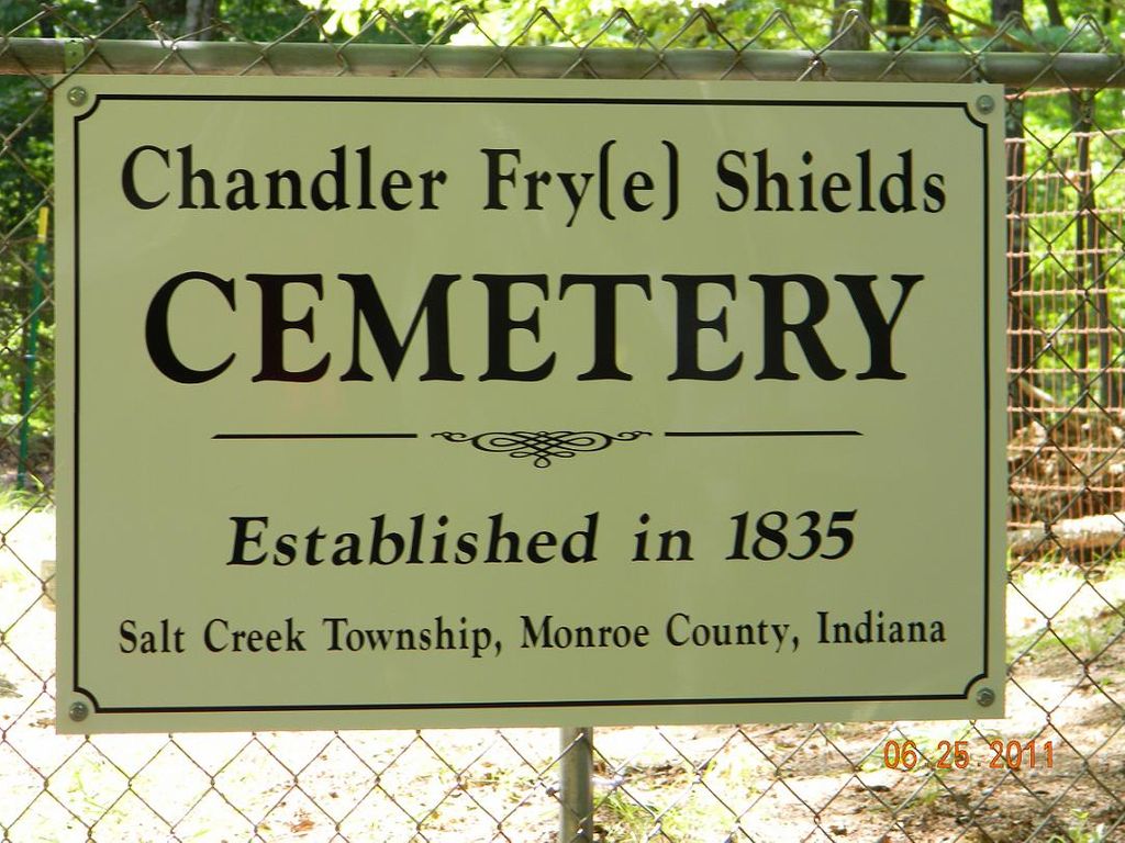
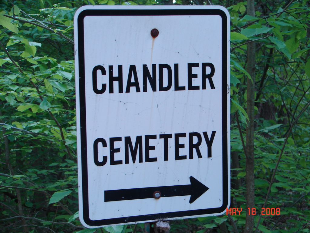
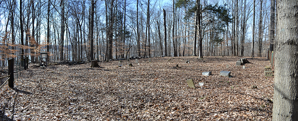
| Description | : | The cemetery is located in Salt Creek Township (Section 35 Township 8N Range 1E) in the Hoosier National Forest on the east side of S Forest Road about 0.4 miles southwest of its intersection with E Elkins Road. Indiana Cemetery Locations, Volume 2, published by the Indiana Genealogical Society (01 April 2006), gives the primary cemetery name as Chandler Cemetery #3 with alternate names of Fry Cemetery, Shields Cemetery #2 and Silas Chandler Cemetery. The cemetery is listed in the Cemetery and Burial Grounds Registry of the Indiana Department of Natural Resources (DNR) and in the State Historical... Read More |
frequently asked questions (FAQ):
-
Where is Chandler Cemetery?
Chandler Cemetery is located at S Forest Road Woodville Hills, Monroe County ,Indiana , 47401USA.
-
Chandler Cemetery cemetery's updated grave count on graveviews.com?
0 memorials
-
Where are the coordinates of the Chandler Cemetery?
Latitude: 39.0864670
Longitude: -86.3746330
Nearby Cemetories:
1. Deckard Cemetery
Brown County, USA
Coordinate: 39.0835495, -86.3358307
2. Burgoon Church Cemetery
Monroe County, USA
Coordinate: 39.0546112, -86.4014130
3. Friendship Cemetery
Bloomington, Monroe County, USA
Coordinate: 39.1223090, -86.3976220
4. Hays Cemetery #1
Bloomington, Monroe County, USA
Coordinate: 39.0482000, -86.3951000
5. Hughes Cemetery (Defunct)
Monroe County, USA
Coordinate: 39.0830560, -86.4322780
6. Patton Homestead Burial Ground
Monroe County, USA
Coordinate: 39.0425835, -86.3609009
7. Hays Cemetery #2
Bloomington, Monroe County, USA
Coordinate: 39.0407000, -86.3819000
8. TC Steele Memorial Cemetery
Belmont, Brown County, USA
Coordinate: 39.1301727, -86.3487778
9. Paynetowns Cemetery
Knight Ridge, Monroe County, USA
Coordinate: 39.0795080, -86.4362450
10. Burtons Knightridge Kampground Gravesite
Bloomington, Monroe County, USA
Coordinate: 39.1136940, -86.4322680
11. Deckard Family Cemetery
Bloomington, Monroe County, USA
Coordinate: 39.0500488, -86.4235611
12. Terrill Cemetery
Brown County, USA
Coordinate: 39.0546989, -86.3202972
13. Pate Family Cemetery
Knight Ridge, Monroe County, USA
Coordinate: 39.1136900, -86.4332060
14. Hillenberg Cemetery
Monroe County, USA
Coordinate: 39.0332000, -86.3648000
15. William Hall Cemetery
Yellowstone, Monroe County, USA
Coordinate: 39.0372000, -86.3346000
16. Knightridge Cemetery
Knight Ridge, Monroe County, USA
Coordinate: 39.1253014, -86.4330978
17. Salt Creek Cemetery
Salt Creek Township, Monroe County, USA
Coordinate: 39.1247101, -86.4338379
18. Vandeman Cemetery
Belmont, Brown County, USA
Coordinate: 39.1440410, -86.3535690
19. Shields Cemetery
Knight Ridge, Monroe County, USA
Coordinate: 39.0901670, -86.4564800
20. Stogdill Cemetery
Elkinsville, Brown County, USA
Coordinate: 39.1164100, -86.3018230
21. Allens Creek Cemetery
Bloomington, Monroe County, USA
Coordinate: 39.0324783, -86.4199600
22. Fleetwood Cemetery
Brown County, USA
Coordinate: 39.1227700, -86.3028200
23. Todd Cemetery
Polk Township, Monroe County, USA
Coordinate: 39.0139008, -86.3780975
24. Butcher-Bender Cemetery
Monroe County, USA
Coordinate: 39.0998420, -86.4686930