
| Memorials | : | 0 |
| Location | : | Shasta, Shasta County, USA |
| Coordinate | : | 40.6038810, -122.4992540 |
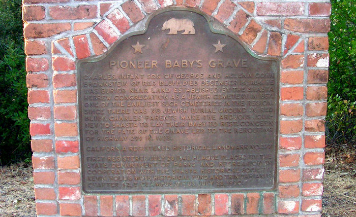
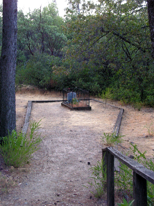
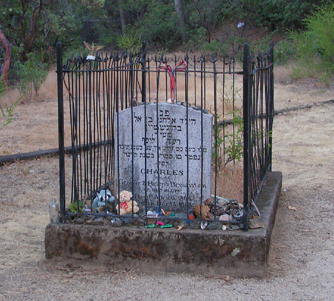
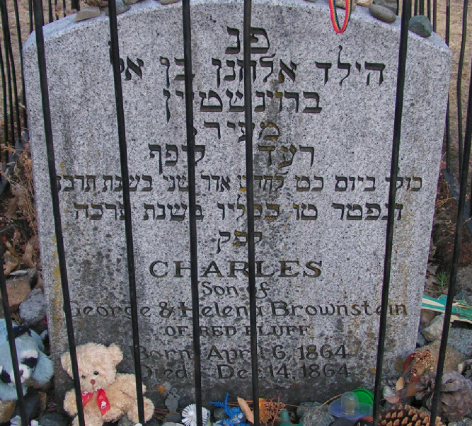
| Description | : | Consists of one burial plot, namely the grave of one infant; considered a cemetery by the state of California. The white marble headstone is surrounded by a wrought iron fence. It is a California Historical Site. It is located about 100 yards west of California Registered Historical Landmark Monument No. 377 on Highway 299. Location of the state monument is described as 40 degrees 36.239'N 122 degrees 29.965' W. It can be viewed on the right when traveling west on Highway 377, Shasta, Shasta County, California. This memorial for the Pioneer Baby's Grave Cemetery was created by findagrave member # 46997739 ~... Read More |
frequently asked questions (FAQ):
-
Where is Charles Brownstein Gravesite?
Charles Brownstein Gravesite is located at State Highway 299 Shasta, Shasta County ,California , 96087USA.
-
Charles Brownstein Gravesite cemetery's updated grave count on graveviews.com?
0 memorials
-
Where are the coordinates of the Charles Brownstein Gravesite?
Latitude: 40.6038810
Longitude: -122.4992540

Nearby Cemetories:
1. Shasta Catholic Cemetery
Shasta, Shasta County, USA
Coordinate: 40.6014950, -122.4917190
2. Shasta Union Cemetery
Shasta, Shasta County, USA
Coordinate: 40.6008682, -122.4906845
3. Shasta Masonic Cemetery
Shasta, Shasta County, USA
Coordinate: 40.5910492, -122.4859695
4. Whiskeytown Cemetery
Whiskeytown, Shasta County, USA
Coordinate: 40.5858002, -122.5381012
5. Saint Joseph Cemetery
Redding, Shasta County, USA
Coordinate: 40.5824509, -122.4310989
6. Middletown Cemetery
Redding, Shasta County, USA
Coordinate: 40.5392800, -122.4748700
7. All Saints Episcopal Church Columbarium
Redding, Shasta County, USA
Coordinate: 40.5974900, -122.4010600
8. Buckeye Pioneer Cemetery
Buckeye, Shasta County, USA
Coordinate: 40.6432991, -122.4006195
9. Old Saint Joseph Cemetery
Redding, Shasta County, USA
Coordinate: 40.5781326, -122.3912811
10. Redding Memorial Park
Redding, Shasta County, USA
Coordinate: 40.5894814, -122.3872833
11. Igo Cemetery
Igo, Shasta County, USA
Coordinate: 40.5130501, -122.5375977
12. Barbara Glass Gravesite
Shasta County, USA
Coordinate: 40.5067600, -122.5049700
13. Shasta General Hospital Cemetery
Redding, Shasta County, USA
Coordinate: 40.5516000, -122.3894000
14. Texas Springs Cemetery
Redding, Shasta County, USA
Coordinate: 40.5116844, -122.4516144
15. Newtown Cemetery
Shasta Lake, Shasta County, USA
Coordinate: 40.6627655, -122.3911972
16. Shasta General Hospital Cemetery
Redding, Shasta County, USA
Coordinate: 40.5509200, -122.3841800
17. Churntown Cemetery
Shasta Lake, Shasta County, USA
Coordinate: 40.6786110, -122.4052780
18. Levi Tower Gravesite
French Gulch, Shasta County, USA
Coordinate: 40.6644860, -122.6365180
19. Lawncrest Memorial Park
Redding, Shasta County, USA
Coordinate: 40.5732994, -122.3432999
20. Northern California Veterans Cemetery
Igo, Shasta County, USA
Coordinate: 40.4785400, -122.5422500
21. Central Valley Cemetery
Shasta Lake, Shasta County, USA
Coordinate: 40.6883011, -122.3649673
22. Black Canyon Cemetery
Shasta Lake, Shasta County, USA
Coordinate: 40.6893420, -122.3651330
23. Happy Valley Cemetery
Redding, Shasta County, USA
Coordinate: 40.4668999, -122.4535980
24. French Gulch Catholic Cemetery
French Gulch, Shasta County, USA
Coordinate: 40.6968994, -122.6402512