
| Memorials | : | 0 |
| Location | : | Monroe, Amherst County, USA |
| Phone | : | (434) 384-9298 |
| Coordinate | : | 37.5224880, -79.2281700 |
frequently asked questions (FAQ):
-
Where is Chestnut Grove Baptist Church Cemetery?
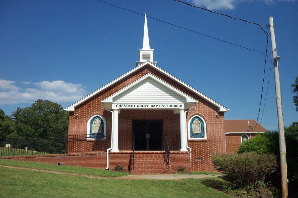
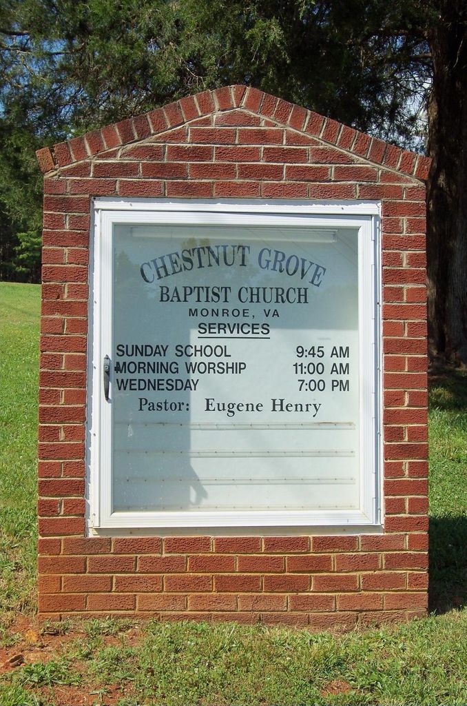
Chestnut Grove Baptist Church Cemetery is located at 202 East Perch Road (Rt. 650) Monroe, Amherst County ,Virginia , 24574USA.
-
Chestnut Grove Baptist Church Cemetery cemetery's updated grave count on graveviews.com?
0 memorials
-
Where are the coordinates of the Chestnut Grove Baptist Church Cemetery?
Latitude: 37.5224880
Longitude: -79.2281700
Nearby Cemetories:
1. Mount Tabor United Methodist Church Cemetery
Monroe, Amherst County, USA
Coordinate: 37.5350660, -79.2432960
2. Harris Cemetery
Monroe, Amherst County, USA
Coordinate: 37.5118570, -79.2482210
3. Tyler-Davies Cemetery
Elon, Amherst County, USA
Coordinate: 37.5024940, -79.2155580
4. Fletcher Cemetery
Amherst County, USA
Coordinate: 37.5224991, -79.1986008
5. Elon Baptist Church Cemetery
Elon, Amherst County, USA
Coordinate: 37.5148820, -79.1950660
6. Elon Presbyterian Church Cemetery
Elon, Amherst County, USA
Coordinate: 37.5183510, -79.1939170
7. Hudson Cemetery
Madison Heights, Amherst County, USA
Coordinate: 37.5288710, -79.1820040
8. Rucker Family Cemetery
Monroe, Amherst County, USA
Coordinate: 37.5406220, -79.1850810
9. Saint Lukes Episcopal Church Cemetery
Pedlar Mills, Amherst County, USA
Coordinate: 37.5590680, -79.2545970
10. Minor Family Cemetery
Pedlar Mills, Amherst County, USA
Coordinate: 37.5564200, -79.2720900
11. Street Cemetery
Madison Heights, Amherst County, USA
Coordinate: 37.5052030, -79.1666470
12. Shelton-Ellis-Watts Cemetery
Monroe, Amherst County, USA
Coordinate: 37.5066801, -79.1636774
13. Watts Cemetery
Monroe, Amherst County, USA
Coordinate: 37.5539590, -79.1722680
14. Sligh - Martin Cemetery
Eagles Eyrie, Bedford County, USA
Coordinate: 37.4819150, -79.2764340
15. Antioch Baptist Church Cemetery
Coleman Falls, Bedford County, USA
Coordinate: 37.4858666, -79.2842774
16. Pleasants Chapel Cemetery
Pedlar Mills, Amherst County, USA
Coordinate: 37.5823650, -79.2140090
17. Cedar Gate Rd Cemetery
Elon, Amherst County, USA
Coordinate: 37.5231830, -79.1497590
18. Cove United Methodist Church Cemetery
Coleman Falls, Bedford County, USA
Coordinate: 37.4989894, -79.3010842
19. Centenary Burial Association Cemetery
Naola, Amherst County, USA
Coordinate: 37.5464420, -79.3018490
20. Brown Family Cemetery
Naola, Amherst County, USA
Coordinate: 37.5622220, -79.2930560
21. Bethany United Methodist Cemetery
Monroe, Amherst County, USA
Coordinate: 37.5292190, -79.1453680
22. Corner Stone Baptist Church Cemetery
Monroe, Amherst County, USA
Coordinate: 37.5491250, -79.3051220
23. Rising Sun Missionary Baptist Church Cemetery
Monroe, Amherst County, USA
Coordinate: 37.5086520, -79.1442890
24. Long Family Cemetery
Winesap, Amherst County, USA
Coordinate: 37.4833120, -79.1578650