| Memorials | : | 0 |
| Location | : | Putnam, Putnam County, USA |
| Coordinate | : | 41.1939550, -89.3965670 |
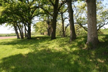
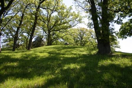
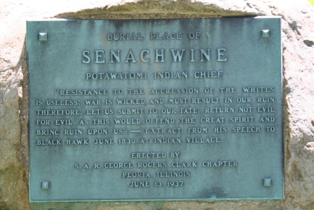
| Description | : | There are no longer signs marking the way. These mounds are on private property. Indian Burial Ground Become a Museum Thursday, May 15, 1930 The Chief Senachwine mounds, "happy hunting ground" of Chief Senachwine, and hundreds of his Pottawatomie braves, who in the early nineteenth century dominated this section of Illinois, has been converted into a park which was opened to the public last week by Walter Winship and George Wheeler, owners of the land upon which the mounds are located, one-half mile north of the village of Putnam. Between seven and eight acres of land are covered by the mounds,... Read More |
frequently asked questions (FAQ):
-
Where is Chief Senachwine Indian Mounds?
Chief Senachwine Indian Mounds is located at Putnam, Putnam County ,Illinois ,USA.
-
Chief Senachwine Indian Mounds cemetery's updated grave count on graveviews.com?
0 memorials
-
Where are the coordinates of the Chief Senachwine Indian Mounds?
Latitude: 41.1939550
Longitude: -89.3965670
Nearby Cemetories:
1. Putnam Cemetery
Putnam, Putnam County, USA
Coordinate: 41.1856100, -89.3900900
2. Saint Francis Cemetery
Putnam, Putnam County, USA
Coordinate: 41.2027460, -89.4375510
3. Levi Long Cemetery
Putnam, Putnam County, USA
Coordinate: 41.2071850, -89.4565630
4. Lone Tree Cemetery
Wheatland Township, Bureau County, USA
Coordinate: 41.1842003, -89.4819031
5. Riverside Cemetery
Hennepin, Putnam County, USA
Coordinate: 41.2463989, -89.3399963
6. Hoyt Cemetery
Henry, Marshall County, USA
Coordinate: 41.1279810, -89.3698950
7. Saint Anthony Cemetery
Hennepin, Putnam County, USA
Coordinate: 41.2527733, -89.3411636
8. Henry Cemetery
Henry, Marshall County, USA
Coordinate: 41.1232986, -89.3719025
9. Perkins Cemetery
Bureau, Bureau County, USA
Coordinate: 41.2681300, -89.3957520
10. Saint Patrick Cemetery
Henry, Marshall County, USA
Coordinate: 41.1198080, -89.3755390
11. Calvary Cemetery
Henry, Marshall County, USA
Coordinate: 41.1193550, -89.3772550
12. Sugar Grove Cemetery
Henry, Marshall County, USA
Coordinate: 41.1268997, -89.4460983
13. Albrecht Family Cemetery
Bureau County, USA
Coordinate: 41.2593560, -89.4566920
14. Florid Cemetery
Florid, Putnam County, USA
Coordinate: 41.2272224, -89.2819443
15. Hunter Cemetery
Bureau County, USA
Coordinate: 41.1958360, -89.5196490
16. Murphy Cemetery
Putnam County, USA
Coordinate: 41.1660995, -89.2746964
17. Greenwood Cemetery
Bureau, Bureau County, USA
Coordinate: 41.2994003, -89.3641968
18. Plow Creek Cemetery
Tiskilwa, Bureau County, USA
Coordinate: 41.2795792, -89.4858551
19. Union Grove Cemetery
Granville Township, Putnam County, USA
Coordinate: 41.2414017, -89.2647018
20. Old Saint Mary's Cemetery
Henry, Marshall County, USA
Coordinate: 41.0822630, -89.3998720
21. Whitefield Cemetery
Henry, Marshall County, USA
Coordinate: 41.1100121, -89.5033875
22. Willow Springs Cemetery
Tiskilwa, Bureau County, USA
Coordinate: 41.2495840, -89.5360850
23. Caledonia Cemetery
Magnolia, Putnam County, USA
Coordinate: 41.1293983, -89.2493973
24. Bonham Cemetery
Sparland, Marshall County, USA
Coordinate: 41.0607986, -89.4289017


