
| Memorials | : | 14 |
| Location | : | Choice, Fillmore County, USA |
| Coordinate | : | 43.6449370, -91.7883620 |
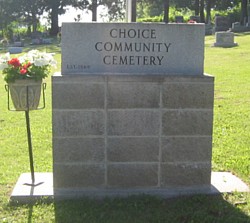
| Description | : | Location: The Choice Cemetery is in Section 15 of Preble Twp. This cemetery is located on the west side of State Highway 43, a mile south of Choice. (Ten miles north of Mabel or 12 miles south of Rushford.) Choice Community Cemetery Association 20046 State Hwy 43 Mabel, MN 55954 |
frequently asked questions (FAQ):
-
Where is Choice Community Cemetery?
Choice Community Cemetery is located at Choice, Fillmore County ,Minnesota ,USA.
-
Choice Community Cemetery cemetery's updated grave count on graveviews.com?
14 memorials
-
Where are the coordinates of the Choice Community Cemetery?
Latitude: 43.6449370
Longitude: -91.7883620
Nearby Cemetories:
1. South Fork Cemetery
Choice, Fillmore County, USA
Coordinate: 43.6522217, -91.7486115
2. Wisel Cemetery
Tawney, Fillmore County, USA
Coordinate: 43.6360817, -91.8432159
3. Saint Marys Cemetery
Fillmore County, USA
Coordinate: 43.6227989, -91.7407990
4. Scheie North Cemetery
Mabel, Fillmore County, USA
Coordinate: 43.6016998, -91.7797012
5. Scheie Lutheran Cemetery
Mabel, Fillmore County, USA
Coordinate: 43.5877040, -91.7894730
6. First Lutheran Church of Highland Cemetery
Lanesboro, Fillmore County, USA
Coordinate: 43.6707993, -91.8705978
7. Highland Friends Church Cemetery
Highland, Fillmore County, USA
Coordinate: 43.6880608, -91.8697205
8. Highland Prairie Lutheran Church Cemetery
Norway Township, Fillmore County, USA
Coordinate: 43.7187620, -91.7861020
9. Newburg Methodist Church Cemetery
Newburg, Fillmore County, USA
Coordinate: 43.5686111, -91.8147202
10. Elstad Lutheran Cemetery
Lanesboro, Fillmore County, USA
Coordinate: 43.6586113, -91.8963928
11. Riceford Norwegian Cemetery
Riceford, Houston County, USA
Coordinate: 43.5755005, -91.7298965
12. Olde English Cemetery
Spring Grove, Houston County, USA
Coordinate: 43.5751600, -91.7294900
13. Kopperud Cemetery
Rushford, Fillmore County, USA
Coordinate: 43.7372017, -91.7497025
14. Faith Lutheran Church Cemetery
Black Hammer, Houston County, USA
Coordinate: 43.6161118, -91.6597214
15. Yucatan Cemetery
Houston County, USA
Coordinate: 43.6946983, -91.6703033
16. Lenora Cemetery
Lenora, Fillmore County, USA
Coordinate: 43.5758018, -91.8899994
17. Garness Lutheran Church Cemetery
Mabel, Fillmore County, USA
Coordinate: 43.5444412, -91.8099976
18. Poor Farm Cemetery
Henrytown, Fillmore County, USA
Coordinate: 43.5878000, -91.9125080
19. Henrytown Cemetery
Henrytown, Fillmore County, USA
Coordinate: 43.5944405, -91.9263916
20. Oak Ridge Lutheran Cemetery
Houston, Houston County, USA
Coordinate: 43.7309400, -91.6806400
21. Mabel Cemetery
Mabel, Fillmore County, USA
Coordinate: 43.5292015, -91.7743988
22. Holt Catholic Cemetery
Lanesboro, Fillmore County, USA
Coordinate: 43.6955986, -91.9392014
23. Henry Cemetery
Henrytown, Fillmore County, USA
Coordinate: 43.5900002, -91.9368973
24. Hongerholt Cemetery
Peterson, Fillmore County, USA
Coordinate: 43.7605600, -91.8399700