
| Memorials | : | 113 |
| Location | : | Cambridge, Dorchester County, USA |
| Website | : | www.christchurchcambridge.org/Cemetery.html |
| Coordinate | : | 38.5727997, -76.0768967 |
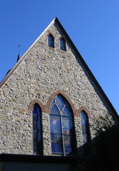
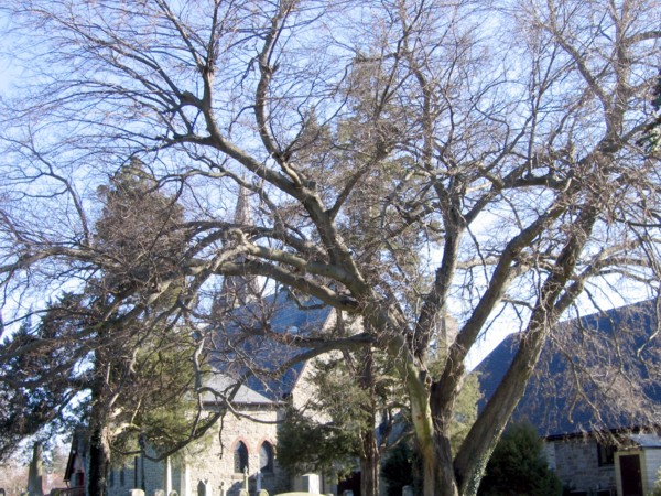
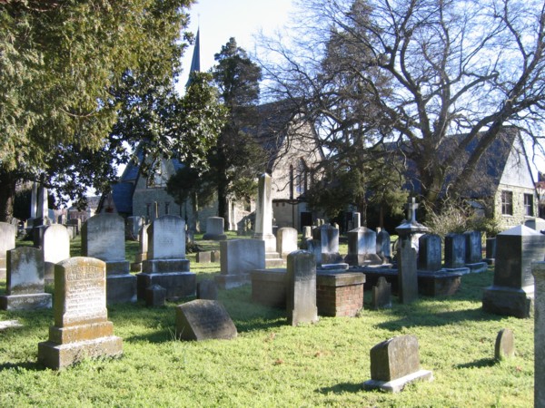
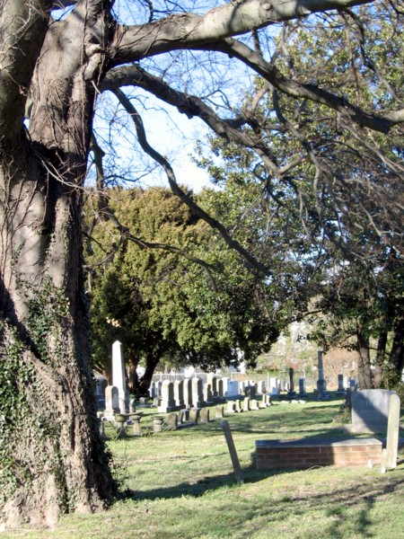
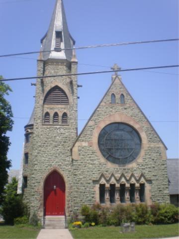
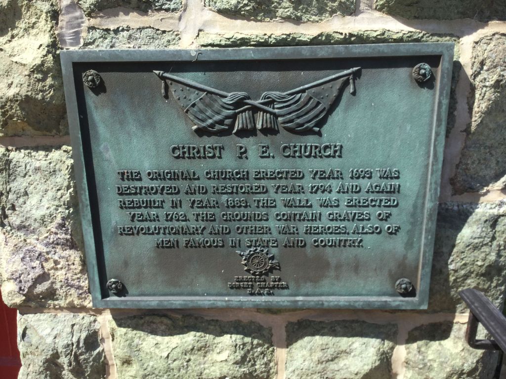
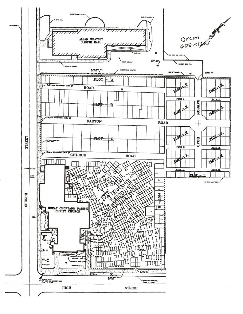
| Description | : | The Great Choptank Parish was one of 30 parishes of the Church of England established in 1692 in the colony of Maryland on behalf of King William and Queen Mary. Christ Church was located in Cambridge as the principal church of that parish. From as early as 1693 there was an Anglican Church on the lands surrounding the present Christ Episcopal Church. The present building, the third on the lands designated at the founding of the City of Cambridge for a church, was constructed 1883. The old cemetery adjacent to Christ Church can be seen from both High and Church... Read More |
frequently asked questions (FAQ):
-
Where is Christ Episcopal Church Cemetery?
Christ Episcopal Church Cemetery is located at Cambridge, Dorchester County ,Maryland ,USA.
-
Christ Episcopal Church Cemetery cemetery's updated grave count on graveviews.com?
79 memorials
-
Where are the coordinates of the Christ Episcopal Church Cemetery?
Latitude: 38.5727997
Longitude: -76.0768967
Nearby Cemetories:
1. Woolford Graves
Cambridge, Dorchester County, USA
Coordinate: 38.5709180, -76.0760290
2. Cambridge Cemetery
Cambridge, Dorchester County, USA
Coordinate: 38.5657997, -76.0757980
3. Waugh Cemetery
Cambridge, Dorchester County, USA
Coordinate: 38.5657997, -76.0832977
4. Bethel Cemetery
Cambridge, Dorchester County, USA
Coordinate: 38.5583000, -76.0847015
5. Eastern Shore State Hospital Cemetery
Cambridge, Dorchester County, USA
Coordinate: 38.5635460, -76.0554860
6. Greenlawn Cemetery
Cambridge, Dorchester County, USA
Coordinate: 38.5694008, -76.1035995
7. Christ Rock United Methodist Church Cemetery
Cambridge, Dorchester County, USA
Coordinate: 38.5443878, -76.1030884
8. Dail Graveyard
Dorchester County, USA
Coordinate: 38.5487887, -76.1250697
9. Dorchester Memorial Park
Cambridge, Dorchester County, USA
Coordinate: 38.5501370, -76.0193070
10. Union Chapel African Methodist Episcopal Cemetery
Cambridge, Dorchester County, USA
Coordinate: 38.5409813, -76.0237198
11. Dickinson Cemetery
Trappe, Talbot County, USA
Coordinate: 38.6263500, -76.0922100
12. Readly Cemetery
Trappe, Talbot County, USA
Coordinate: 38.6363983, -76.0643997
13. Antioch Cemetery
Dorchester County, USA
Coordinate: 38.5494003, -76.1568985
14. Windemere Cemetery
Cambridge, Dorchester County, USA
Coordinate: 38.5811500, -76.1713400
15. Old Paradise Cemetery
Trappe, Talbot County, USA
Coordinate: 38.6518390, -76.0565420
16. Paradise Cemetery
Trappe, Talbot County, USA
Coordinate: 38.6481018, -76.0355988
17. Stoney Point Graveyard - Neck District
Lloyds, Dorchester County, USA
Coordinate: 38.5998000, -76.1761500
18. Merrick Cemetery
Talbot County, USA
Coordinate: 38.6446991, -76.0258026
19. Kemp Cemetery
Trappe, Talbot County, USA
Coordinate: 38.6547012, -76.0560989
20. Airey Cemetery
Cambridge, Dorchester County, USA
Coordinate: 38.5155983, -75.9888992
21. Piney Hill Cemetery
Trappe, Talbot County, USA
Coordinate: 38.6617012, -76.0488968
22. Old Field Cemetery
Cambridge, Dorchester County, USA
Coordinate: 38.4918870, -76.1324520
23. Upper Bambury Cemetery
Trappe, Talbot County, USA
Coordinate: 38.6500015, -76.0113983
24. Locust Grove Cemetery
Locust Grove, Talbot County, USA
Coordinate: 38.6657500, -76.0906200