| Memorials | : | 0 |
| Location | : | Boncarbo, Las Animas County, USA |
| Coordinate | : | 37.2212430, -104.7571480 |
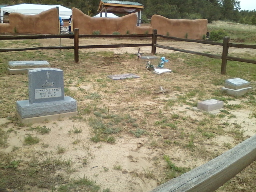
| Description | : | This cemetery is on The Refuge of Christ In The Canyons Fellowship. It is maintained by Reverend Ed and Barbara Richardson. Directions 1.Trinidad is the closest town to The Refuge. Trinidad is 200 miles south of Denver on I-25 and 250 miles north of Albuquerque, NM on I-25. 2.Once in Trinidad, you will want to exit I-25 on to State Highway 12 West. Follow signs to get on to Highway 12, which will zig-zag you out of town to the west. 3.Continue on Highway 12 for 7.0 miles into the hills. You will pass Trinidad Lake on the... Read More |
frequently asked questions (FAQ):
-
Where is Christ In The Canyons Refuge Cemetery?
Christ In The Canyons Refuge Cemetery is located at County Road 43.5 Boncarbo, Las Animas County ,Colorado , 81082USA.
-
Christ In The Canyons Refuge Cemetery cemetery's updated grave count on graveviews.com?
0 memorials
-
Where are the coordinates of the Christ In The Canyons Refuge Cemetery?
Latitude: 37.2212430
Longitude: -104.7571480
Nearby Cemetories:
1. Burro Canyon Cemetery
Las Animas County, USA
Coordinate: 37.1857986, -104.7050018
2. Albertson Cemetery
Las Animas County, USA
Coordinate: 37.2752991, -104.6825027
3. Gulnare-Lindsey-Jones Family Cemetery
Gulnare, Las Animas County, USA
Coordinate: 37.3114900, -104.7536440
4. Jarosa Cemetery
Gulnare, Las Animas County, USA
Coordinate: 37.3097845, -104.8000551
5. San Juan Cemetery
Las Animas County, USA
Coordinate: 37.1267014, -104.7380981
6. Medina Cemetery
Segundo, Las Animas County, USA
Coordinate: 37.1298000, -104.7992000
7. Altenhien Cemetery
Gulnare, Las Animas County, USA
Coordinate: 37.3185500, -104.7648100
8. San Juan Cemetery
Las Animas County, USA
Coordinate: 37.1232986, -104.7433014
9. Weston Cemetery
Weston, Las Animas County, USA
Coordinate: 37.1350000, -104.8530556
10. Pacheca Cemetery
Las Animas County, USA
Coordinate: 37.1357994, -104.8731003
11. Tijeras Cemetery
Las Animas County, USA
Coordinate: 37.1239014, -104.6530991
12. Prince Cemetery
Las Animas County, USA
Coordinate: 37.2952995, -104.8906021
13. Vigil Cemetery
Vigil, Las Animas County, USA
Coordinate: 37.1480200, -104.8938590
14. Trujillo Creek Cemetery
Aguilar, Las Animas County, USA
Coordinate: 37.3563995, -104.7367020
15. Long's Canon Cemetery
Cokedale, Las Animas County, USA
Coordinate: 37.1381900, -104.6157200
16. Reilly Canyon Cemetery
Cokedale, Las Animas County, USA
Coordinate: 37.1382420, -104.6124930
17. Scott Cemetery
Monument Park, Las Animas County, USA
Coordinate: 37.2928009, -104.9218979
18. Hastings Mine
Las Animas County, USA
Coordinate: 37.3380810, -104.6193960
19. Hicks Cemetery
Las Animas County, USA
Coordinate: 37.2658005, -104.9685974
20. Jansen Cemetery
Las Animas County, USA
Coordinate: 37.1594009, -104.5464020
21. Ludlow Massacre Memorial Site
Ludlow, Las Animas County, USA
Coordinate: 37.3391400, -104.5839160
22. Vigil Cemetery
Las Animas County, USA
Coordinate: 37.1464005, -104.5408020
23. Carpio Longsdale Catholic Cemetery
Jansen, Las Animas County, USA
Coordinate: 37.1484140, -104.5330240
24. Simpsons Rest Cemetery
Trinidad, Las Animas County, USA
Coordinate: 37.1810000, -104.5134000


