
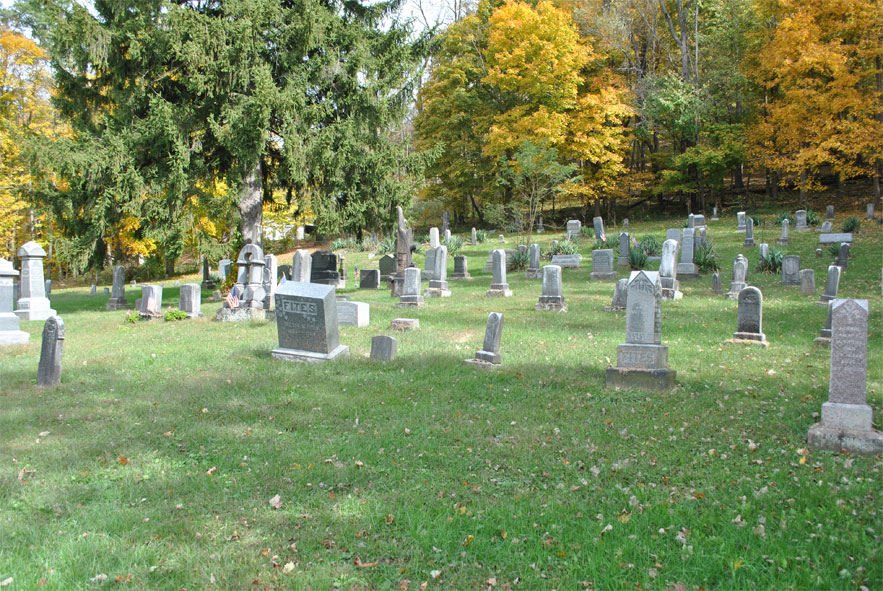
| Memorials | : | 305 |
| Location | : | Glenmont, Holmes County, USA |
| Coordinate | : | 40.5198100, -82.0941700 |
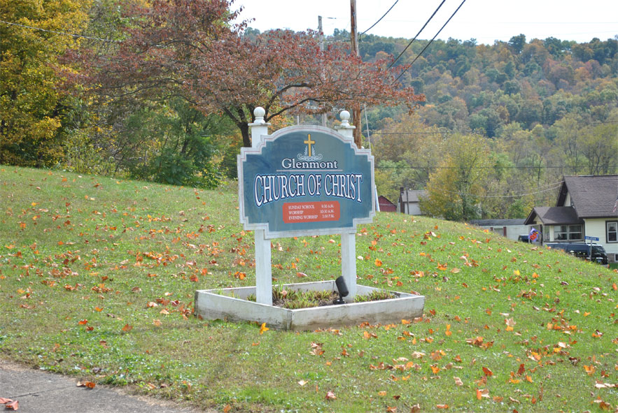
| Description | : | The cemetery is located at the intersection of Main Street (Ohio State Route 520 / County Road 21) and Depot Street (Ohio State Route 520) beside the Glenmont Church of Christ. The cemetery is located in Richland Township, Holmes County, Ohio, and is # 5658 (Christian Cemetery / Church of Christ Cemetery) in “Ohio Cemeteries 1803-2003”, compiled by the Ohio Genealogical Society. The cemetery is registered with the Ohio Division of Real Estate and Professional Licensing (ODRE) as Glenmont Church of Christ Cemetery with registration license numbers CGR.0000981060. |
frequently asked questions (FAQ):
-
Where is Christian Church Cemetery?
Christian Church Cemetery is located at Main Street and Depot Street Glenmont, Holmes County ,Ohio , 44628USA.
-
Christian Church Cemetery cemetery's updated grave count on graveviews.com?
31 memorials
-
Where are the coordinates of the Christian Church Cemetery?
Latitude: 40.5198100
Longitude: -82.0941700
Nearby Cemetories:
1. Saints Peter and Paul Catholic Church Cemetery
Glenmont, Holmes County, USA
Coordinate: 40.5205190, -82.0945540
2. Sunnyside Cemetery
Glenmont, Holmes County, USA
Coordinate: 40.5194016, -82.0828018
3. Bucy Cemetery
Glenmont, Holmes County, USA
Coordinate: 40.4903421, -82.0948743
4. Barnes Cemetery
Holmes County, USA
Coordinate: 40.4934100, -82.1243400
5. Union Grove Cemetery
Richland Township, Holmes County, USA
Coordinate: 40.4768982, -82.1149979
6. Wolf Creek Cemetery
Holmes County, USA
Coordinate: 40.4795410, -82.0522280
7. Saint Joseph Mission Cemetery
Glenmont, Holmes County, USA
Coordinate: 40.5191900, -82.1649000
8. Welcome Cemetery
Welcome, Holmes County, USA
Coordinate: 40.5518799, -82.0311432
9. Remington Pioneer Cemetery
Holmes County, USA
Coordinate: 40.4719265, -82.1369143
10. Stillwell Cemetery
Holmes County, USA
Coordinate: 40.4603430, -82.0951510
11. Kaylor Ridge Cemetery
Nashville, Holmes County, USA
Coordinate: 40.5517006, -82.1682968
12. Emerick Farm Cemetery
Killbuck, Holmes County, USA
Coordinate: 40.5157060, -81.9998380
13. Brown Cemetery
Holmes County, USA
Coordinate: 40.4600000, -82.1491660
14. Monroe Cemetery
Coshocton County, USA
Coordinate: 40.4508018, -82.0580978
15. Temple Cemetery
Nashville, Holmes County, USA
Coordinate: 40.5908012, -82.0625000
16. Old Nashville Cemetery
Nashville, Holmes County, USA
Coordinate: 40.5949570, -82.1061090
17. Knox Township Cemetery
Nashville, Holmes County, USA
Coordinate: 40.5950020, -82.1059670
18. Shrimplin Cemetery
Killbuck, Holmes County, USA
Coordinate: 40.5086520, -81.9953000
19. Nashville Presbyterian Cemetery
Nashville, Holmes County, USA
Coordinate: 40.5954730, -82.1069100
20. Community Bible Church Cemetery
Millersburg, Holmes County, USA
Coordinate: 40.5607470, -82.0091640
21. Perdue Cemetery
Millersburg, Holmes County, USA
Coordinate: 40.5743410, -82.0232500
22. Nashville Methodist Church Cemetery
Nashville, Holmes County, USA
Coordinate: 40.5961726, -82.1157087
23. Christy Chapel Cemetery
Holmes County, USA
Coordinate: 40.5423200, -81.9936100
24. Monroe Lutheran Cemetery
Millersburg, Holmes County, USA
Coordinate: 40.5484070, -81.9929190