
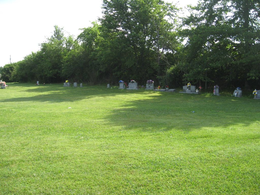
| Memorials | : | 3 |
| Location | : | Grimsley, Fentress County, USA |
| Coordinate | : | 36.2569700, -84.9880300 |
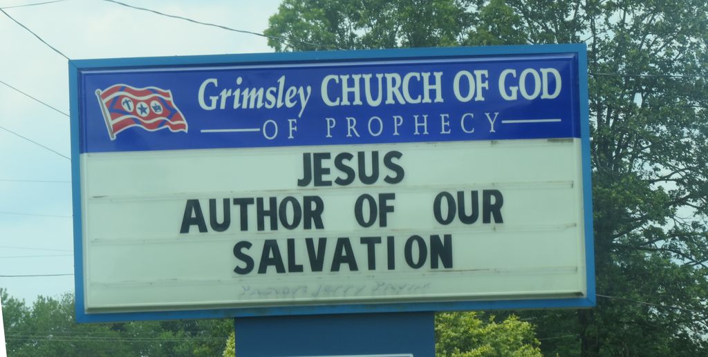
| Description | : | This cemetery is located on the east side of Highway 127 in the Grimsley Community. |
frequently asked questions (FAQ):
-
Where is Church of God of Prophecy Cemetery?
Church of God of Prophecy Cemetery is located at Grimsley, Fentress County ,Tennessee ,USA.
-
Church of God of Prophecy Cemetery cemetery's updated grave count on graveviews.com?
3 memorials
-
Where are the coordinates of the Church of God of Prophecy Cemetery?
Latitude: 36.2569700
Longitude: -84.9880300
Nearby Cemetories:
1. Petree Cemetery
Grimsley, Fentress County, USA
Coordinate: 36.2578600, -84.9917500
2. Mount Carmel Cemetery
Grimsley, Fentress County, USA
Coordinate: 36.2660000, -84.9830200
3. Grimsley Methodist Church Cemetery
Grimsley, Fentress County, USA
Coordinate: 36.2663879, -84.9827805
4. Young Cemetery
Grimsley, Fentress County, USA
Coordinate: 36.2774970, -84.9782600
5. Richards Cemetery
Grimsley, Fentress County, USA
Coordinate: 36.2796250, -84.9873350
6. Norris Cemetery
Fentress County, USA
Coordinate: 36.2747002, -84.9630966
7. Hicks Cemetery
Fentress County, USA
Coordinate: 36.2686005, -84.9483032
8. Goney Cemetery
Grimsley, Fentress County, USA
Coordinate: 36.2771988, -85.0242004
9. Pete Atkins Cemetery
Fentress County, USA
Coordinate: 36.2859630, -84.9620710
10. Clarkrange Missionary Baptist Church Cemetery
Clarkrange, Fentress County, USA
Coordinate: 36.2209300, -85.0132700
11. Mount Gilead Cemetery
Fentress County, USA
Coordinate: 36.2595800, -84.9344500
12. Springs Chapel Cemetery
Banner Springs, Fentress County, USA
Coordinate: 36.2382900, -84.9384900
13. Martha Washington Cemetery
Clarkrange, Fentress County, USA
Coordinate: 36.2181470, -85.0432540
14. Dillon Farm Cemetery
Sandy, Fentress County, USA
Coordinate: 36.2933000, -85.0711900
15. Clarkrange Cemetery
Clarkrange, Fentress County, USA
Coordinate: 36.1842003, -85.0168991
16. Bart Jones Cemetery
Jonesville, Fentress County, USA
Coordinate: 36.1866340, -84.9482550
17. Roanoke United Methodist Church Cemetery
Jamestown, Fentress County, USA
Coordinate: 36.3311000, -84.9567000
18. Clarkrange United Baptist Church Cemetery
Clarkrange, Fentress County, USA
Coordinate: 36.1808557, -85.0119462
19. Jonesville Community Baptist Church Cemetery
Clarkrange, Fentress County, USA
Coordinate: 36.1864014, -84.9357986
20. Boles Cemetery
Fentress County, USA
Coordinate: 36.3094200, -85.0691500
21. Beaty Cemetery
Fentress County, USA
Coordinate: 36.2882996, -84.8889008
22. Campground Cemetery
Clarkrange, Fentress County, USA
Coordinate: 36.1895120, -85.0546810
23. Tinch Cemetery
Fentress County, USA
Coordinate: 36.3168983, -84.9092026
24. Davidson Cemetery
Fentress County, USA
Coordinate: 36.2747002, -85.0991974