
| Memorials | : | 0 |
| Location | : | Lauterbourg, Departement du Bas-Rhin, France |
| Coordinate | : | 48.9733600, 8.1849600 |
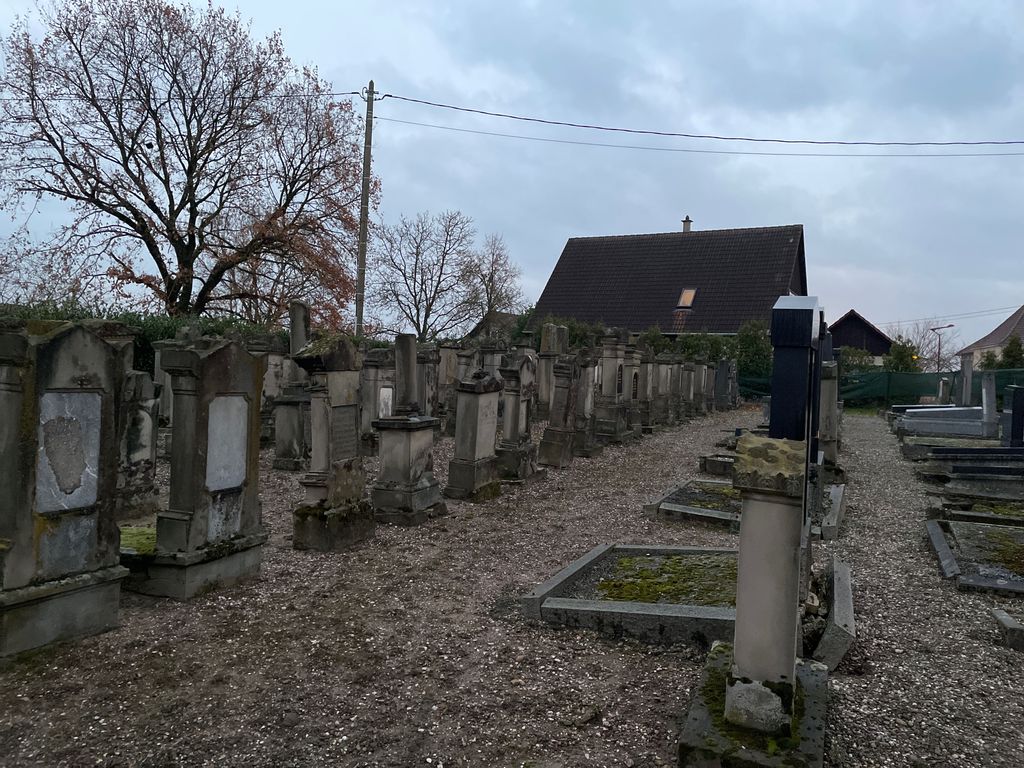
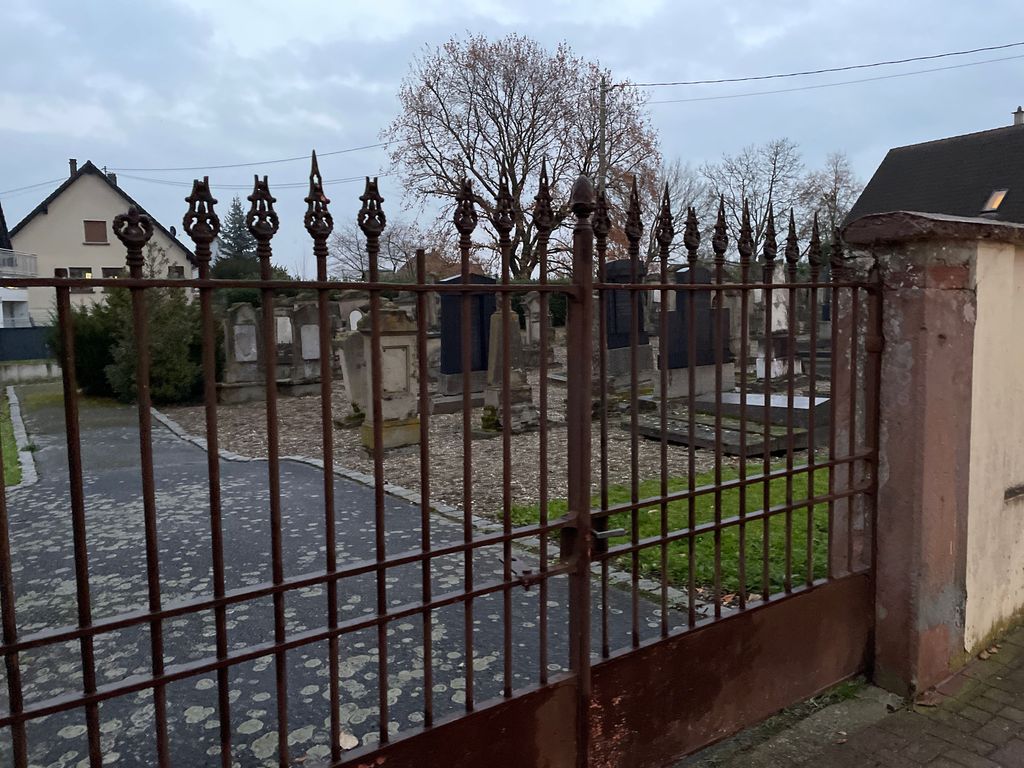
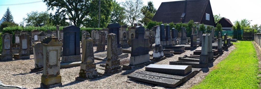
| Description | : | Permission was granted in 1875 to establish this Jewish cemetery just south of the Christian cemetery ground. The first known burial (still remaining) is from 1877. |
frequently asked questions (FAQ):
-
Where is Cimetière juif de Lauterbourg?
Cimetière juif de Lauterbourg is located at Rue de la Chapelle Lauterbourg, Departement du Bas-Rhin ,Alsace , 67630France.
-
Cimetière juif de Lauterbourg cemetery's updated grave count on graveviews.com?
0 memorials
-
Where are the coordinates of the Cimetière juif de Lauterbourg?
Latitude: 48.9733600
Longitude: 8.1849600
Nearby Cemetories:
1. Cimetière de Lauterbourg
Lauterbourg, Departement du Bas-Rhin, France
Coordinate: 48.9742670, 8.1846790
2. Friedhof Berg
Berg, Landkreis Germersheim, Germany
Coordinate: 48.9806900, 8.2030480
3. Friedhof Illingen
Illingen, Landkreis Rastatt, Germany
Coordinate: 48.9350100, 8.2117300
4. Friedhof Neuburg am Rhein
Neuburg am Rhein, Landkreis Germersheim, Germany
Coordinate: 48.9816340, 8.2480340
5. Friedhof Au am Rhein
Au am Rhein, Landkreis Rastatt, Germany
Coordinate: 48.9506000, 8.2413000
6. Cimetière de Mothern
Mothern, Departement du Bas-Rhin, France
Coordinate: 48.9312146, 8.1535148
7. Friedhof Elchesheim
Elchesheim, Landkreis Rastatt, Germany
Coordinate: 48.9297000, 8.2163000
8. Friedhof Neuburgweier
Neuburgweier, Landkreis Karlsruhe, Germany
Coordinate: 48.9734600, 8.2695200
9. Friedhof Würmersheim
Würmersheim, Landkreis Rastatt, Germany
Coordinate: 48.9371600, 8.2550500
10. Neuer Friedhof Hagenbach
Hagenbach, Landkreis Germersheim, Germany
Coordinate: 49.0183530, 8.2434420
11. Alter Friedhof Hagenbach
Hagenbach, Landkreis Germersheim, Germany
Coordinate: 49.0212320, 8.2476800
12. Neuer Friedhof Durmersheim
Durmersheim, Landkreis Rastatt, Germany
Coordinate: 48.9285000, 8.2618000
13. Alter Friedhof Durmersheim
Durmersheim, Landkreis Rastatt, Germany
Coordinate: 48.9317000, 8.2723000
14. Friedhof Mörsch
Mörsch, Landkreis Karlsruhe, Germany
Coordinate: 48.9635880, 8.2931350
15. Friedhof Steinmauern
Steinmauern, Landkreis Rastatt, Germany
Coordinate: 48.9022000, 8.2027000
16. Friedhof Bietigheim
Bietigheim, Landkreis Rastatt, Germany
Coordinate: 48.9167000, 8.2566000
17. Friedhof Forchheim
Forchheim, Landkreis Karlsruhe, Germany
Coordinate: 48.9796000, 8.3098000
18. Friedhof Maximilliansau
Maximiliansau, Landkreis Germersheim, Germany
Coordinate: 49.0282900, 8.2854290
19. Friedhof Ötigheim
Ötigheim, Landkreis Rastatt, Germany
Coordinate: 48.8938219, 8.2382023
20. Friedhof Plittersdorf
Plittersdorf, Landkreis Rastatt, Germany
Coordinate: 48.8846000, 8.1592800
21. Waldfriedhof Bienwaldruhe
Kandel, Landkreis Germersheim, Germany
Coordinate: 49.0640600, 8.1746390
22. Friedhof Wörth am Rhein
Wörth am Rhein, Landkreis Germersheim, Germany
Coordinate: 49.0551260, 8.2649910
23. Waldfriedhof Rastatt
Rastatt, Landkreis Rastatt, Germany
Coordinate: 48.8716000, 8.2239000
24. Cimetière de Crœttwiller
Crœttwiller, Departement du Bas-Rhin, France
Coordinate: 48.9320020, 8.0378130