| Memorials | : | 2 |
| Location | : | Afton, Union County, USA |
| Coordinate | : | 41.0460854, -94.2025299 |
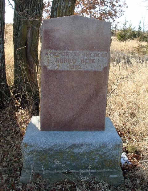
| Description | : | Union Twp SE 1/4 Sec. 8 This single stone cemetery is located to the west of an A-Frame style home on the old Creamery Road north of Afton. One large granite marker erected by Charles Maharry in the 1920's. The inscription reads: "In Memory of the Dead Buried here-1863". This is believed to be the first cemetery of Afton, and early newspapers refer to burial at the Afton cemetery north of town. In the early sixties, many of the burials were moved to what is now the Greenlawn cemetery three fourths of a mile northeast of Afton. When cemetery signs were... Read More |
frequently asked questions (FAQ):
-
Where is Civil War Era Cemetery?
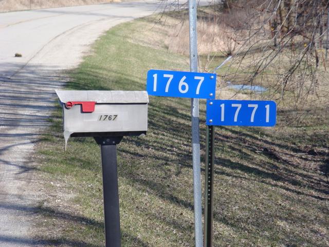
Civil War Era Cemetery is located at 1771 Creamery Road Afton, Union County ,Iowa ,USA.
-
Civil War Era Cemetery cemetery's updated grave count on graveviews.com?
2 memorials
-
Where are the coordinates of the Civil War Era Cemetery?
Latitude: 41.0460854
Longitude: -94.2025299
Nearby Cemetories:
1. Saint Edwards Catholic Cemetery
Afton, Union County, USA
Coordinate: 41.0359993, -94.2129974
2. Greenlawn Cemetery
Afton, Union County, USA
Coordinate: 41.0335999, -94.1856003
3. County Home Cemetery
Creston, Union County, USA
Coordinate: 41.0449982, -94.2590027
4. Rollins Plot Cemetery
Afton, Union County, USA
Coordinate: 41.0040283, -94.2234802
5. Norris Plot Cemetery
Afton, Union County, USA
Coordinate: 41.0079994, -94.1579971
6. Cedar Grove Cemetery
Lorimor, Union County, USA
Coordinate: 41.1209984, -94.2200012
7. Mount Pisgah Cemetery
Thayer, Union County, USA
Coordinate: 41.0511017, -94.1007996
8. Browns Mountain Cemetery
Thayer, Union County, USA
Coordinate: 41.0499992, -94.0999985
9. Abel Cemetery
Arispe, Union County, USA
Coordinate: 40.9790001, -94.1429977
10. Dodge Center Cemetery
Afton, Union County, USA
Coordinate: 41.1279984, -94.1829987
11. Groesbeck Cemetery
Lorimor, Union County, USA
Coordinate: 41.1100006, -94.1230011
12. Evergreen Cemetery
Creston, Union County, USA
Coordinate: 41.1139984, -94.2839966
13. Bragg Cemetery
Lorimor, Union County, USA
Coordinate: 41.1282997, -94.1433029
14. Beulah Cemetery
Thayer, Union County, USA
Coordinate: 41.0589981, -94.0759964
15. Otterbein Cemetery
Thayer, Union County, USA
Coordinate: 40.9990005, -94.0879974
16. Bethel Cemetery
Thayer, Union County, USA
Coordinate: 41.0600014, -94.0693970
17. West Union Cemetery
Thayer, Union County, USA
Coordinate: 41.0191994, -94.0721970
18. Monette Cemetery
Lorimor, Union County, USA
Coordinate: 41.0800743, -94.0715866
19. Old Jerusalem Cemetery
Creston, Union County, USA
Coordinate: 41.1159401, -94.3084335
20. Graceland Cemetery
Creston, Union County, USA
Coordinate: 41.0369987, -94.3519974
21. Hickman Cemetery
Grand River Township, Madison County, USA
Coordinate: 41.1652140, -94.2132650
22. Thayer Catholic Cemetery
Thayer, Union County, USA
Coordinate: 41.0374985, -94.0357971
23. Liberty Cemetery
Union Township, Adair County, USA
Coordinate: 41.1585620, -94.2902070
24. Ide Cemetery
Creston, Union County, USA
Coordinate: 40.9770012, -94.3499985


