
| Memorials | : | 0 |
| Location | : | Harrison, Clare County, USA |
| Coordinate | : | 44.0020200, -84.7982500 |
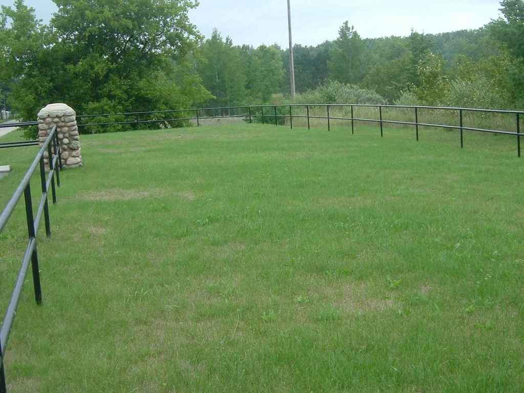
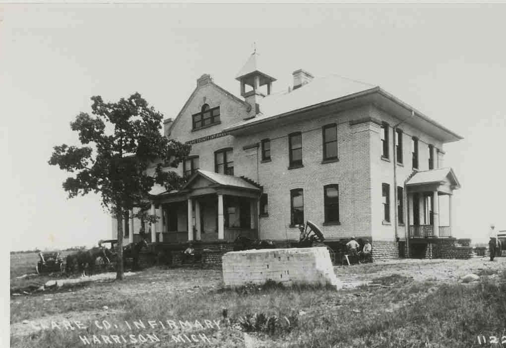
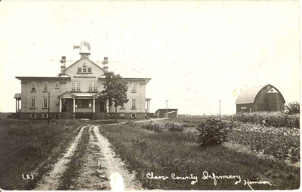
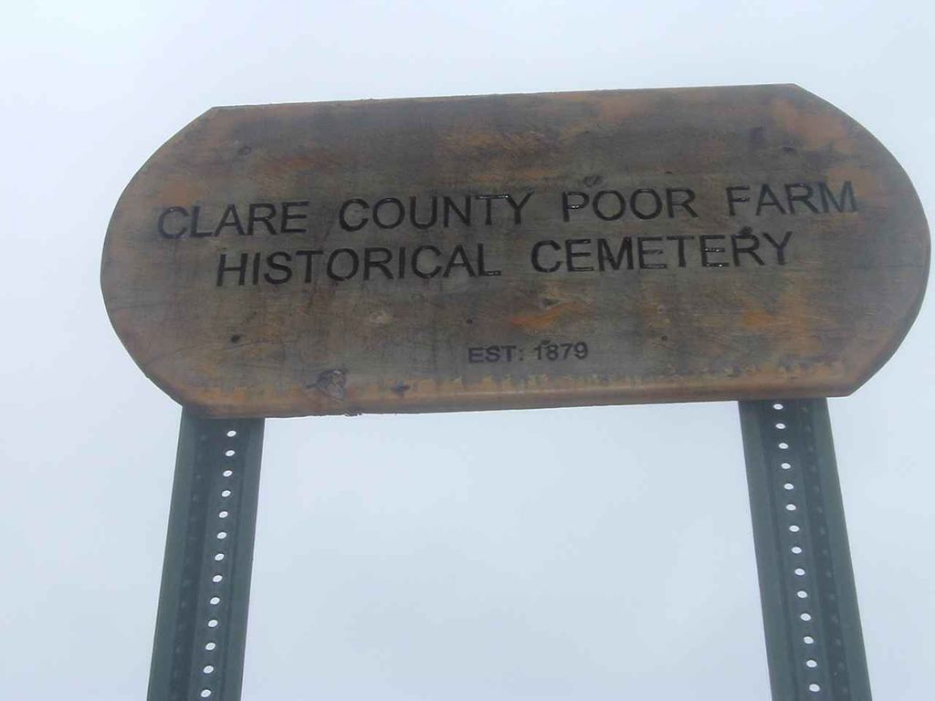
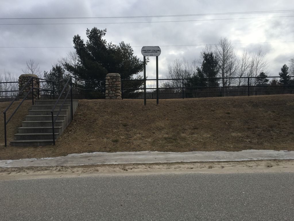
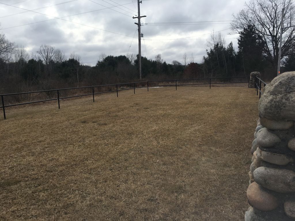
| Description | : | The first poor farm in Clare County began in 1871 in Section 35 of Grant Township on 80 acres. George Lutes was the first resident. When the county seat was moved to Harrison in 1879 it was decided to move the poor farm there too. The second poor farm was on 160 acres in Section 20 of Hayes Township just outside the growing village of Harrison. The third and final poor farm (location of the "Clare County Poor Farm Historical Cemetery") was renamed the "Clare County Infirmary" and was located on County Farm Road in Harrison. It opened... Read More |
frequently asked questions (FAQ):
-
Where is Clare County Poor Farm Historical Cemetery?
Clare County Poor Farm Historical Cemetery is located at Harrison, Clare County ,Michigan ,USA.
-
Clare County Poor Farm Historical Cemetery cemetery's updated grave count on graveviews.com?
0 memorials
-
Where are the coordinates of the Clare County Poor Farm Historical Cemetery?
Latitude: 44.0020200
Longitude: -84.7982500
Nearby Cemetories:
1. Maple Grove Cemetery
Harrison, Clare County, USA
Coordinate: 44.0299988, -84.8094025
2. Saint Athanasius Catholic Cemetery
Harrison, Clare County, USA
Coordinate: 44.0311110, -84.8108330
3. Pleasant Plains Cemetery
Hayes Township, Clare County, USA
Coordinate: 44.0447006, -84.7889023
4. Ott Cemetery
Hatton Township, Clare County, USA
Coordinate: 43.9667015, -84.7356033
5. Hillcrest Cemetery
Greenwood Township, Clare County, USA
Coordinate: 44.0299988, -84.8735962
6. Devils Knob Golf Course Burial Site
Hamilton Township, Clare County, USA
Coordinate: 44.0432760, -84.7168880
7. Hatton Township Cemetery
Hatton Township, Clare County, USA
Coordinate: 43.9305550, -84.8177770
8. Cedar Crest Cemetery
Hamilton Township, Clare County, USA
Coordinate: 44.0605550, -84.7066670
9. Arthur Township Cemetery
Arthur Township, Clare County, USA
Coordinate: 43.9516983, -84.6658020
10. Evergreen Cemetery
Frost Township, Clare County, USA
Coordinate: 44.1094440, -84.8286110
11. Lincoln Township Cemetery
Lake George, Clare County, USA
Coordinate: 43.9677780, -84.9433330
12. Saint Johns Evangelical Lutheran Cemetery
Arthur Township, Clare County, USA
Coordinate: 43.9886110, -84.6377780
13. Dover Amish Cemetery
Clare, Clare County, USA
Coordinate: 43.8869800, -84.7730590
14. Woods Cemetery
Sheridan Township, Clare County, USA
Coordinate: 43.8953018, -84.7272034
15. Hamilton Township Cemetery
Hamilton Township, Clare County, USA
Coordinate: 44.0497423, -84.6264065
16. Old Township Cemetery
Lincoln Township, Clare County, USA
Coordinate: 43.9003800, -84.9295500
17. Thompson Cemetery
Sheridan Township, Clare County, USA
Coordinate: 43.8772220, -84.7061110
18. Wilson Grave
Summerfield Township, Clare County, USA
Coordinate: 44.1366583, -84.8605505
19. Garrity Cemetery
Hamilton Township, Clare County, USA
Coordinate: 44.0577780, -84.6166670
20. Summerfield Cemetery
Summerfield Township, Clare County, USA
Coordinate: 44.1175003, -84.9191971
21. Freeman Township Cemetery
Freeman Township, Clare County, USA
Coordinate: 43.9583330, -84.9955560
22. Fernwood Cemetery
Temple, Clare County, USA
Coordinate: 44.0144440, -85.0186110
23. Surrey Township Cemetery
Farwell, Clare County, USA
Coordinate: 43.8358002, -84.8506012
24. Saint Cecilia Cemetery
Clare, Clare County, USA
Coordinate: 43.8263890, -84.7588890