
| Memorials | : | 0 |
| Location | : | Heber Springs, Cleburne County, USA |
| Coordinate | : | 35.2728520, -92.0206640 |
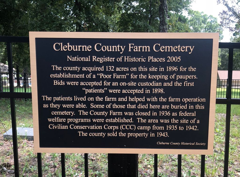
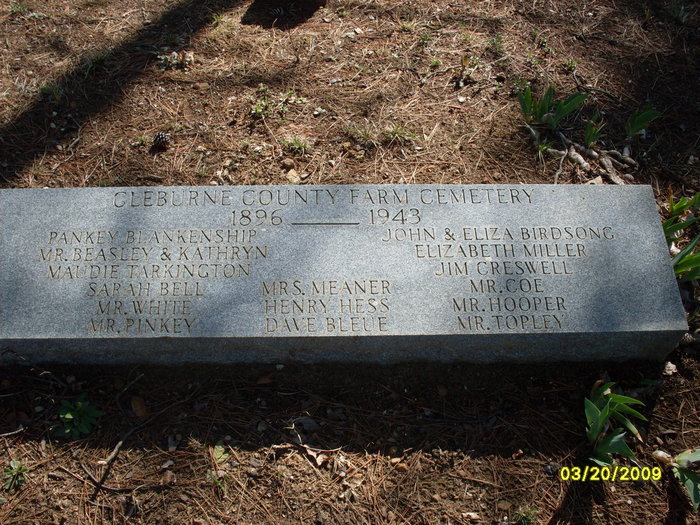
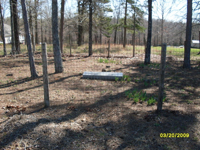
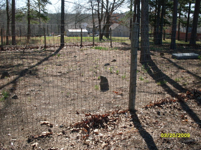
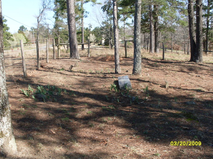
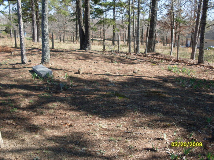
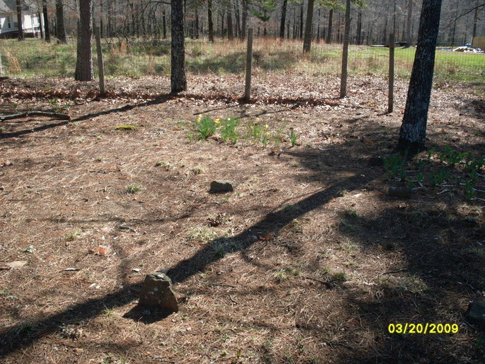
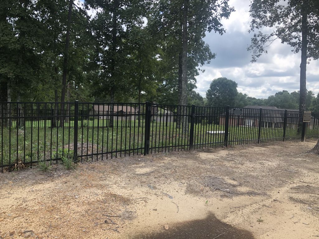
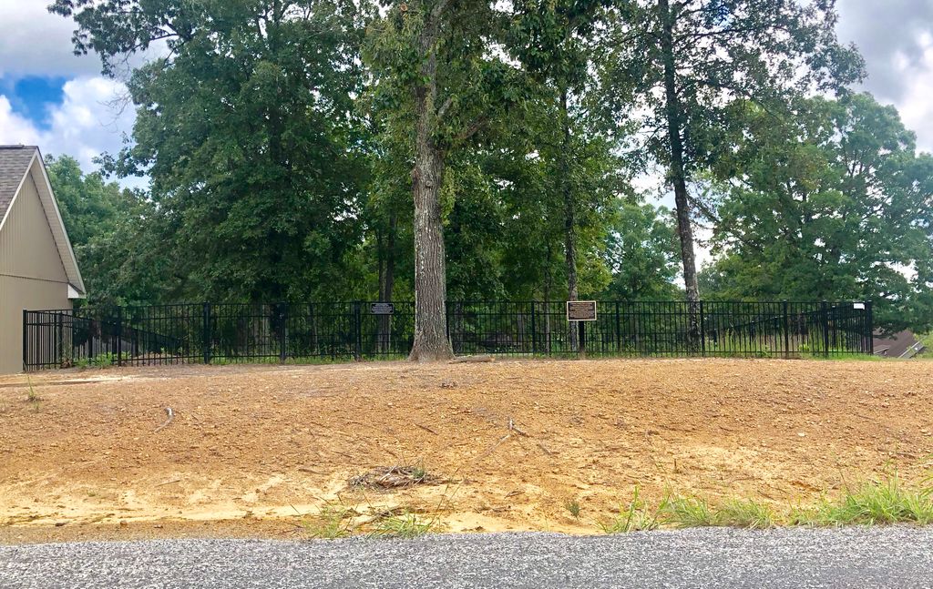
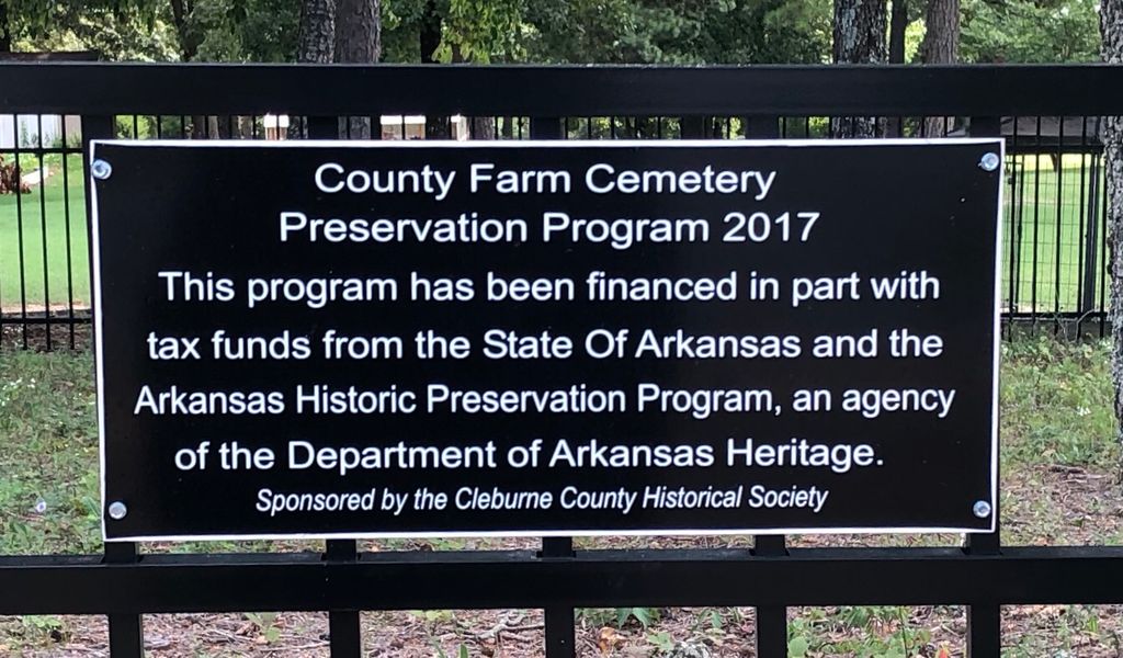
| Description | : | My mom told me that she believed that her aunt Dollie had told her about this cemetery and that Sarah Miller as well as several others were buried there. The one thing they were'nt sure about was what it was named, and so after months of searching my husband and I found what we all had been looking for. The cemetery is located off highway 25 South of Heber Springs in what is now known as Mountain Aire. In 1982 members of the CCHS cleaned and fenced the plot, where the graves with their... Read More |
frequently asked questions (FAQ):
-
Where is Cleburne County Farm Cemetery?
Cleburne County Farm Cemetery is located at Heber Springs, Cleburne County ,Arkansas ,USA.
-
Cleburne County Farm Cemetery cemetery's updated grave count on graveviews.com?
0 memorials
-
Where are the coordinates of the Cleburne County Farm Cemetery?
Latitude: 35.2728520
Longitude: -92.0206640
Nearby Cemetories:
1. New Hart Cemetery
Rose Bud, White County, USA
Coordinate: 35.2951200, -92.0468300
2. Romance Cemetery
Romance, White County, USA
Coordinate: 35.2400093, -92.0486069
3. Gray Cemetery
White County, USA
Coordinate: 35.2380981, -91.9871979
4. Starkey Cemetery
White County, USA
Coordinate: 35.2817001, -92.0753021
5. Gravel Hill Memorial Garden
Romance, White County, USA
Coordinate: 35.2432400, -91.9778300
6. Mount Bethel Cemetery
Rose Bud, White County, USA
Coordinate: 35.3177440, -92.0018060
7. Quattlebaum Cemetery
White County, USA
Coordinate: 35.2467003, -91.9708023
8. Old Hopewell Cemetery
Rose Bud, White County, USA
Coordinate: 35.3261900, -92.0296810
9. Mount Hebron Cemetery
Joy, White County, USA
Coordinate: 35.2910100, -91.9582300
10. Norman Cemetery
Joy, White County, USA
Coordinate: 35.3280200, -92.0076700
11. Holleman Cemetery
Joy, White County, USA
Coordinate: 35.3265930, -91.9959230
12. Dupriest Cemetery
Rose Bud, White County, USA
Coordinate: 35.2628000, -92.1008000
13. Mount Olive Bedford Chapel Cemetery
Rose Bud, White County, USA
Coordinate: 35.2516470, -92.0982170
14. Bethesda Cemetery
Rose Bud, White County, USA
Coordinate: 35.3029000, -92.0957000
15. Pleasant Ridge Cemetery
White County, USA
Coordinate: 35.3036003, -91.9321976
16. Rose Bud Cemetery
Rose Bud, White County, USA
Coordinate: 35.3328018, -92.0922012
17. Sidon Cemetery
Sidon, White County, USA
Coordinate: 35.3450012, -91.9574966
18. Floyd Cemetery
Floyd, White County, USA
Coordinate: 35.1944084, -91.9664688
19. New Floyd Cemetery
Floyd, White County, USA
Coordinate: 35.1909640, -91.9716040
20. Saint Marys Cemetery
Rose Bud, White County, USA
Coordinate: 35.3329710, -92.1074770
21. Moon Cemetery
Rose Bud, White County, USA
Coordinate: 35.3408012, -92.1006012
22. Pleasant Grove Cemetery
Floyd, White County, USA
Coordinate: 35.2055130, -91.9347992
23. Harmony Cemetery
White County, USA
Coordinate: 35.2342644, -91.9097977
24. Mount Vernon Cemetery
Mount Vernon, Faulkner County, USA
Coordinate: 35.2305984, -92.1299973