
| Memorials | : | 0 |
| Location | : | Donelson, Davidson County, USA |
| Phone | : | 800-535-9725 |
| Website | : | www.tn.gov/didd/ |
| Coordinate | : | 36.1644540, -86.6429150 |
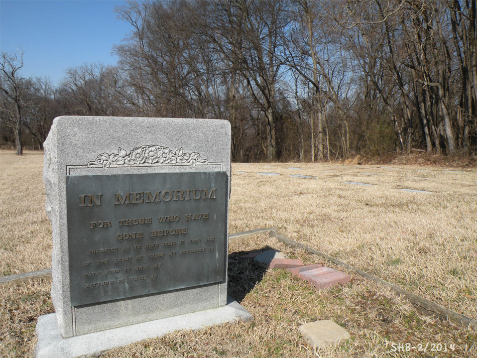
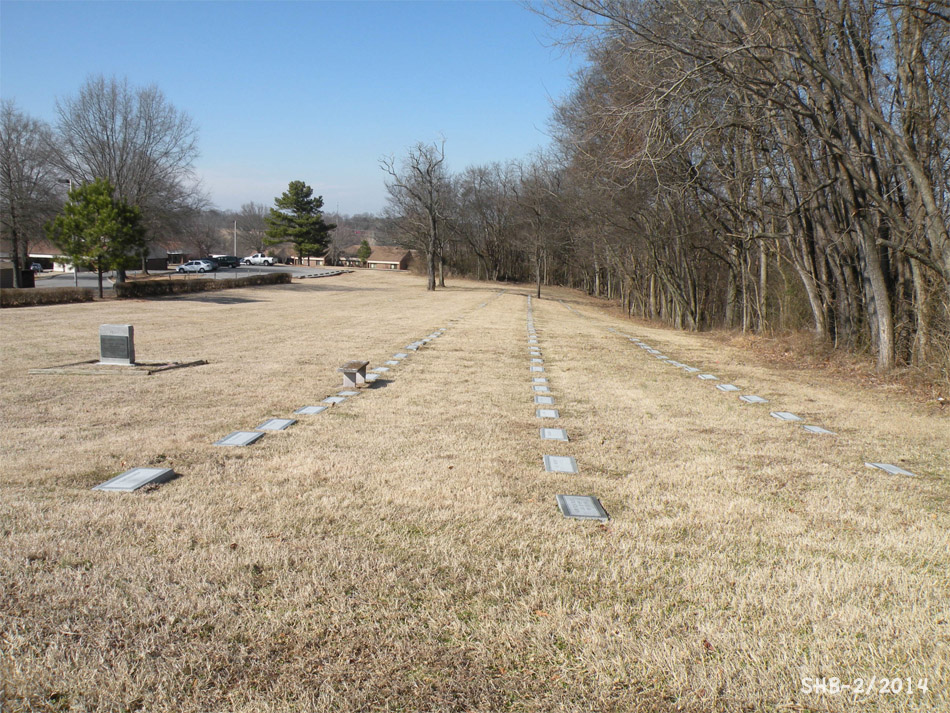
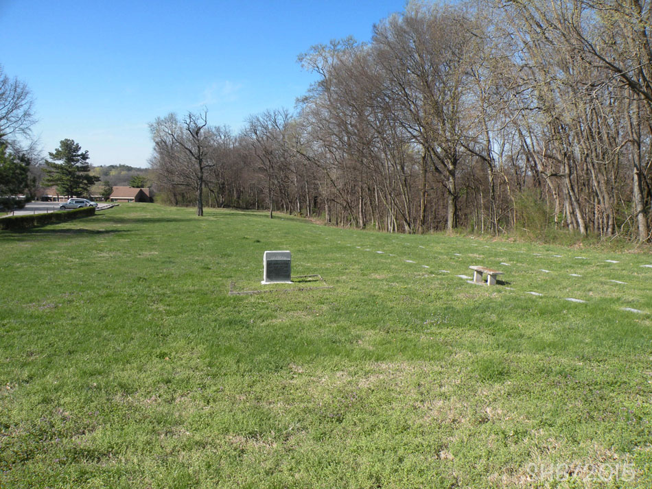
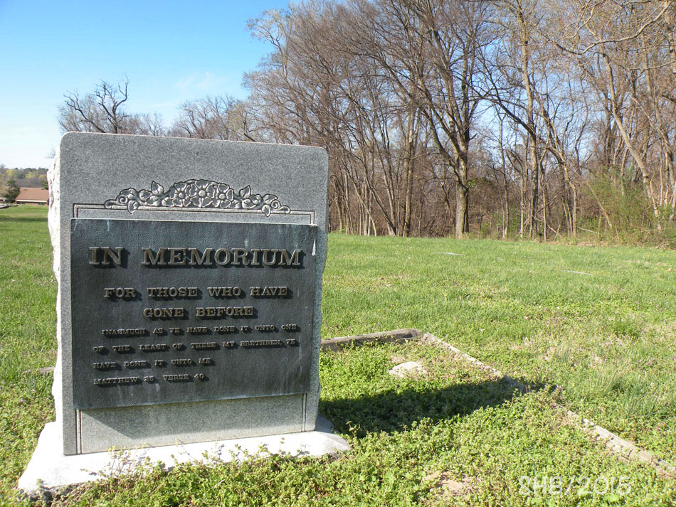
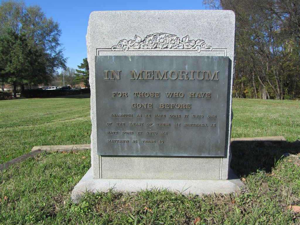
| Description | : | Opened in 1923 as the "Tennessee State Home and Training School for Feeble-Minded Persons," the name was changed to Clover Bottom in the 1940s. The facility closed in 2015. Most residents’ families made arrangements for burial elsewhere, but a small on-site cemetery was maintained. An archeological survey in 2012 found a minimum of 185 graves in five rows. Graves that are marked usually only have a surname and initial with no dates due to federal and state privacy laws regarding patient records. For further information contact the Tennessee Department of Intellectual & Developmental Disabilities in Nashville at 800-535-9725 (toll-free) or... Read More |
frequently asked questions (FAQ):
-
Where is Clover Bottom Developmental Center Cemetery?
Clover Bottom Developmental Center Cemetery is located at Stewarts Ferry Pike Donelson, Davidson County ,Tennessee ,USA.
-
Clover Bottom Developmental Center Cemetery cemetery's updated grave count on graveviews.com?
0 memorials
-
Where are the coordinates of the Clover Bottom Developmental Center Cemetery?
Latitude: 36.1644540
Longitude: -86.6429150
Nearby Cemetories:
1. Hoggatt Graveyard
Nashville, Davidson County, USA
Coordinate: 36.1710210, -86.6477820
2. Bacigalupo Family Cemetery
Donelson, Davidson County, USA
Coordinate: 36.1666570, -86.6605560
3. Evans Family Cemetery
Donelson, Davidson County, USA
Coordinate: 36.1620540, -86.6610090
4. Scott-Hessey Cemetery
Hermitage, Davidson County, USA
Coordinate: 36.1770400, -86.6224100
5. Donelson Church of Christ Cemetery
Donelson, Davidson County, USA
Coordinate: 36.1711350, -86.6691150
6. Bryantown Cemetery
Nashville, Davidson County, USA
Coordinate: 36.1427994, -86.6539001
7. Chandler Cemetery
Davidson County, USA
Coordinate: 36.1746020, -86.6167720
8. James Buchanan Cemetery
Nashville, Davidson County, USA
Coordinate: 36.1444016, -86.6594009
9. Saint Philips Episcopal Church Columbarium
Donelson, Davidson County, USA
Coordinate: 36.1741990, -86.6814720
10. Gleaves Cemetery
Hermitage, Davidson County, USA
Coordinate: 36.1674995, -86.6025009
11. Bell Family Cemetery
Nashville, Davidson County, USA
Coordinate: 36.1307335, -86.6342545
12. Fuqua Cemetery (Defunct)
Davidson County, USA
Coordinate: 36.1405983, -86.6119003
13. Absolem Gleaves Cemetery
Hermitage, Davidson County, USA
Coordinate: 36.1740270, -86.6009740
14. Hayes-Wright Cemetery
Nashville, Davidson County, USA
Coordinate: 36.1319200, -86.6254700
15. Creel Family Cemetery
Hermitage, Davidson County, USA
Coordinate: 36.1864319, -86.6081848
16. Pulley Cemetery
Donelson, Davidson County, USA
Coordinate: 36.1269300, -86.6312200
17. Evans-Hill Cemetery
Hermitage, Davidson County, USA
Coordinate: 36.1728980, -86.5942650
18. Stateland Baptist Church Cemetery
Old Hickory, Davidson County, USA
Coordinate: 36.2023600, -86.6225040
19. Starkey Cemetery
Donelson, Davidson County, USA
Coordinate: 36.1225000, -86.6352000
20. Albert H. Ellis Cemetery
Hermitage, Davidson County, USA
Coordinate: 36.1426680, -86.5975930
21. John Howell Baker Cemetery
Davidson County, USA
Coordinate: 36.2019980, -86.6103880
22. Fuqua Cemetery
Davidson County, USA
Coordinate: 36.1328011, -86.6006012
23. New Hope Church Cemetery
Hermitage, Davidson County, USA
Coordinate: 36.1711006, -86.5855026
24. Cook Cemetery
Hermitage, Davidson County, USA
Coordinate: 36.1626250, -86.5845050