| Memorials | : | 0 |
| Location | : | Charleston, Kanawha County, USA |
| Coordinate | : | 38.2921701, -81.6152589 |
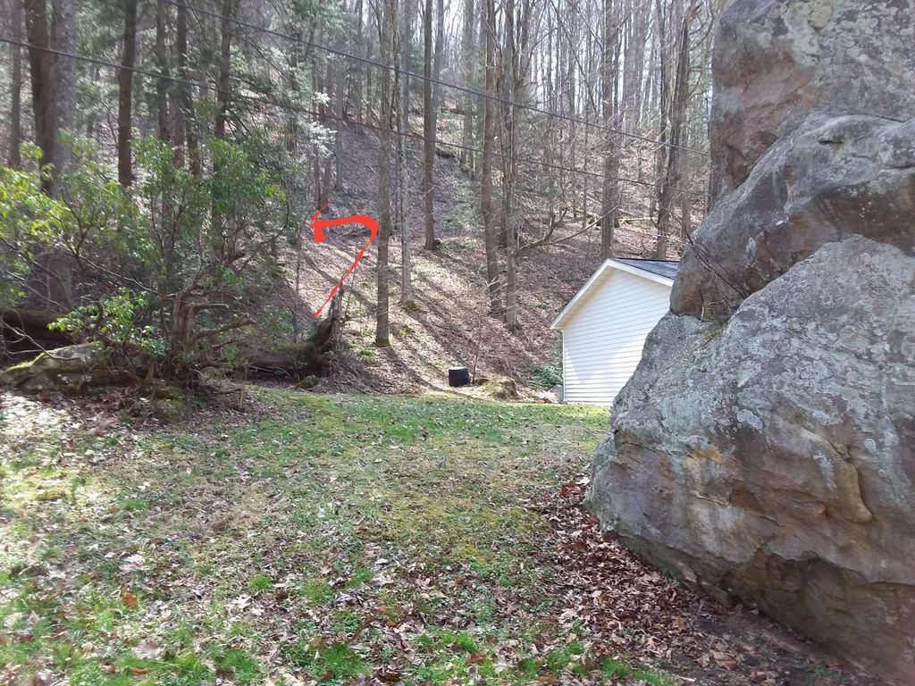
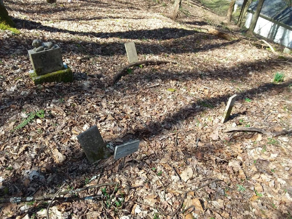
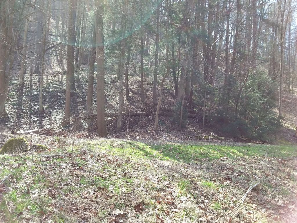
| Description | : | Small family cemetery located on Cane Fork Road, Charleston, West Virginia. The cemetery has been noted as "Pennington Cemetery", and there are Penningtons buried there - but most know the cemetery as the Comer Cemetery. It's across the road from the creek between #2262 Cane Fork and a big rock by the road (see pictures). The cemetery is not cleared. **The Pennington Cemetery is located at the top of the hill off South Park/Cane Fork to the old Pennington farm (maps call the road Lick Branch), family calls the road the Pennington Lane. |
frequently asked questions (FAQ):
-
Where is Comer Cemetery?
Comer Cemetery is located at Cane Fork Road Charleston, Kanawha County ,West Virginia , 25314USA.
-
Comer Cemetery cemetery's updated grave count on graveviews.com?
0 memorials
-
Where are the coordinates of the Comer Cemetery?
Latitude: 38.2921701
Longitude: -81.6152589
Nearby Cemetories:
1. Keely Cemetery
Charleston, Kanawha County, USA
Coordinate: 38.3255070, -81.6366270
2. Mount Joy Cemetery
Charleston, Kanawha County, USA
Coordinate: 38.3176900, -81.6545700
3. Gilliland Cemetery
Charleston, Kanawha County, USA
Coordinate: 38.3293180, -81.6458390
4. Adkins Cemetery
Charleston, Kanawha County, USA
Coordinate: 38.3345620, -81.6551270
5. Monument on Kanawha Boulevard
Charleston, Kanawha County, USA
Coordinate: 38.3437150, -81.6319790
6. Christ Church United Methodist All Saints Columbar
Charleston, Kanawha County, USA
Coordinate: 38.3450630, -81.6291540
7. Clark Cemetery
Kanawha County, USA
Coordinate: 38.3296000, -81.6653400
8. Baptist Temple Columbarium
Charleston, Kanawha County, USA
Coordinate: 38.3455880, -81.6286190
9. Fisher Hill Cemetery
Charleston, Kanawha County, USA
Coordinate: 38.3335991, -81.5699997
10. Clay Family Cemetery
Charleston, Kanawha County, USA
Coordinate: 38.3444400, -81.5853700
11. Becket Cemetery
Charleston, Kanawha County, USA
Coordinate: 38.3288600, -81.6739000
12. Nunley Cemetery
Charleston, Kanawha County, USA
Coordinate: 38.3301000, -81.5573000
13. Bnai Israel Cemetery
Charleston, Kanawha County, USA
Coordinate: 38.3520920, -81.6173120
14. Mountain View Memorial Park
Charleston, Kanawha County, USA
Coordinate: 38.3526900, -81.6198060
15. Donnally Cemetery
Charleston, Kanawha County, USA
Coordinate: 38.3488300, -81.5825600
16. Mount Olivet Cemetery
Charleston, Kanawha County, USA
Coordinate: 38.3544790, -81.6122980
17. Blount Cemetery
Coal Fork, Kanawha County, USA
Coordinate: 38.3078100, -81.5354040
18. Haws Cemetery
Charleston, Kanawha County, USA
Coordinate: 38.3495500, -81.6536700
19. French Cemetery
Davis Creek, Kanawha County, USA
Coordinate: 38.3217010, -81.6917038
20. Jarvis Cemetery
Charleston, Kanawha County, USA
Coordinate: 38.3301960, -81.6888930
21. Younger Hollow Cemetery
Coal Fork, Kanawha County, USA
Coordinate: 38.3191986, -81.5333023
22. Melton Cemetery
Charleston, Kanawha County, USA
Coordinate: 38.3621800, -81.6050800
23. Bryant Family Cemetery
Davis Creek, Kanawha County, USA
Coordinate: 38.3260000, -81.6957000
24. Lower Elk Two Mile Cemetery
Charleston, Kanawha County, USA
Coordinate: 38.3671880, -81.6054260


